

WATCH FOR SNOW SQUALLS
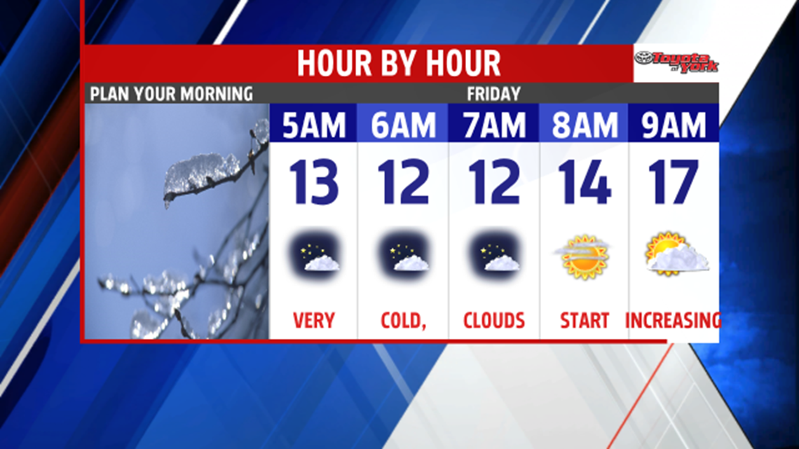
High pressure calms our winds tonight, and clears the skies for a few hours. Calmer winds and mostly clear skies will lead to a frigid morning in the single digits and low teens.

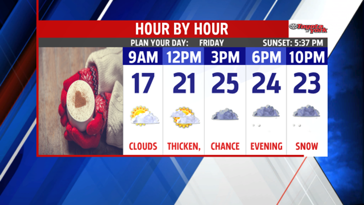
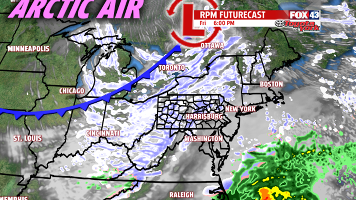
Clouds quickly return diminishing the sunshine by afternoon. Light southerly breeze will help temperatures climb into the mid and upper 20s. Snow squalls will accompany an Arctic boundary Friday evening. Snow squalls are quick bursts of snow, which can put down a quick coating of snow and cause visibility to sharply reduce. They are fast moving and there may be several bands of snow swinging through by evening.

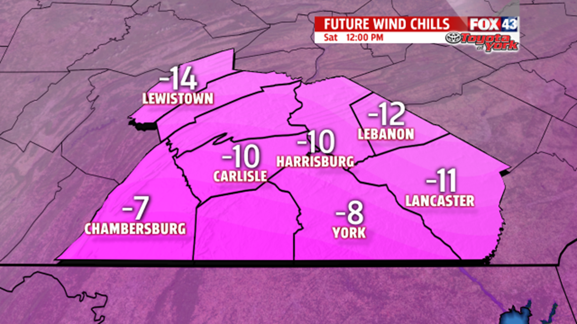
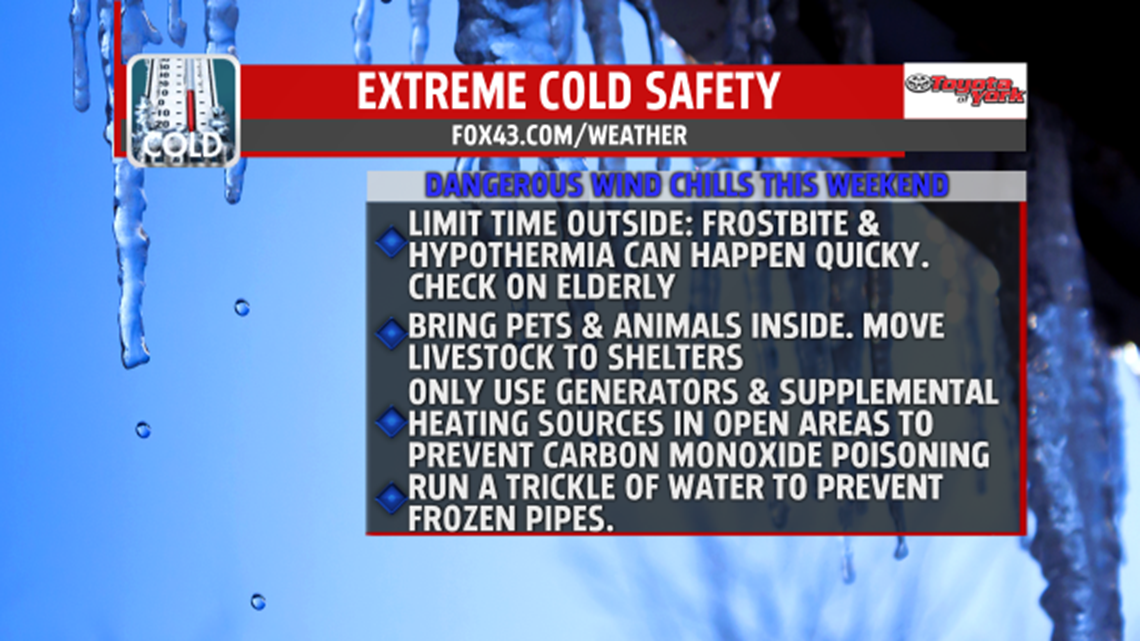
Following the front, is the arrival of the coldest air of the season. Temperatures will struggle to climb through the teens. Winds will be blustery and will be capable of producing wind chills of 10 to 15 degrees below zero. Below are some cold weather safety tips to help you stay safe and warm.


Please stay warm and be mindful of your pets. They get cold too!
MaryEllen Pann,
Chief Meteorologist
