

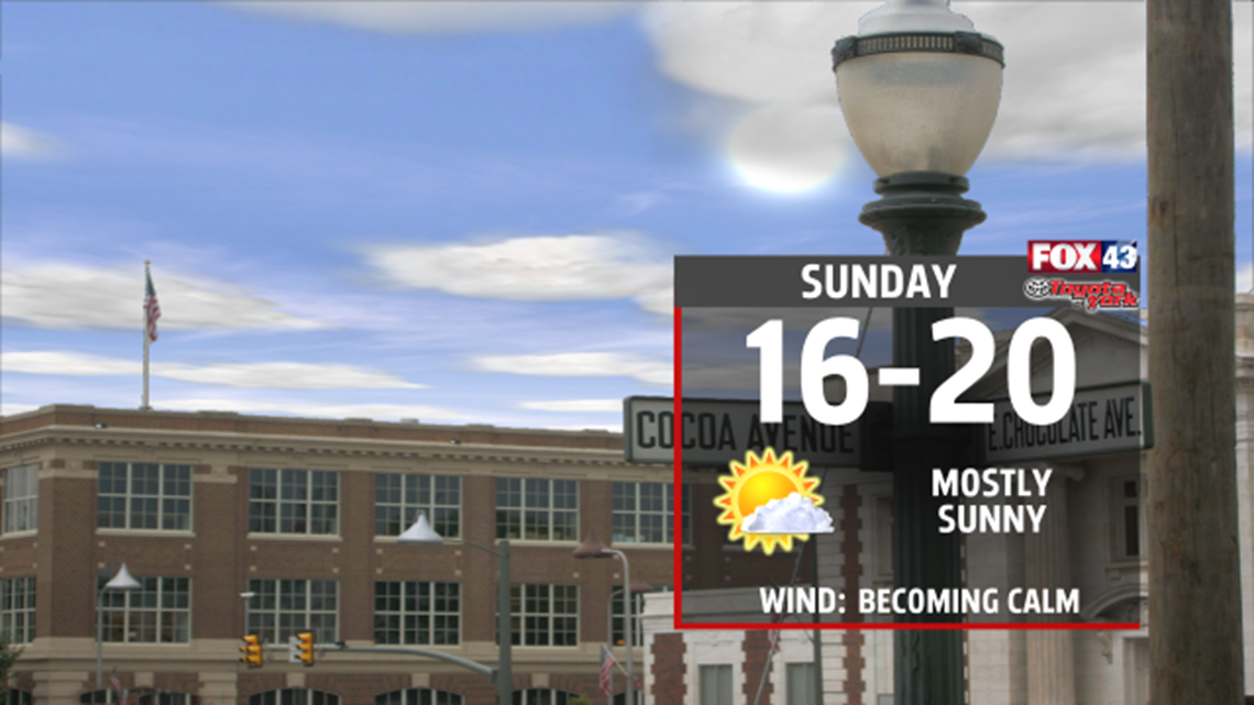
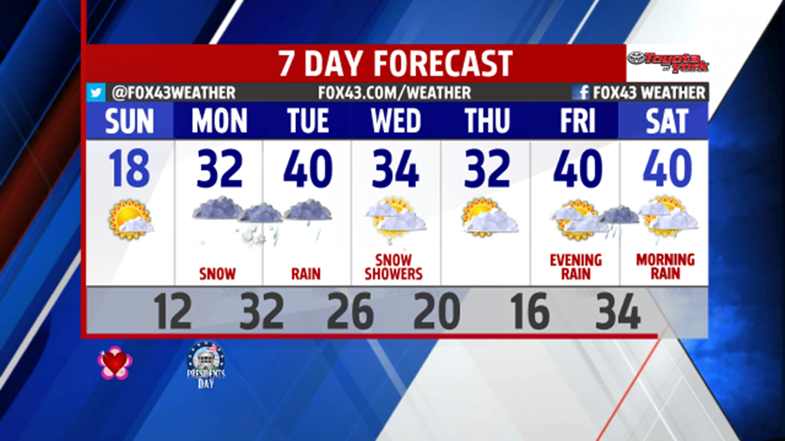
WIND-FREE SUNDAY: After a windy Saturday, you won’t notice any breezes on Sunday. The winds turn calm because an area of high moves into our skies. Anytime we have a strong area of high pressure over us, it gets rid of the wind. The area of high pressure also brings us sunny skies. Expect highs in the upper teens.

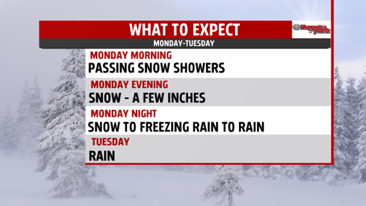
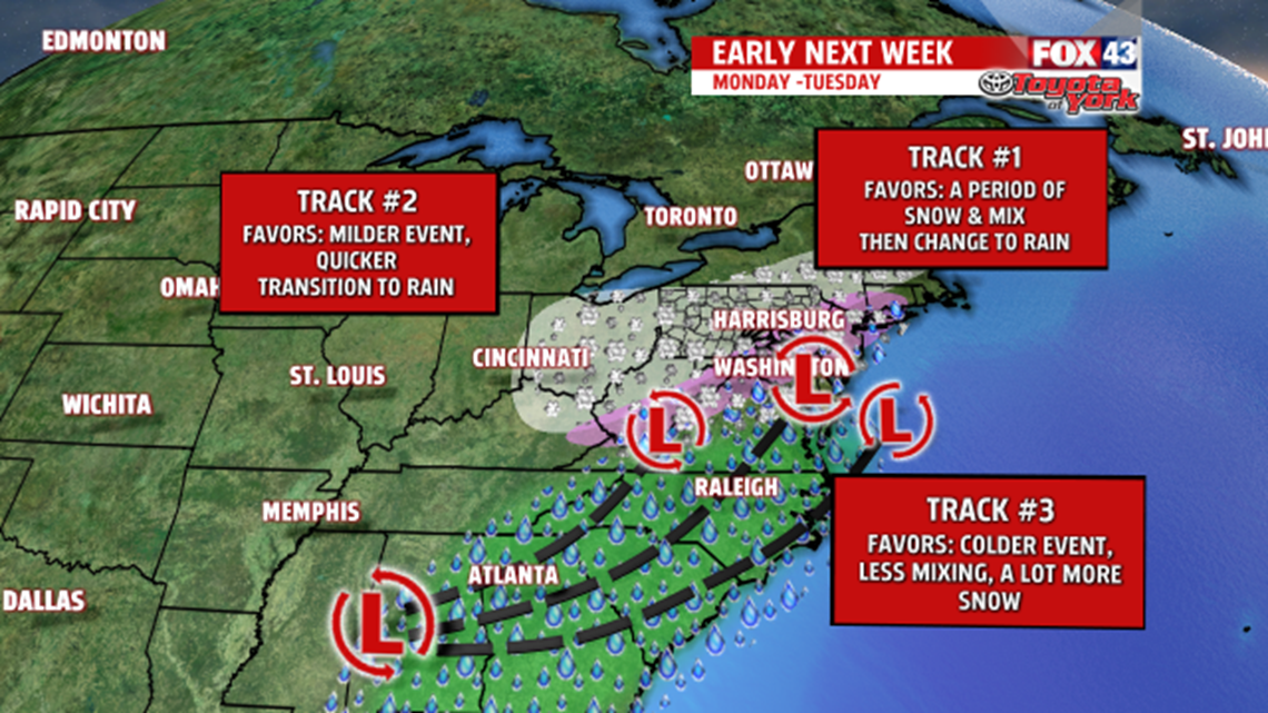
SNOW’S COMING: Don’t get too use to the clear skies, we quickly turn cloudy Sunday night. On Monday, we’ll have passing snow showers in the morning. In the afternoon, anytime after 2 P.M., snow arrives. The snow starts along the Pennsylvania-Maryland state line and spread north. Expect some snow for the evening. The snow will instantly stick to the cold ground. We’ll get a few inches of snow Monday evening and Monday night before the snow turns to sleet.

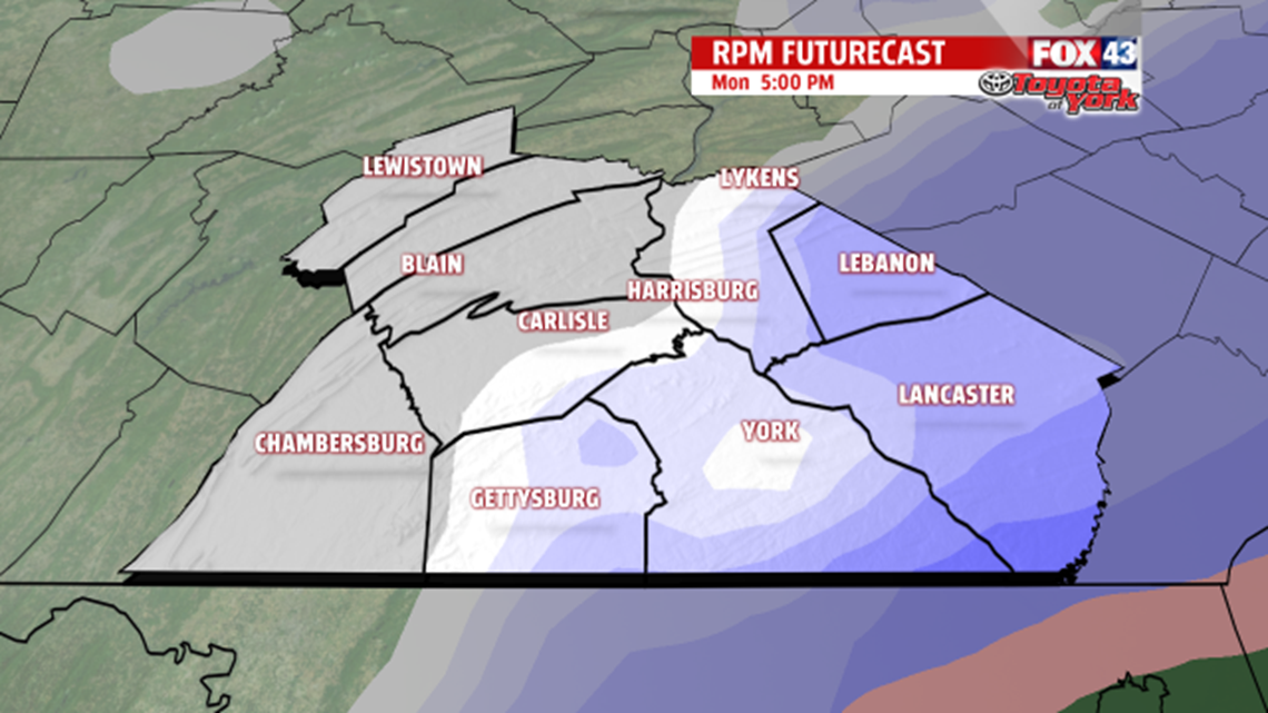
The sleet doesn’t last long. Instead, it turns to freezing rain. Freezing rain causes ice to form on the salt-free ground. The freezing rain turns into regular rain later Monday night. Expect plain rain in most places Tuesday morning and Tuesday day. With that all said, some spots west of Harrisburg like in Perry, Juniata, and Mifflin Counties may have the snow or freezing much longer than everyone else. This depends on the exact track of the storm, and we need more time to track this. We’ll keep you updated.

WINDS RETURN LATER IN THE WEEK: On Wednesday, we’ll have some light snow or snow showers. Plan on little accumulations of that snow. Highs top out in the mid 30s. After a sunny Thursday, windy conditions return on Friday. We’ll have rain Friday evening into Saturday. Highs in the 40s close out the week.

-Meteorologist Drew Anderson
