

WET COUPLE OF DAYS AHEAD
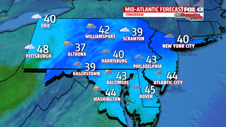
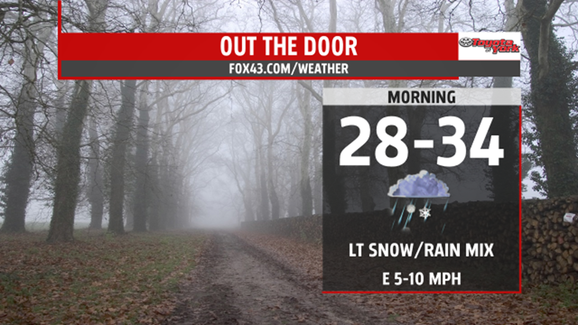
Clouds are streaming in from the south, as an area of low pressure moves towards the northeast. It will track to the North Carolina coast and lift northward through the day Tuesday. It will spread very light precipitation in the later part of the morning drive. With morning lows in the upper 20s to low 30s, and a marginal thermal profile in the upper levels, a wintry mix is possible before changing to light rain.

Any wintry mix will be brief. Precipitation overall will be light, and with a persistent easterly flow, drizzle and clouds will be with us much of the day. We get a break from the light rain in the late afternoon and evening. Highs will be held to near 40 degrees. A more significant low pressure system takes shape over Texas, deepens and tracks towards the Ohio Valley Wednesday.

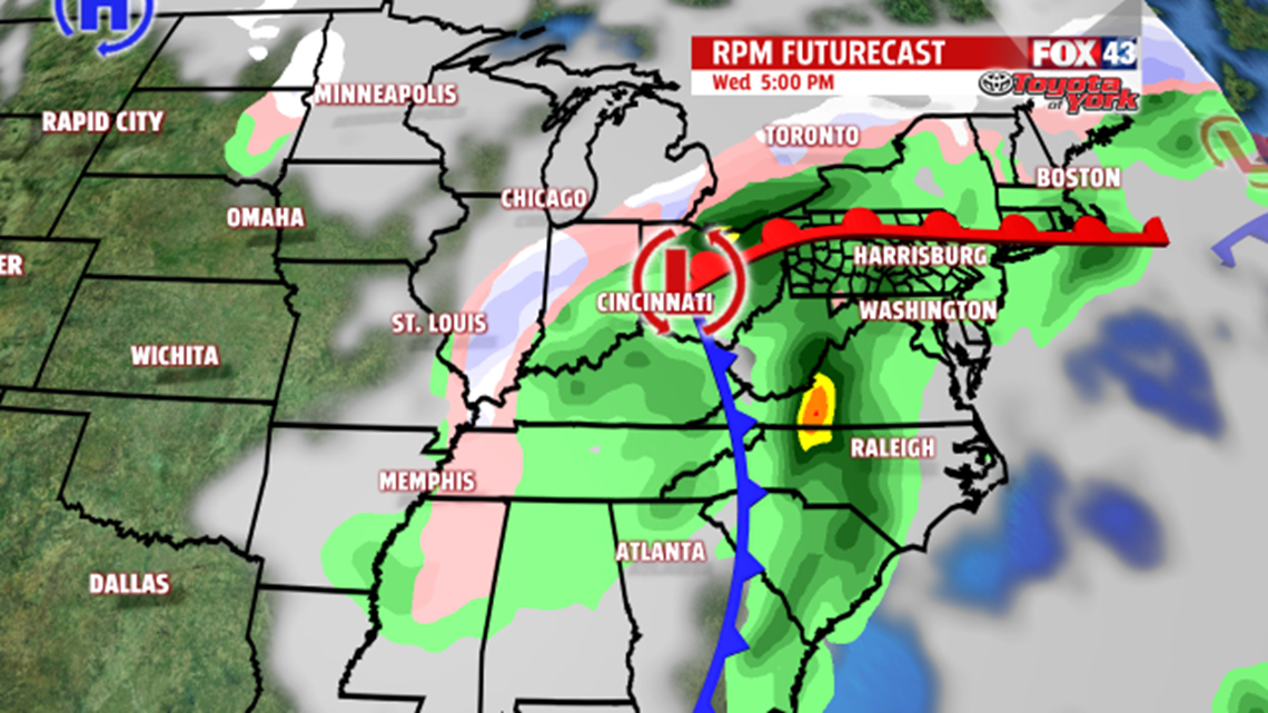
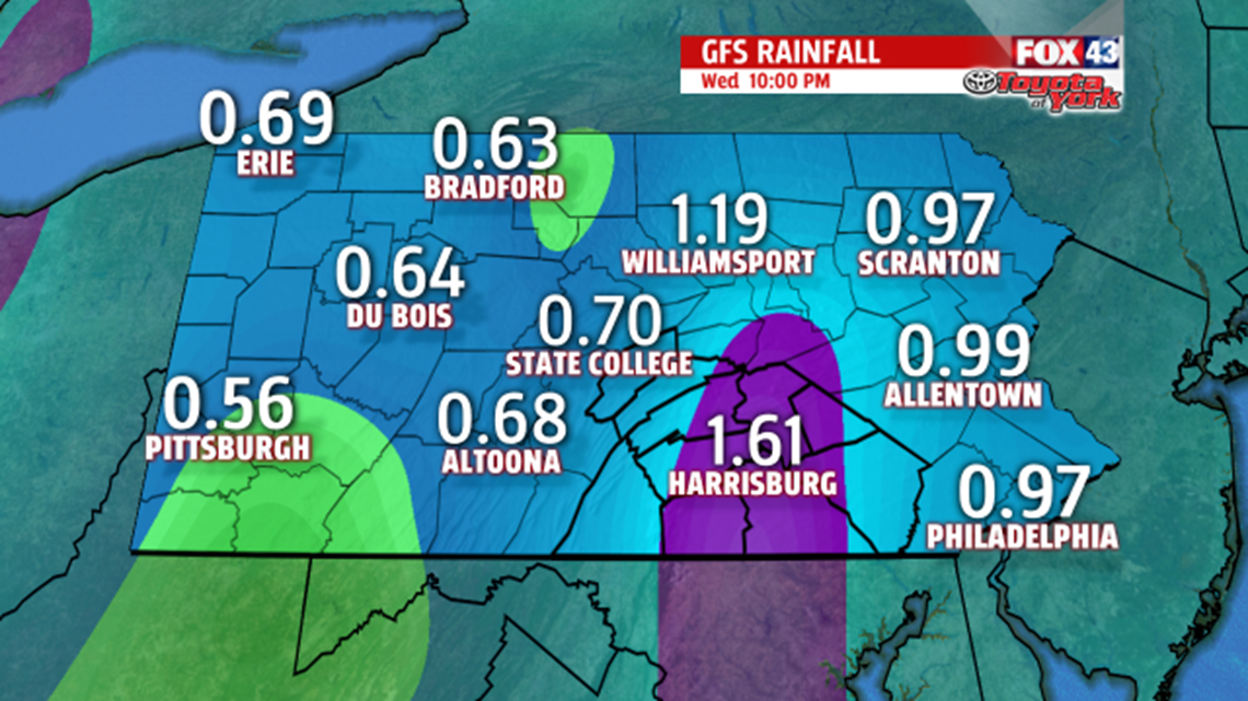
With the low to our west, we remain on the mild side of the system; therefore temperatures will slowly climb through the 40s Wednesday, and reach the 50s by early Thursday. Rainfall with this system may approach an inch or more in places before it moves out. Weather remains unsettled, with a rain or snow chance for Thursday.

MaryEllen Pann,
Chief Meteorologist
