

The severe weather threat is over for the rest of the night.
Previous weather story below:
A Severe Thunderstorm Warning is in effect for Cumberland, Dauphin, Lancaster, Lebanon & York Counties until 7:30pm.
Thunderstorm wind gusts are expected to produce damage. People outside should move to shelter.
A TORNADO WATCH remains in effect until 11pm for York, Lancaster and Adams counties. The potential for tornadoes will increase north and northeastward through late afternoon and early evening. Strong to severe thunderstorms will move up from the south-southwest capable of producing damaging winds and isolated tornadoes. Be ready to take cover if threatening weather should approach.
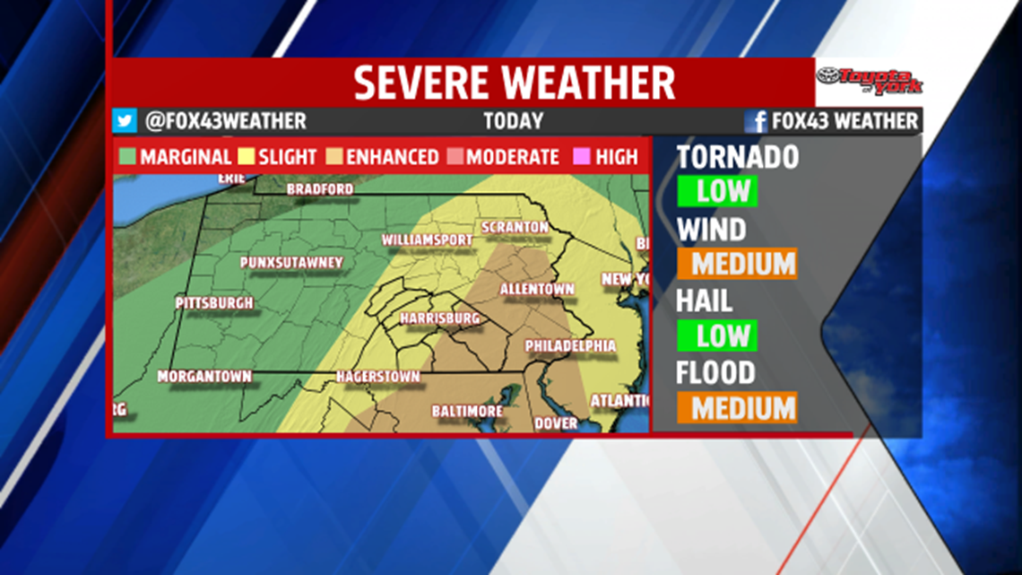
Thunderstorms are possible this evening, with a chance for damaging winds, and a small tornado threat. The Storm Prediction Center placed the area under an ENHANCED RISK for severe weather.

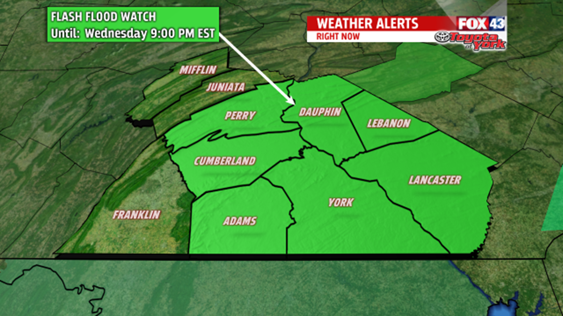
Temperatures will continue to climb, with the high of the day, coming in before midnight. Winds will become quite gusty too. Rain will pick up in intensity, as the line of showers and thunderstorms rolls through during the evening hours. FLASH FLOOD WATCH is in effect until 9pm this evening.

DRYING OUT
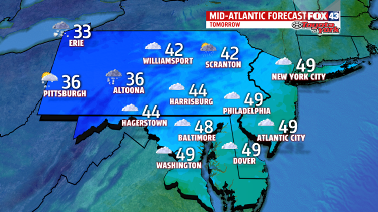
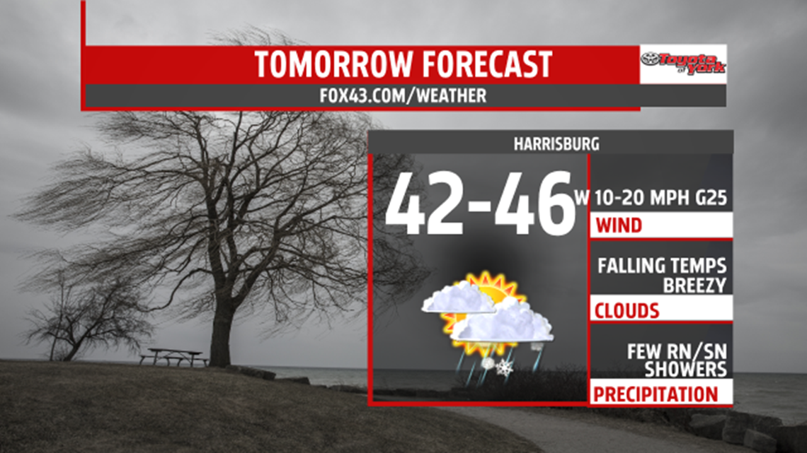
It remains mild into the early morning hours Thursday, and a few rain or snow showers are possible. However, most of the area will experience a drier day. After a midnight high in the lower 50s, temperatures will fall to the lower to middle 40s during the afternoon hours. A colder breeze sets up out of the northwest, which will cause temperatures to drop into the 20s overnight. It will be a noticeably colder but drier for Friday. Highs will remain in the lower to middle 30s under plenty of sunshine.

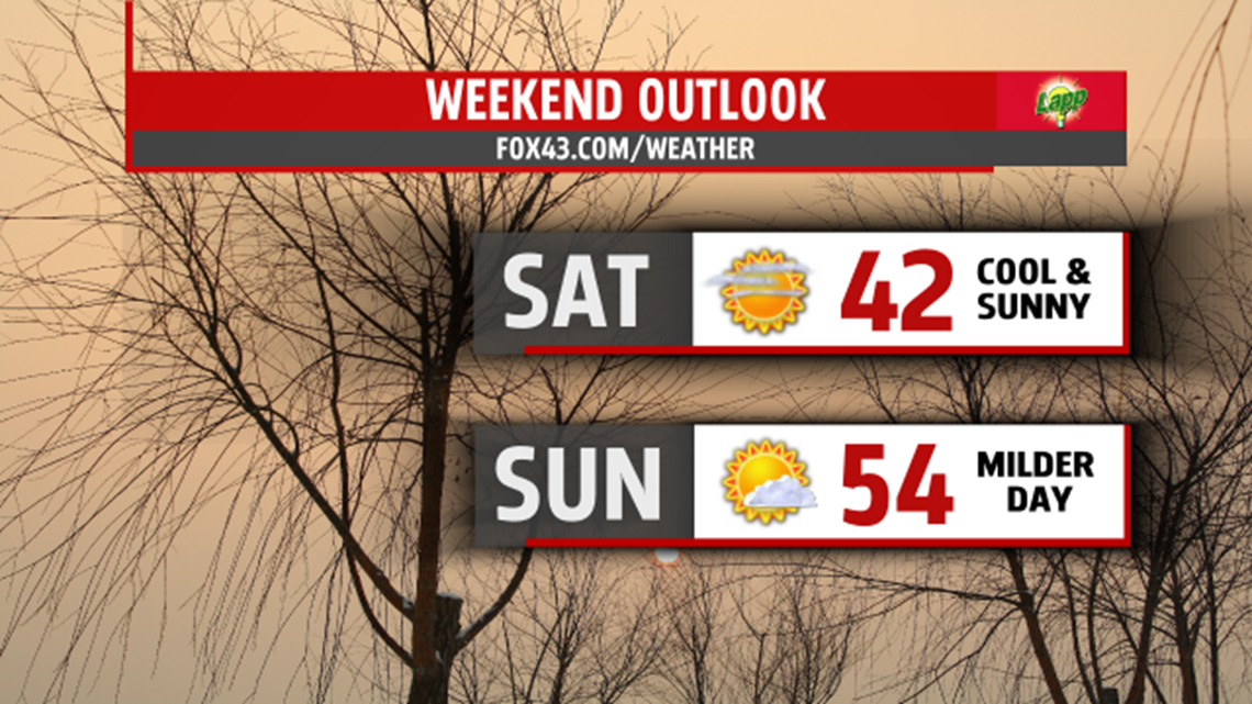
WEEKEND OUTLOOK:
High pressure provides plenty of sunshine and dry conditions for the weekend. High temperatures make a jump from the lower 40s Saturday, to the lower 50s on Sunday. The next cold front swings in Monday, bringing a minimal shower threat. Expect a high near 50 Monday. March arrives colder with highs only in the 30s for Tuesday.

MaryEllen Pann,
Chief Meteorologist
