COLDER AND DRIER AIR WORKS IN
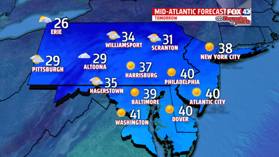
This evening we continue with light rain/snow showers. However, drier air is finally pouring in across the area. A stretch of dry weather will help the soggy grounds to dry. Water levels are finally receding. Flooding threat will lessen this evening. While there will be plenty of sunshine for Friday, colder air will settle in too. Highs are noticeably chillier in the 30s. It is also quite breezy.

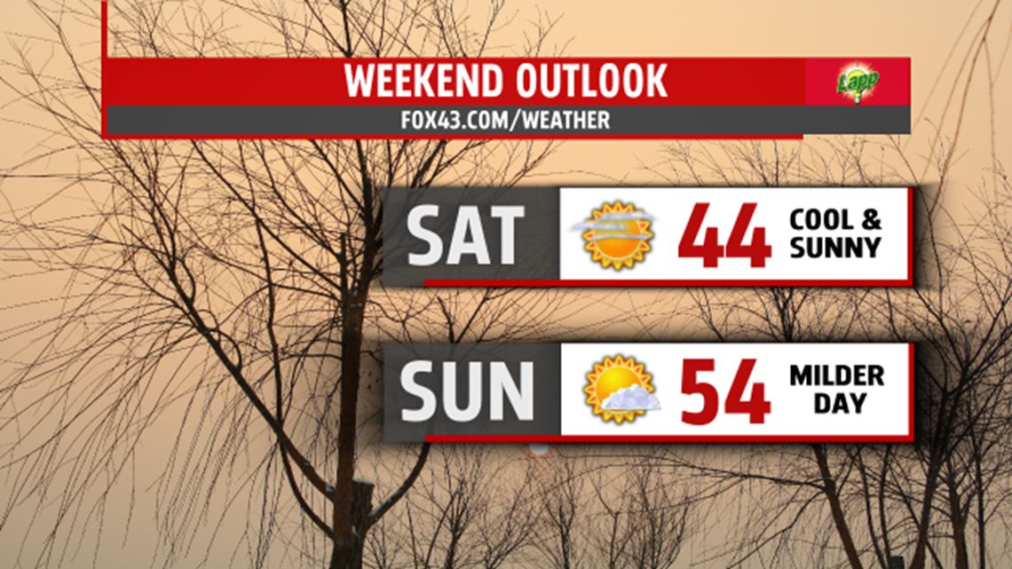
Calmer conditions and clearing skies, will lead to quickly falling temperatures to the lower 20s by Saturday morning. It is dry both days, with plenty of sunshine and few clouds to begin the weekend. Highs warm to the upper 30s to lower 40s. Sunday, it will be sunnier and warmer as temperatures climb through the upper 40s to lower 50s.