STUBBORN CLOUDS
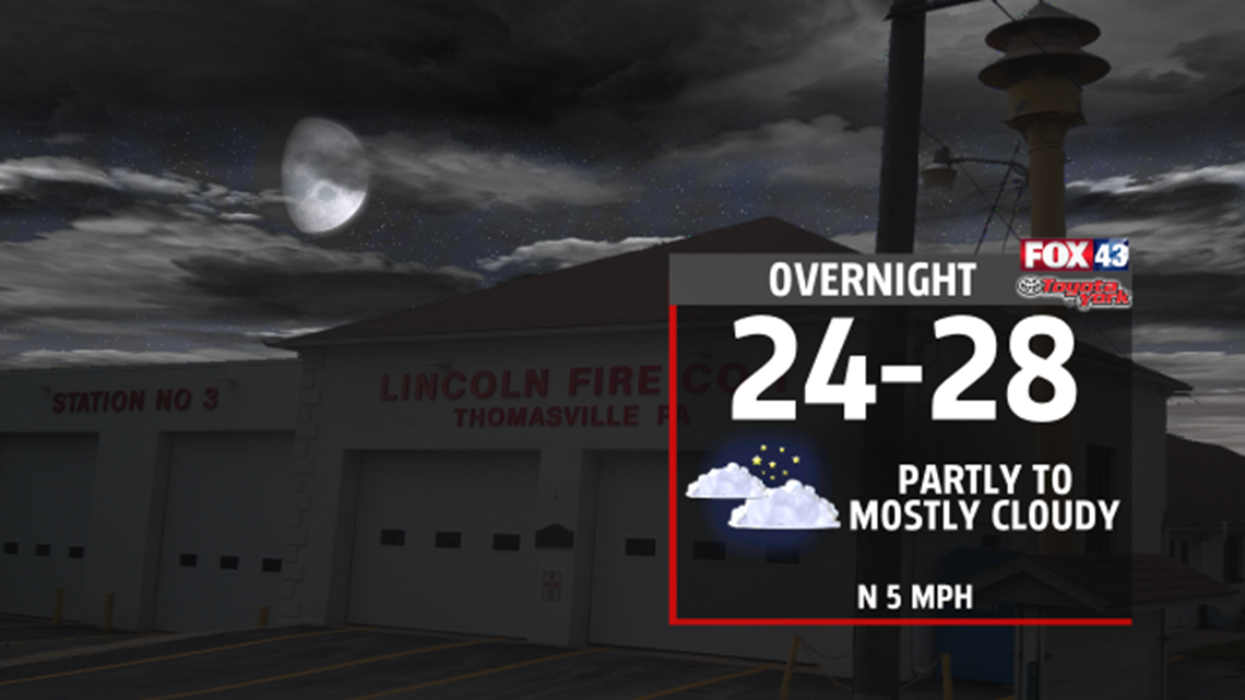
Clouds break up some, as high pressure builds in, briefly tonight. Lows expected in the mid to upper 20s.

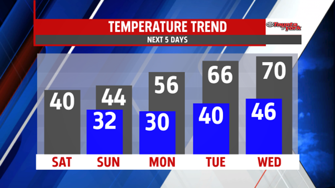
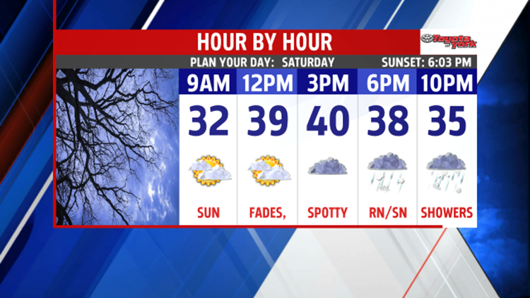
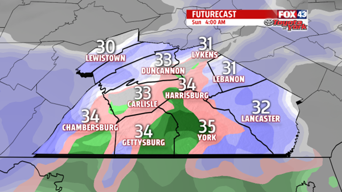
Any sunshine early in the day will diminish quickly as the clouds fill in. That will keep temperatures from warming up too much. Highs will hover in the upper 30s to lower 40s. The next clipper system races in towards evening. It will bring spotty rain or snow showers late into the overnight period. A coating of snow is possible in some areas. Clouds linger into the late morning hours; however, skies brighten by the afternoon Sunday as high pressure builds in. Temperatures climb to seasonable averages in the middle 40s.

A FANTASTIC STRETCH OF MILDER AIR
High pressure strengthens in the Atlantic early next week and sets up a south-southwesterly flow. Jet stream lifts well to the north, a combination of a persistent southwesterly flow and a ridge of high pressure building aloft, spells out several days of well above average temperatures. Expect a beautiful start to the week with mostly sunny skies and highs in the middle 50s. It gets even warmer by Tuesday, as temperatures climb well into the 60s. Some areas will flirt with 70 degrees by mid-week. Next best threat of rain is Thursday, as a frontal boundary sets up over the area. Several weak waves will ripple along the boundary, which will keep the clouds and rain around for most of the day. The wet weather may linger into Friday morning. Temperatures will fall back but stay well above normal.