CHILLIER AIR ARRIVES FOR THE WEEKEND
Overnight, skies will be clear, winds will die down and temperatures will fall quickly to the upper 30s to low 40s. You will notice the chill more so than recent mornings.

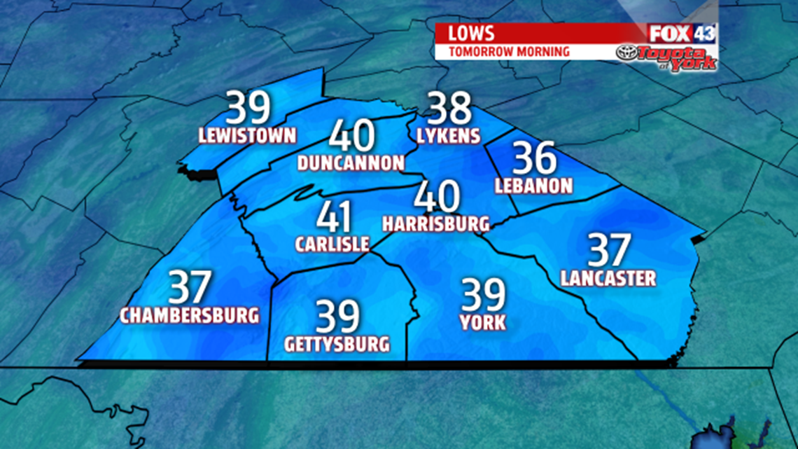
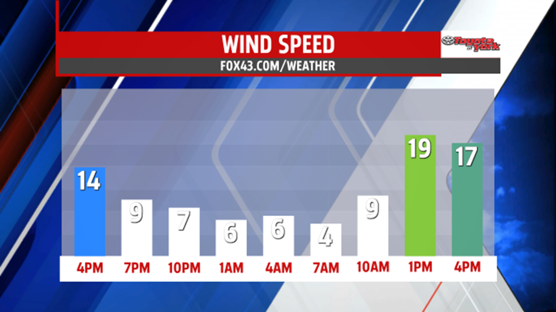
Highs will be mild once again in the mid 50s. Winds increase through the day as the front sags south. They shift from the west to the northwest 10 to 20 MPH with gusts to 30 MPH. Low temperatures leading into the weekend drop to the upper 20s and low 30s, a much colder start then recent mornings. The day starts with sunshine, but clouds moving in by afternoon, quickly dim the bright skies. High temperatures in the mid 40s, fall short of seasonable averages.


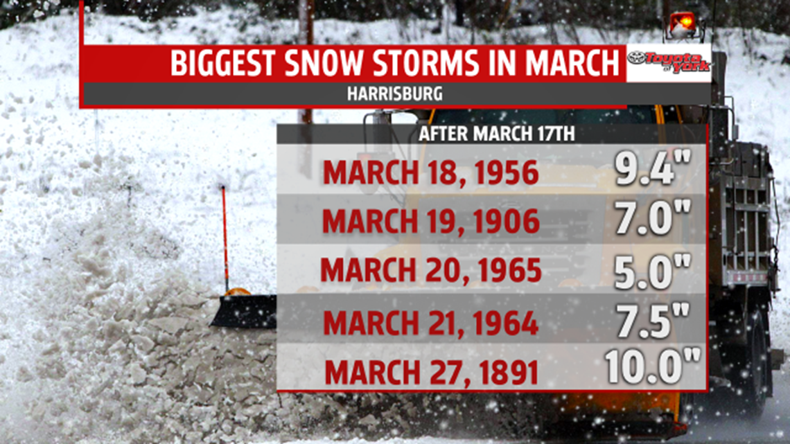
Any accumulations would be on grassy surfaces since roadway temperatures this time of the year are much warmer and not supportive of accumulating snowfall. It is not out of the realm of possibility for snow this time of the year. Here is a look at the biggest snow storms after March 17th. Below average temperatures in the 40s, continue into the beginning of the week.