

KEEP THE UMBRELLA NEARBY
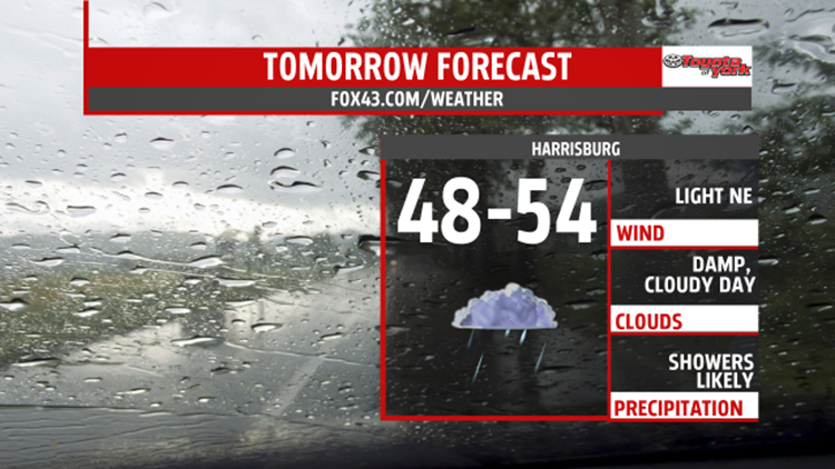
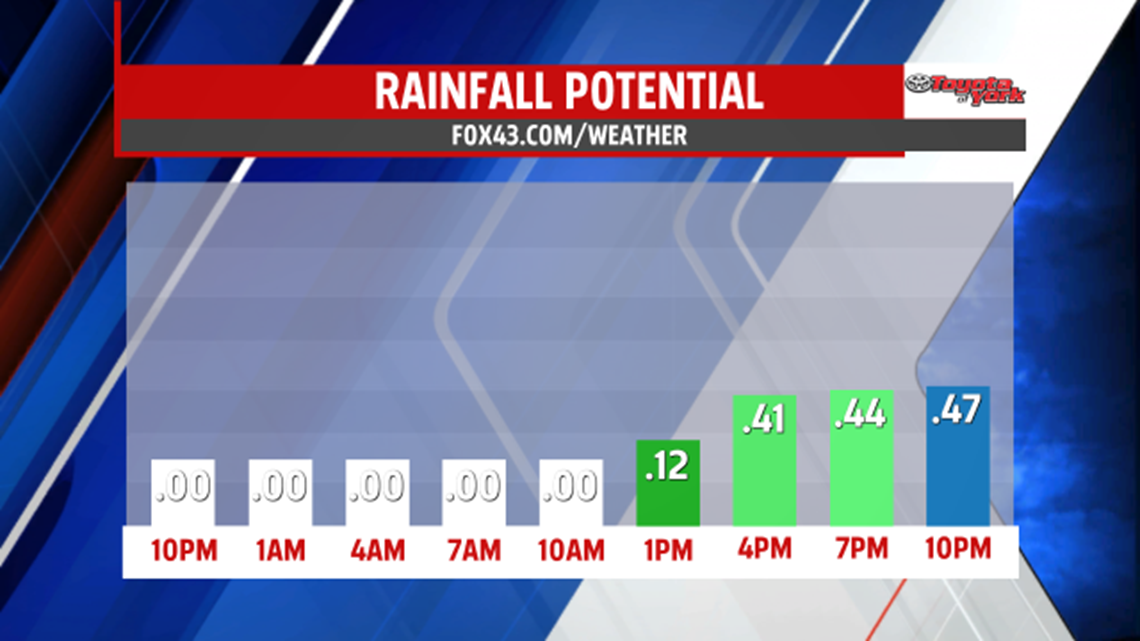
Clouds will thicken up overnight as low pressure slides along a stalled front just to our south. This system will bring on and off showers for Thursday. Another system keeps the wet weather threat around for Friday, although, there will be more dry hours. Both days will be cool and running below average, with highs only managing to warm into the 50s. Rainfall amounts will range between .15″ to .50″. Some isolated amounts may come in higher.

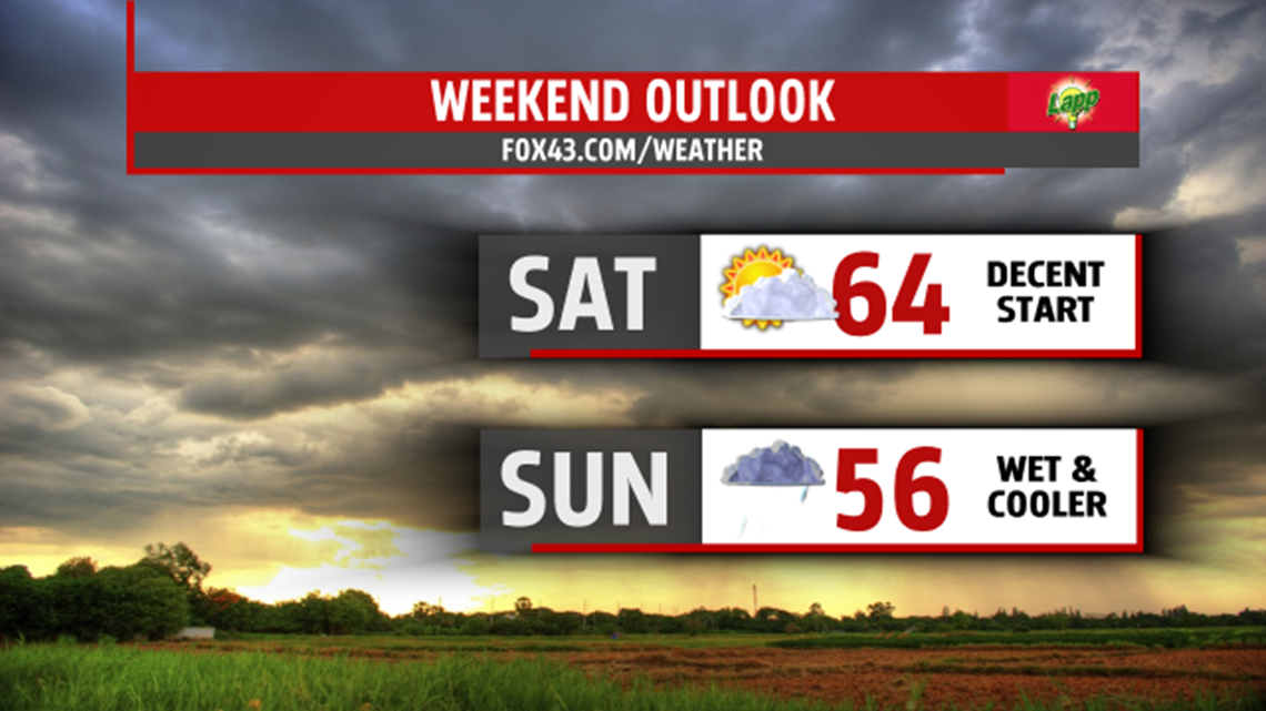
WEEKEND OUTLOOK
One day looks dry, the other wet. If you want to work or play outside, Saturday is the day. Clouds will mix with sunshine but it is dry. However, our next system brings showers for Sunday. Highs Saturday warm to the 60s but they remain cool, in the 50s, for the second half of the weekend and first day of May.

NEXT WEEK
Showers will threaten some areas to begin the first full week of May. With the clouds and a few showers, temperatures remain cooler than average in the upper 50s and lower 60s. Sunshine and drier weather returns, albeit brief, for Tuesday and that means more seasonable temperatures in the middle 60s. Rain quickly makes a return by Wednesday.
SEVERE WEATHER AWARENESS WEEK
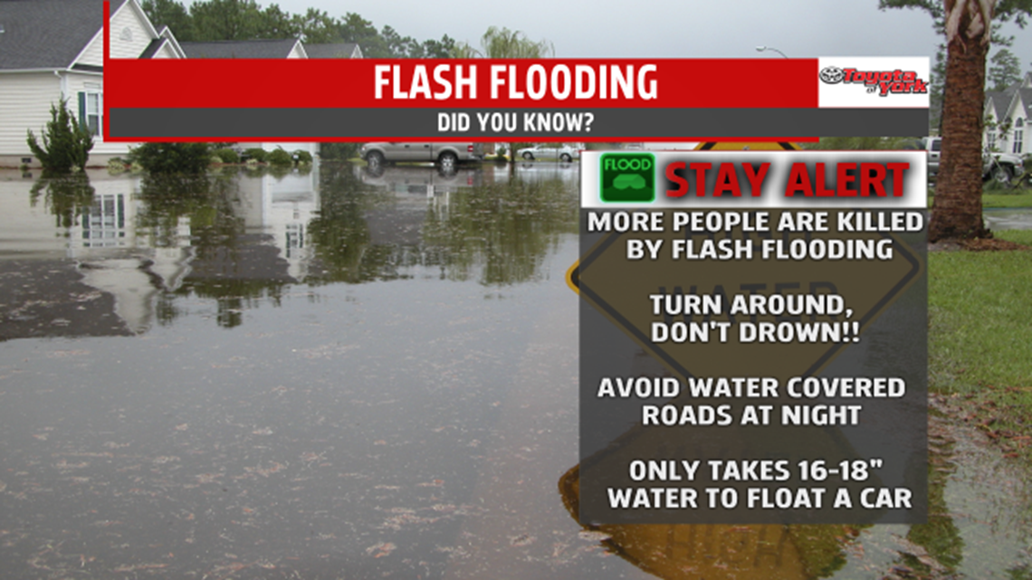
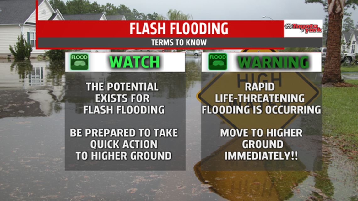
Severe Weather Awareness Week continues across Pennsylvania with today’s topic: FLASH FLOODING.
Most people don’t realize there are more deaths as a result of fooding than any other weather related event. Many are caused by motorists who attempt to drive through flooded roadways. A short phrase to remember: “Turn around, don’t drown!”. Seems simple but remembering it may save a life.

Flash flood watches and warnings are issued by the National Weather Service when heavy rain may cause rapid rises along our creeks, streams and rivers. Poor drainage areas may see flash flooding too. Heavy rain is often caused by torrential thunderstorm rainfall which results in rapid rises of water levels.
A Flash Flood Watch means the potential exists for this type of flooding, especially for creeks, streams and poor drainage roads. This gives you heads up for the possibility of flash flooding.
A Flash Flood Warning means rapid, life-threatening flooding is imminent or occurring. It indicates heavy rain will cause the water to rise and overflow bans of nearby waterways. It is urgent for you to protect your life and your property.

Make sure to have a safety plan ahead of time so when threatening weather approaches, you are prepared to head to your safe place immediately.
It is highly recommended to purchase a NOAA Wether radio to keep you alerted to forecast updates and possible warnings.
Stay with FOX43 Weather for updated changes to the forecast through the rest of the week!
Have a good day!
MaryEllen Pann,
Chief Meteorologist
