

WET WEATHER THREAT CONTINUES
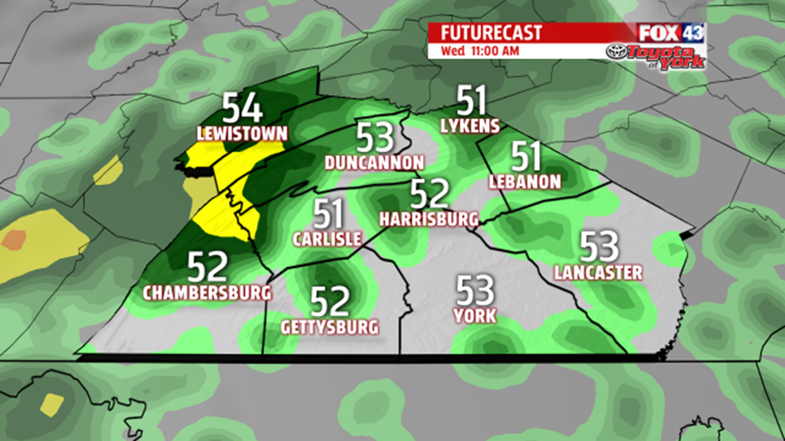
Showers are expected to threat this evening and overnight. they will be spotty in nature. Overnight lows are cooler, in the middle 40s to lower 50s. We wake up to a few isolated showers for Wednesday morning as the same stubborn storm system slowly drifts eastward. We’ll see more showers through the afternoon too. Then we get a break from the wet weather but leftover drizzle and mist may persist under an easterly flow.

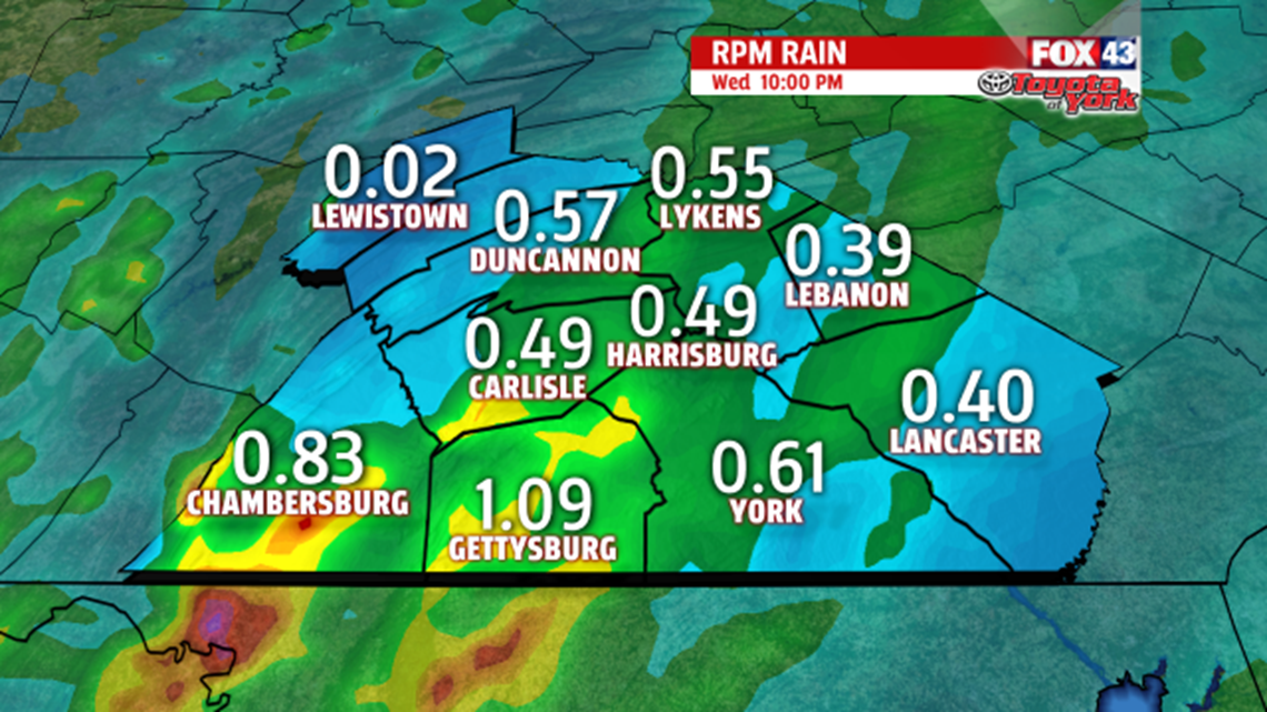
We may pick up an additional .25″ to .50″ of rainfall is possible.

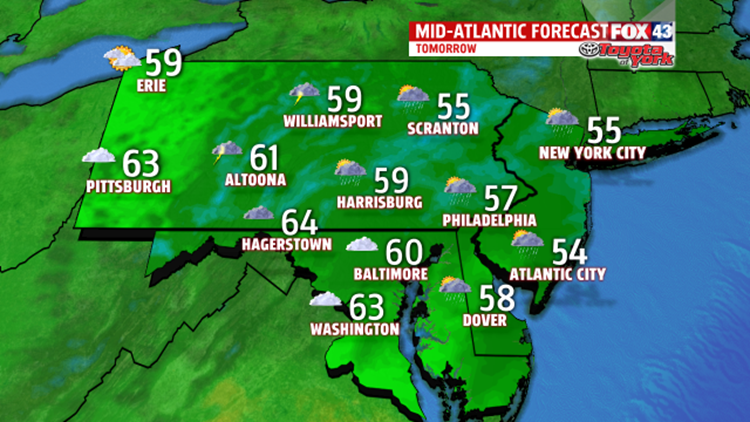
High temperatures will climb through the lower to middle 60s. Cooler air will spread in for Thursday as an upper-level system, along with upper-level energy, slides across the region. Expect highs on the cooler side in the 50s. Rain showers linger into Friday early then become isolated later in the day. Temperatures remain below average near 60 degrees.
WEEKEND OUTLOOK
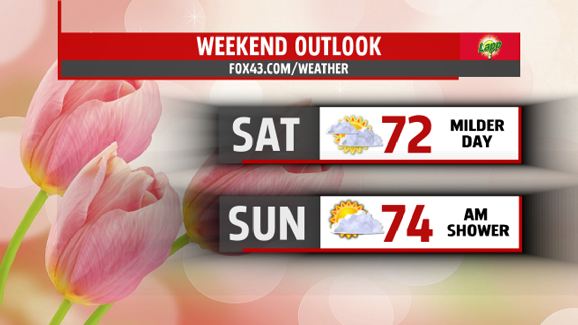
Mother’s Day weekend brings a short break from the wet weather. Clouds will mix in and out of the sunshine for Saturday, with temperatures taking a nice jump into the 70s. However, showers return for Sunday, Mother’s Day, but it won’t be a washout. With limited sunshine, highs are cooler but will still push 70 degrees.

NEXT WEEK
The pattern looks to break next week as sunshine returns in full force Monday. Several more dry days expected with warmer temperatures too.
Stay with FOX43 Weather for updated changes to the forecast through the rest of the week!
Have a good day!
MaryEllen Pann,
Chief Meteorologist
