


SUMMER HEAT ARRIVES THIS WEEK
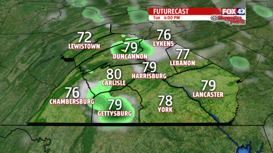
Tonight, fog forms again towards the early morning hours in areas where rain fell today. Expect diminished visibility, especially, where the fog is dense. There may even be an isolated shower. Skies brighten late morning into the early afternoon before clouds bubble up, and while most of the day is dry, an isolated shower can’t be ruled out. We’ll see more sunshine and temperatures warming to the upper 70s to near 80 degrees. A summer-like pattern sets up the rest of the week. Temperatures warm well into the 80s, especially late week! Wednesday remains dry but daily isolated thunderstorm chances are likely both Thursday and Friday. Temperatures climb higher into the middle 80s

MEMORIAL DAY WEEKEND OUTLOOK
The summer pattern remains through the holiday weekend! Highs climb to the middle and upper 80s. Right now, Saturday is the driest with a very minimal chance for thunderstorm development. However, Sunday and Memorial Day, during the afternoon, thunderstorms threaten. Highs will drop a few degrees but still warm into the lower to middle 80s.


Stay with FOX43 Weather for updated changes to the forecast through the rest of the week!
Have a good day!
MaryEllen Pann,
Chief Meteorologist
