

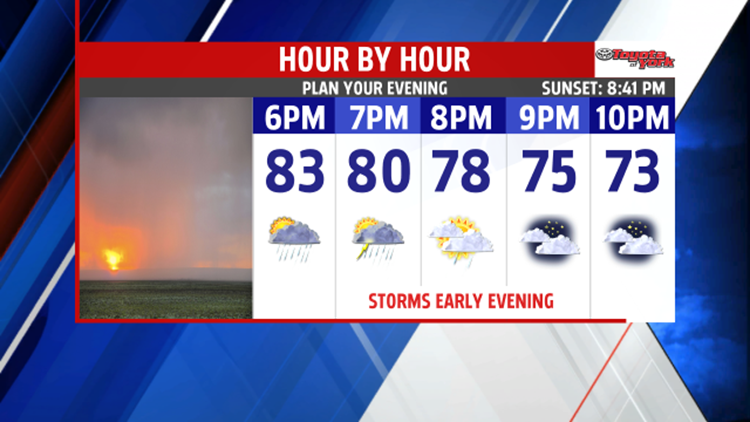
MUGGY/FEW AFTERNOON AND EVENING STORMS
The warm and very humid conditions are leading too strong to severe storms this
afternoon and evening. Damaging winds around 60mph, hail and heavy rainfall likely through the early evening. Severe Thunderstorm Watch is in effect until 10pm for our eastern counties.
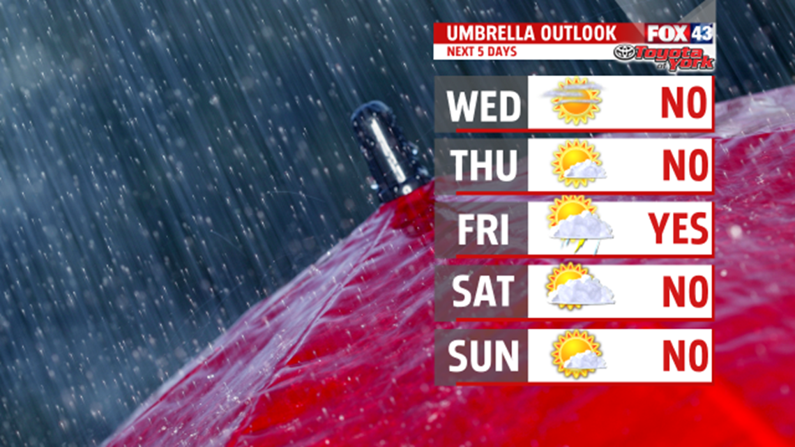
High pressure builds in for a couple of days to bring drier conditions and more sunshine. We enjoy a break from the humidity before it returns at the end of the week. Highs are cooler in the upper 70s to lower 80s on Wednesday, then will climb to the lower to middle 80s on Thursday. Our next front arrives Friday. As of now, it looks weak and does not provide enough moisture to bring widespread showers and thunderstorms. The front slowly moves south by Saturday morning. Highs are warm in the middle 80s Friday ,and you’ll notice the humidity once again.

FOURTH OF JULY WEEKEND OUTLOOK:
With the front nearby Saturday, an isolated shower or thunderstorm cannot be ruled out. Most of the day is dry, humid and warm with highs in the middle 80s. More sunshine expected for Sunday. Highs warm to the lower 80s. Fourth of July looks great. High pressure provides plenty of sunshine and dry conditions for Independence Day celebrations. Temperatures warm to the middle 80s.


STAYING WARM
It remains warm and dry through Tuesday with high pressure firmly in place. Highs are warmer in the upper 80s, and you’ll notice the July humidity hanging around too.
Stay with FOX43 Weather for updated changes to the forecast through the rest of the week!
Have a good day!
MaryEllen Pann,
