

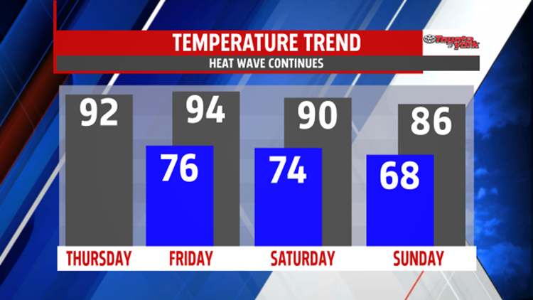


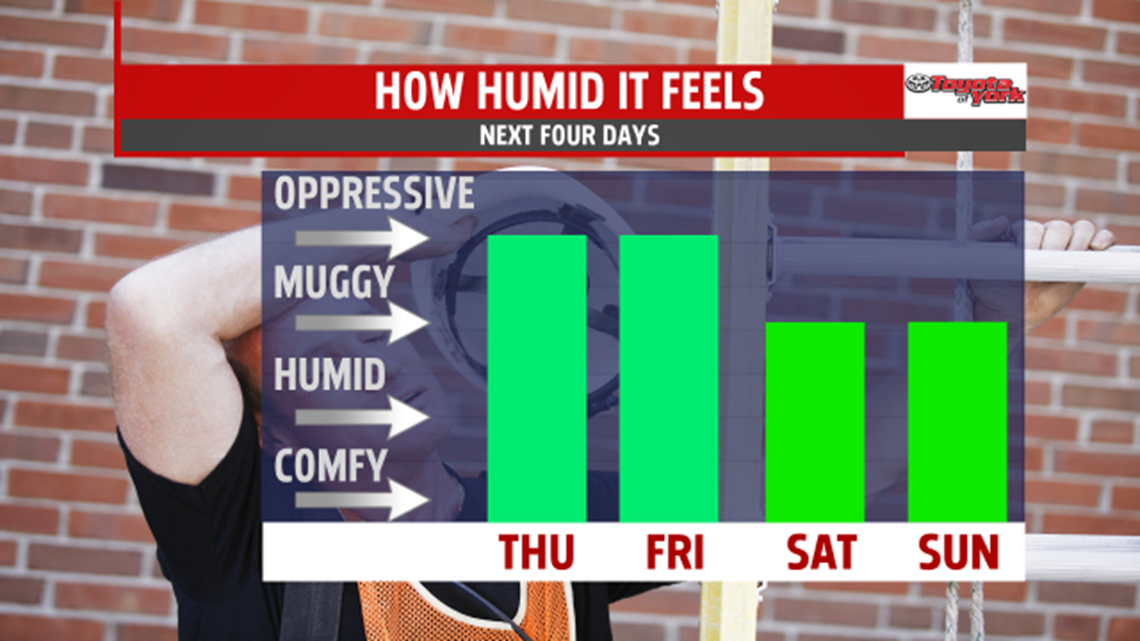


WEEKEND NOT AS HOT: A secondary cold front swings through Saturday, and this keeps the afternoon shower and thunderstorm chances in place on Saturday. Afternoon temperatures are still quite warm, with readings hovering in the upper 80s to near 90 degrees. Sunday the humidity levels finally come down a bit, and temperatures are seasonably warm. Expect readings in the lower to middle 80s.
NEXT WEEK: A strong ridge of high pressure returns to the region, and this brings back the warmth and humidity through early next week. Slight warming takes place Monday under plenty of sunshine. Readings are in the middle to upper 80s. Temperatures are expected to approach 90 degrees again Tuesday under plenty of sunshine. Wednesday is another humid and toasty one, with highs near 90 degrees once again. There’s a small chance for a few pop up thunderstorms, but most locations look dry.
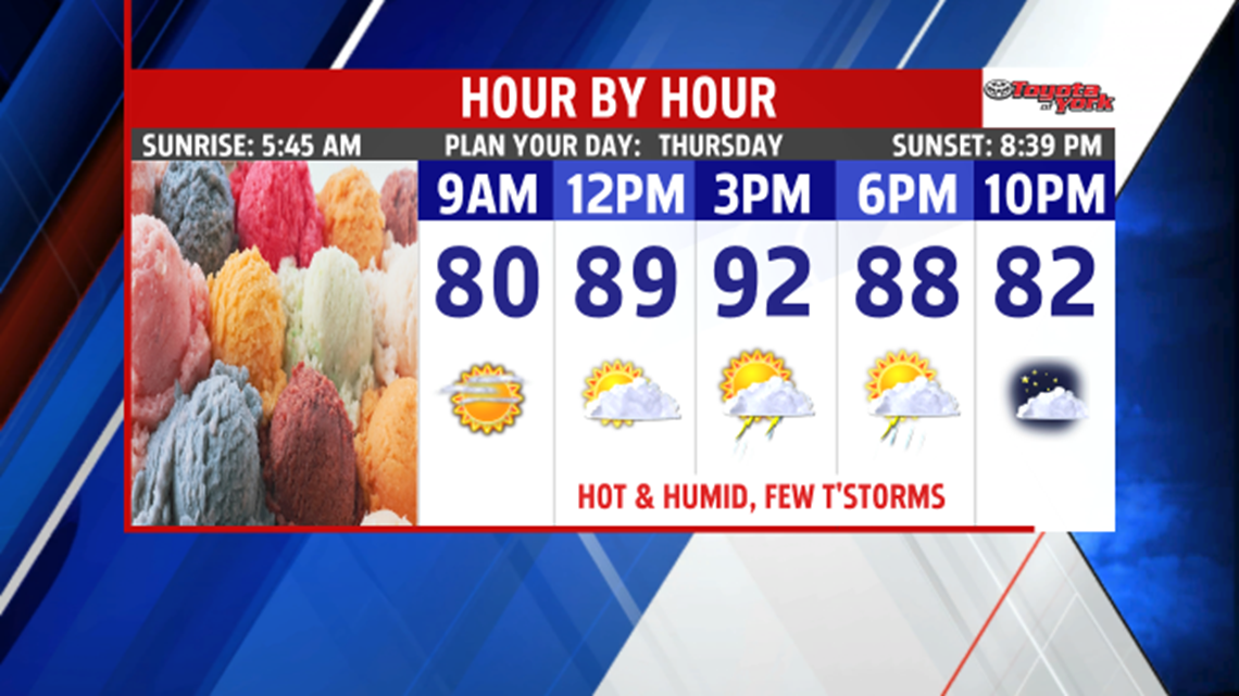
Have a great Thursday!
-Meteorologist Andrea Michaels
