

APPROACHING DANGEROUS HEAT INDICES
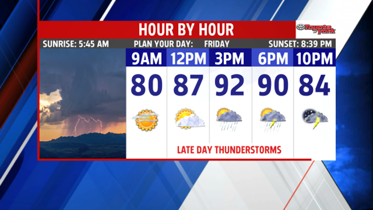
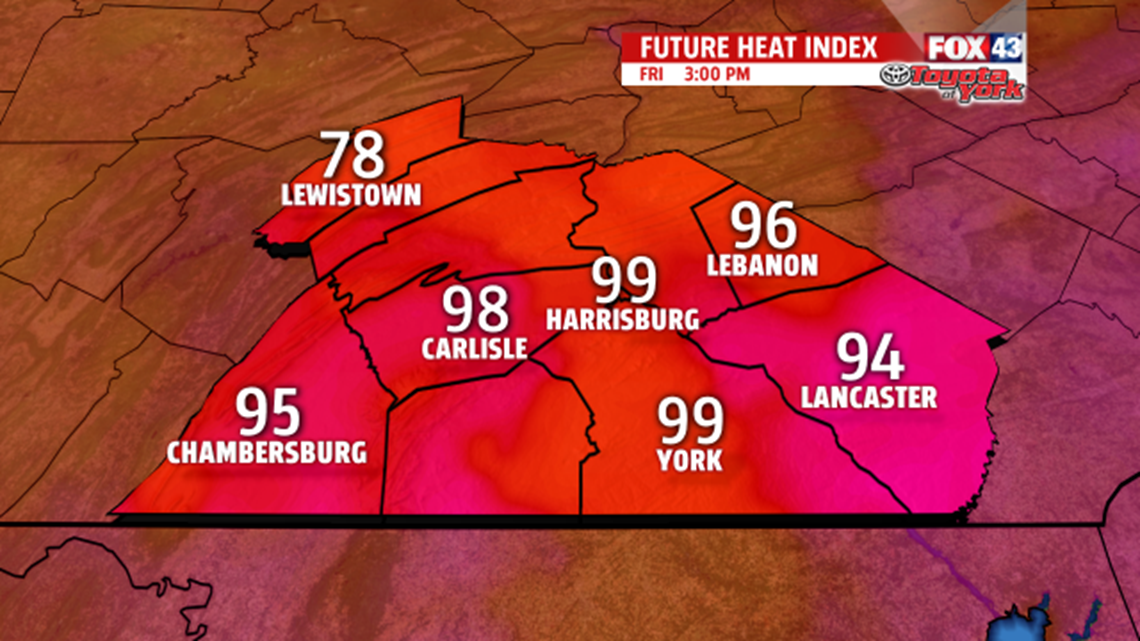
The heat is on! We continue our stretch of hot and humid days with highs expected to hit well into the 90s once again Friday. With the humidity factored in, it will feel like 100 degrees or higher in some areas.


Please use caution if spending a long time outdoors. Drink plenty of water even if you don’t feel like you are thirsty. It is important to stay hydrated to avoid heat-related

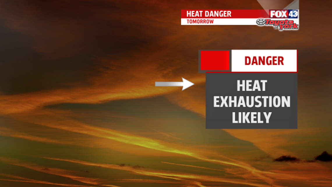
Please use caution if spending a long time outdoors. Drink plenty of water even if you don’t feel like you are thirsty. It is important to stay hydrated to avoid heat-related illnesses. Also, limit or avoid the hottest part of the day, which is the afternoon hours. Take breaks in the shade and wear light colored clothing. A hat helps too. These are a few tips to help enjoy the summer heat. Be sure to check on the elderly and children and we don’t want to forget our pets too.
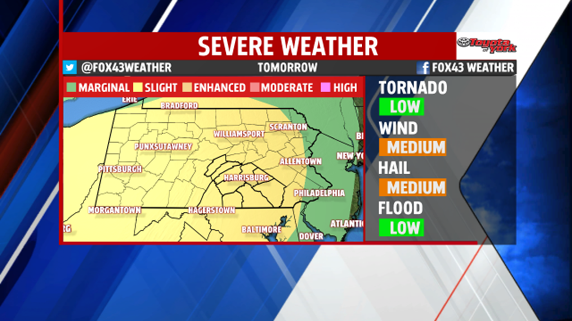
With the heat and humidity and the first of two cold fronts swinging in, there is a chance for strong thunderstorms in the afternoon. They are expected to be scattered across the area. The Storm Prediction Center placed the area under a SLIGHT Risk for severe weather. Damaging winds and large hail main threats. Frequent lightning and brief heavy downpours will also be possible.

A BREAK IN THE EXTREME HEAT AN HUMIDITY:
Stronger upper-level energy and a secondary front will bring another threat for a few afternoon thunderstorms to begin the weekend. The heat and humidity are around for one more day but drier, less humid and less warm air arrives for Sunday. High pressure builds across the area bringing plenty of sunshine, and a nice, summer day. Highs are around 90 Saturday and into the middle 80s for Sunday.
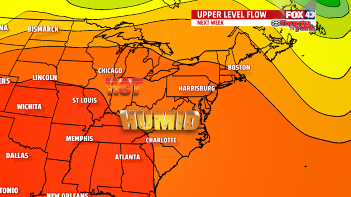
NEXT WEEK:
Another ridge builds bringing the heat and humidity once again. Expect a comfortable Monday with highs in the middle and upper 80s. Tuesday is warm near 90 degrees, and you’ll notice the humidity increasing. By Wednesday, we are in the lower 90s and feeling the sticky, steamy air return. Isolated late day thunderstorms will be possible but the better chance holds off until late week.

Stay with FOX43 Weather for updated changes to the forecast through the rest of the week!
Have a good day!
MaryEllen Pann,
Chief Meteorologist
