

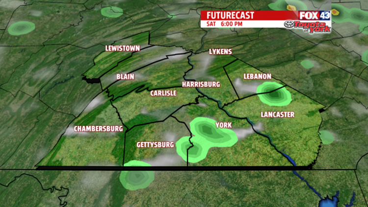
SATURDAY STORMS: We’ll have a few hit or miss, pop-up thunderstorms this afternoon and evening. They’ll be less widespread than Friday’s afternoon storms. For the spots that get a storm, expect heavy rain and some strong wind gusts.
If you live in Lancaster, Lebanon, and York Counties, you’ll see more afternoon and evening thunderstorms than everyone else. The storms will be stronger and last a bit longer. Expect heavy rain and gusty winds. Expect these hit or miss storms to pop up between now and 7 P.M.
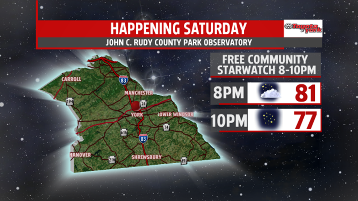
Dry weather returns for everyone by sunset, and what clouds we do have in the sky will quickly disappear. It’ll be a good night to go to the free public starwatch in York.

“COOLER” WEATHER: We get some of those storms on Saturday because of a cold front. The cold front will bring us less humid air, and you’ll notice the difference Saturday night and Sunday. With that said, the air won’t feel completely comfortable. We’ll still have some humidity; it just won’t be as bad as the past few days. After highs near 90 on Saturday, the cold front “cools” us to a seasonal 84 on Sunday.

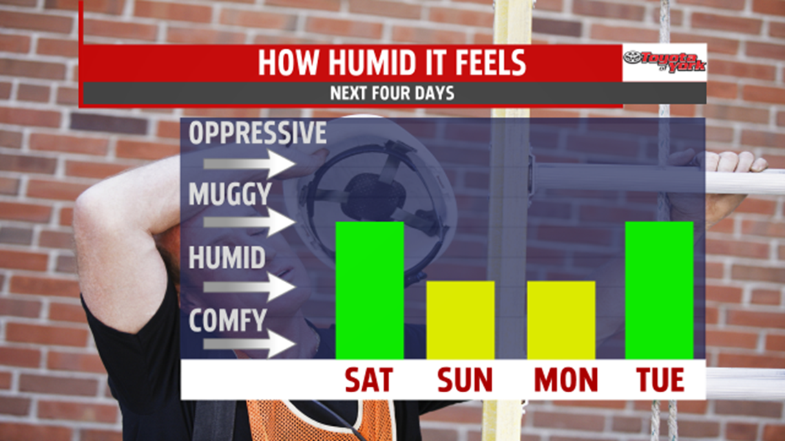
HEAT RETURNS: Very quickly the heat and very humid weather returns. We’ll feel pretty darn humid again on Tuesday, and highs soar to 88. On Wednesday, we crack 90, and we keep the 90s rolling through Thursday. While we stay dry on Tuesday, we’ll get a few thunderstorms with heavy rain on Wednesday afternoon. Then, on Thursday, we’ll have widespread scattered afternoon thunderstorms. They’ll have heavy rain and gusty winds.

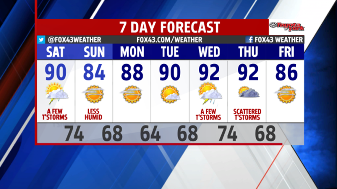
MORE RELIEF: Thursday’s storm come with another cold front, so we drop to the mid 80s on Friday and loose some of the humidity.
-Meteorologist Drew Anderson
