

FINALLY A BREAK IN THE HEAT WAVE
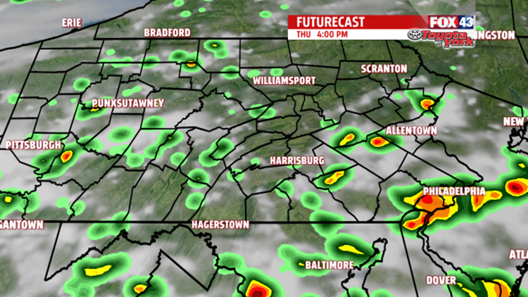
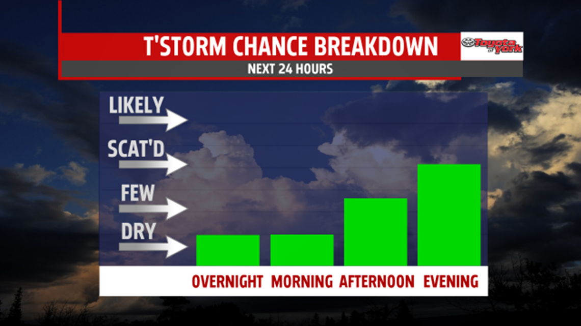
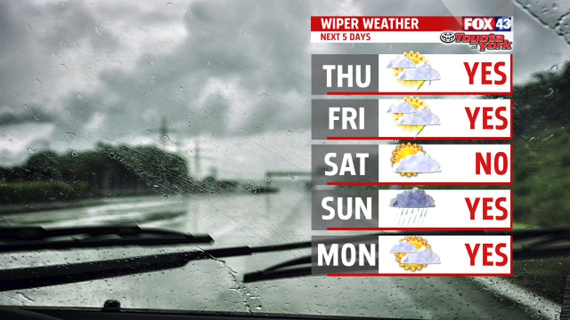
We may have seen our last official 90 degree day. Our forecast is for 90 tomorrow but increasing clouds may hold us in the 80s. Winds shift to the southwest but remain light. Dew points rise once again into the 60s and 70s making it feel more humid. A few showers and thunderstorms are possible during the afternoon but the best chance is during the evening and overnight.

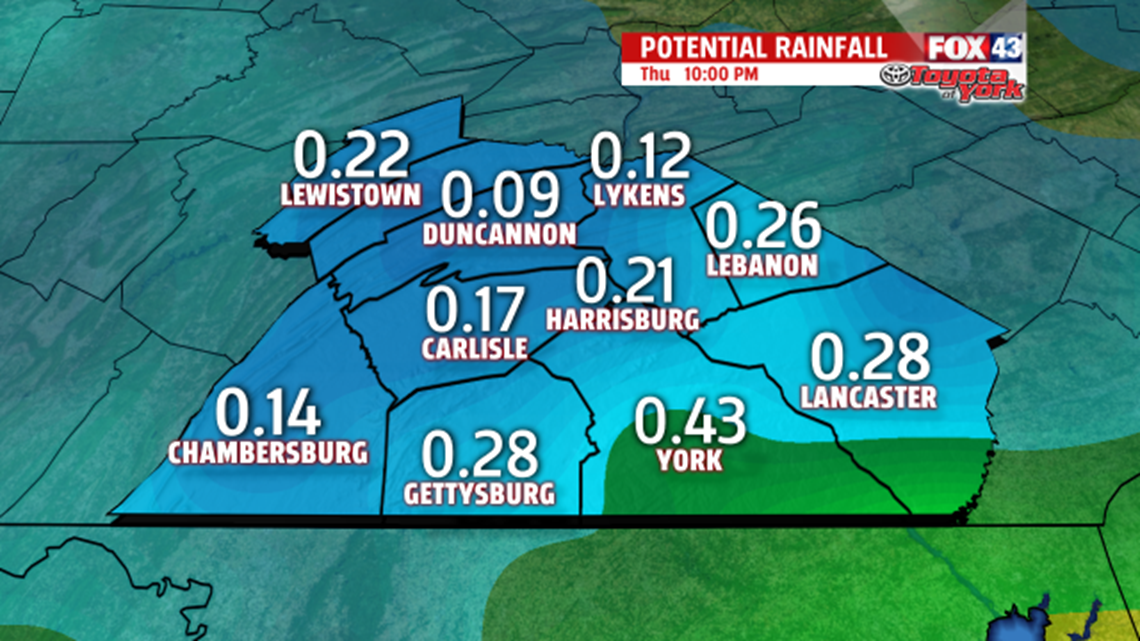
We could pick up a .10″ to .5″ by late evening with much more arriving Friday. Some areas by the end of the week could see as much as an 1 inch or more. High temperatures drop back to the mid and upper 80s Friday.

High pressure keeps most of Saturday dry but our next frontal system arrives late in the evening bringing a return of showers and possible thunderstorms. Highs Saturday with some sunshine, should warm to the middle and upper 80s. An easterly flow sets up overnight into Sunday keeping clouds pretty thick for the second half of the weekend. Low pressure moving through brings a good chance for showers and a few thunderstorms. Temperatures will be held in the lower 80s.

HEATING BACK UP!
Showers linger through the morning drive Monday but skies brighten heading through the day. High temperatures are climbing back to the mid 80s. A ridge of high pressure builds in for Tuesday and Wednesday bringing a return of hot and humid conditions. Highs Tuesday are in the upper 80s, while we are cracking 90 degrees by mid-week.
Stay with FOX43 Weather for updated changes to the forecast through the rest of the week!
Have a good day!
MaryEllen Pann,
Chief Meteorologist
