

STILL HUMID BUT DRIER
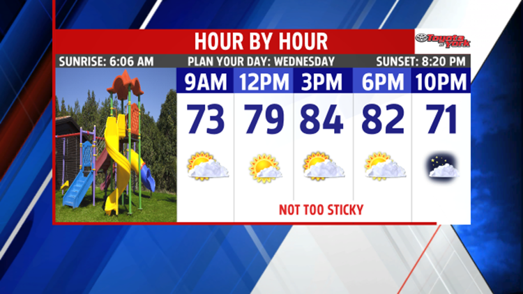
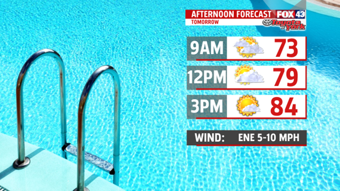
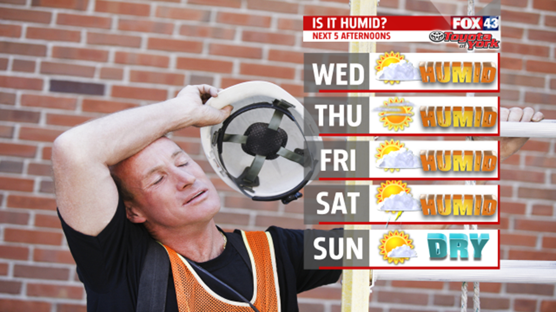
High pressure builds in to ensure a couple of dry days. Even though the humidity is knocked down a bit, it still feels muggy. We rid of some of the clouds allowing for brighter skies Wednesday. Temperatures warm into the lower and middle 80s. Still seeing plenty of sunshine Thursday, and it’s a tad warmer too.

Winds shift more to the south allowing for temperatures to nudge up a bit into the middle 80s. It feels oppressive again for Friday with dew points expected back around 70 or higher. It’s a hot day as high temperatures make a run at 90 degrees. A late day thunderstorm can’t be ruled out but the mainly dry stretch continues until Saturday morning.


WEEKEND OUTLOOK:
A cold front increases our chances for showers and thunderstorms Saturday, especially in the early part of the day. It is hot with highs touching 90 degrees again, steamy and uncomfortable as the humidity remains high. However, much nicer conditions for the second half of the weekend follow the departing cold front. The drier air begins to spill in as early as Saturday evening. Skies clear as high pressure dives south from Canada. It scours out the humidity too. The comfortable, sunny weather continues Monday too. Highs both days are back into the lower and middle 80s.

Stay with FOX43 Weather for updated changes to the forecast through the rest of the week!
Have a good day!
MaryEllen Pann,
Chief Meteorologist
