

QUIET, MAINLY DRY DAY
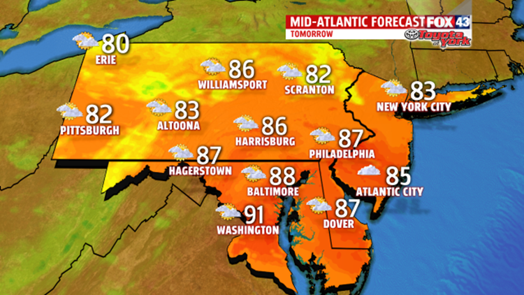
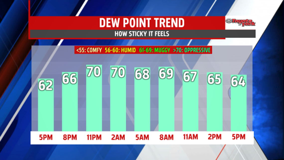
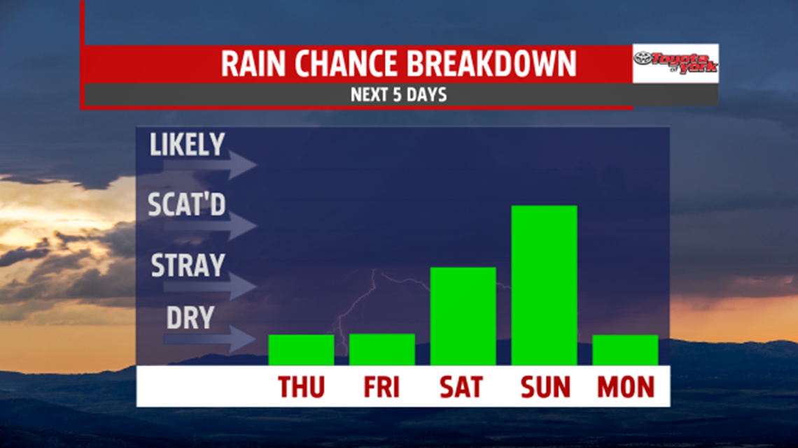
Most of the day is quiet. Expect plenty of sunshine and very little shower chance. Humidity is tolerable with dew points in the 60s, however, it does start to rise by the end of the week. Highs are closer to average in the middle 80s. Temperatures warm by Friday with most areas back in the upper 80s. Plenty of sunshine for the day with little to no chance of any thunderstorms.

Thunderstorm threat increases into the weekend. If you have outdoor plans, Saturday is the driest of the two days. A few thunderstorms could develop during the hottest part of the afternoon but most of the area is rain free. Highs climb to the upper 80s again. A cold front approaching Sunday brings more widespread showers and thunderstorms during the late afternoon and evening. The air is expected to be thick and sticky with the humidity running high. Temperatures warm to the middle 80s.

NEXT WEEK
High pressure building in behind the departing front provides a welcome break from the heat and humidity. Temperatures return to more seasonable averages in the lower 80s, and we finally scour out the humidity. Clouds are around much of the day Monday with drier, more comfortable air, spilling in during the afternoon. Skies give way to more sunshine Tuesday and highs in many locations dip into the 70s! We begin the day with lows returning to the 50s and 60s for a few mornings. High pressure provides another fantastic day Wednesday with highs in the lower 80s.


Stay with FOX43 Weather for updated changes to the forecast through the rest of the week!
Have a good day!
MaryEllen Pann,
Chief Meteorologist
