

ANOTHER HEAT WAVE

WEEKEND OUTLOOK
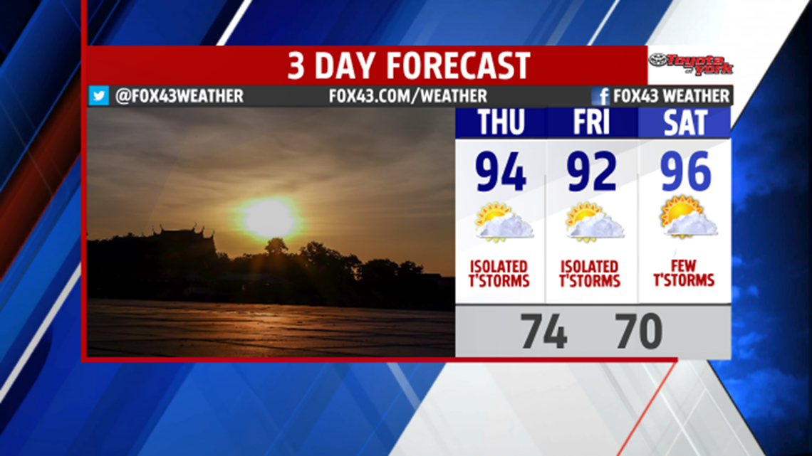
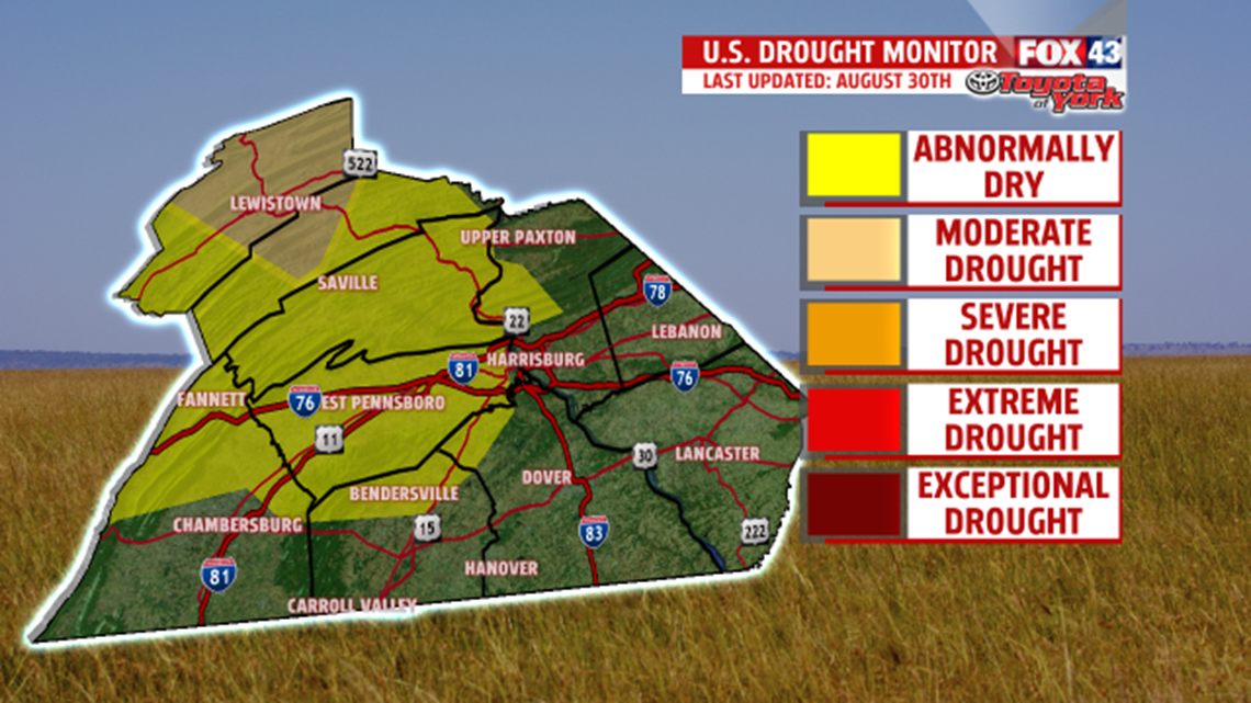
We turn up the heat for the beginning of the weekend. Highs jump to the lower and middle 90s. The next system may trigger a few thunderstorms during the afternoon with more of a chance overnight into early Sunday. With the front to our south late Sunday morning, it is somewhat cooler and certainly less humid. Plenty of blue skies and sunshine and not as hot, with highs still running above seasonable averages in the lower 80s. We certainly can use the rain. Cumberland County has been added to the drought watch which now includes Mifflin, Juniata, Perry, Dauphin, Lebanon and Cumberland Counties. Here is a look at the latest Drought Monitor update for the driest areas across the Lower Susquehanna.

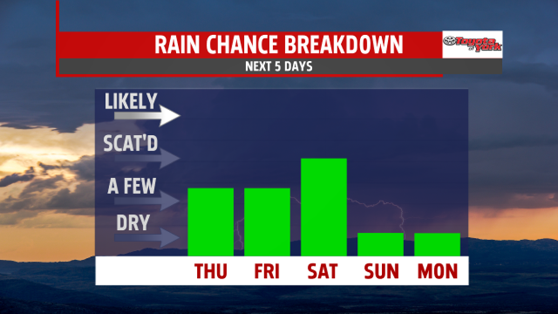
Our rain chances are isolated to few the next several days.

NEXT WEEK
We continue the break from the heat and humidity early next week. High pressure dominates and provides plenty of sunshine for both Monday and Tuesday. Afternoon high temperatures warm to above seasonable averages in the lower and middle 80s. Wednesday our next front system brings a return threat of a few showers and thunderstorms.
Stay with FOX43 Weather for updated changes to the forecast through the rest of the week!
Have a good day!
MaryEllen Pann,
Chief Meteorologist
