

CONTINUED WARM AND HUMID
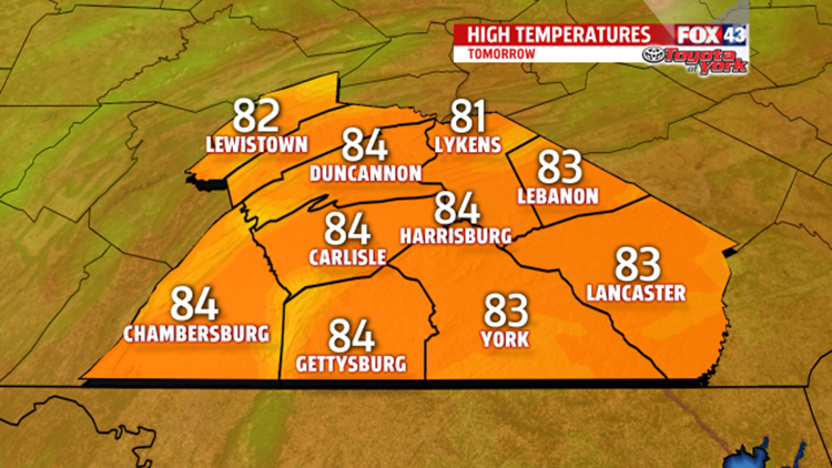
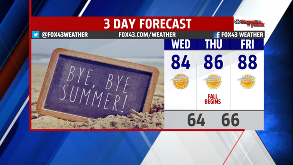
The last day of summer is fittingly warm and humid. Clouds break up overnight leaving partly cloudy skies. Patchy morning fog and lingering low level clouds are around the morning. Sunshine helps to burn away the clouds leaving mostly sunny skies. It is warm in the lower and middle 80s.


The first day of fall is even warmer in the middle and upper 80s under mostly sunny skies. The summer feel continues for Friday as temperatures climb to the upper 80s. Sunshine mixes with a few clouds.

WEEKEND OUTLOOK
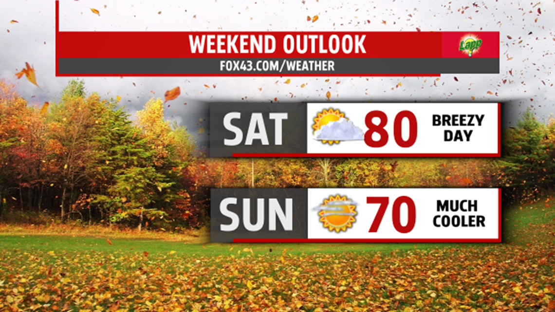
Fall lovers get ready! A stronger cold front expected very early Saturday morning brings a taste of fall weather. An isolated shower is possible, then skies slowly clear. Winds pick up Saturday afternoon and continue breezy through the second half of the weekend. Highs struggle to reach 80 degrees. Canadian high pressure settles across the area and provides cooler air for the second half of the weekend. Morning lows plummet to the 40s and 50s. Despite plenty of sunshine, highs struggle through the upper 60s to hit 70 degrees.

FIRST FULL WEEK OF FALL
It’s a refreshing start to the day Monday, with morning lows in the 50s. Brilliant sunshine in the sky for the day helps to warm temperatures to the lower 70s. A few showers with the next cold front are possible late Tuesday, otherwise, sunshine and dry weather expected for much of the day. Highs in the lower 70s.
Stay with FOX43 Weather for updated changes to the forecast through the rest of the week!
Have a good day!
MaryEllen Pann,
Chief Meteorologist
