

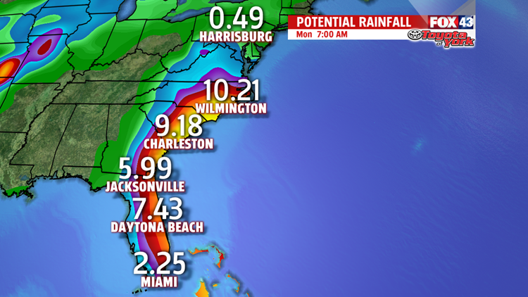
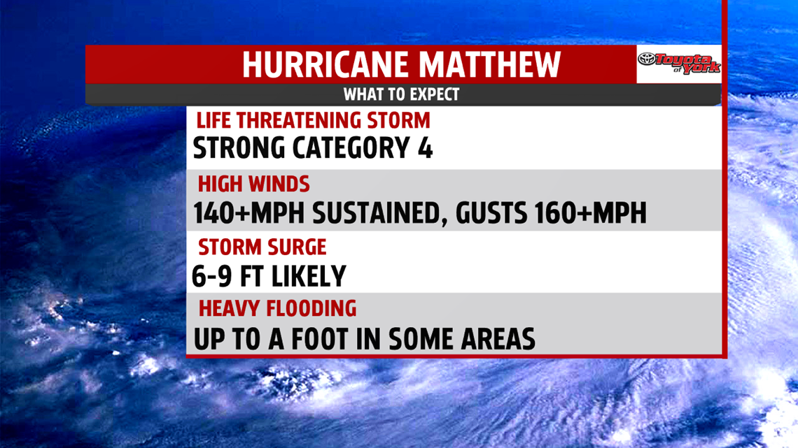
WHERE WILL MATTHEW MAKE LANDFALL: Category 4 Hurricane Matthew’s current track takes the storm along the coast of Florida, with possible landfall as of now near Daytona Beach and up to Jacksonville as a strong category 4 with sustained winds in excess of 140mph. Gusts could be as high as 160mph. Storm surge along the coast of Florida of 6-9 feet is expected along with up to 8 inches of rain and higher in Florida.

WHAT’S NEXT: The current track takes Matthew up the coast of Georgia and and the Carolinas, where the main threat here will be the heavy rain and winds. The storm will weaken to a category 2 as it works its way up to the southern fringe of North Carolina, before turning out to sea.

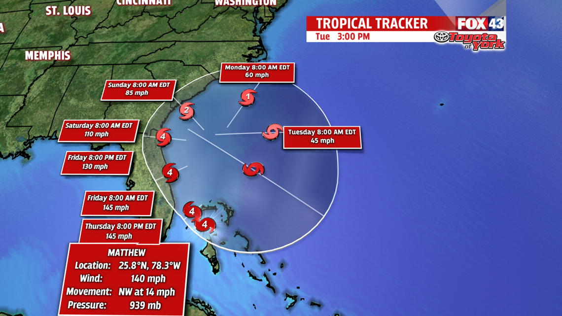
THE DIFFERENCE A FEW MILES MAKES: The current track of Matthew takes him right along the coast. However, if the track were to shift just 25 miles to the west, we’re talking direct impacts of the eye wall in Orlando. If it shifts 25 miles to the east, the eye never sees land. Those few miles can make a lot of difference to the effects seen inland. Nevertheless, this is a particularly dangerous situation for the southeastern coast of the United States.
BACK AT HOME: Pennsylvania is not expected to be affected by Hurricane Matthew at this time. This weekend, temperatures will cool into the 60s with a cold front passing by, bringing lots of cloud cover and rain into the forecast Friday night and into Saturday. We will stay cooler into Monday, but skies will clear. Lots of sunshine and highs back near 70 balance out next week.
Have a great night!
-Meteorologist Bradon Long
