


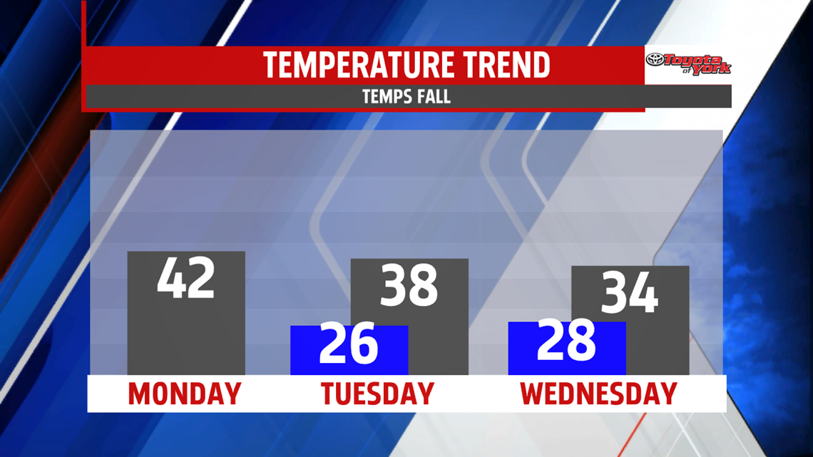

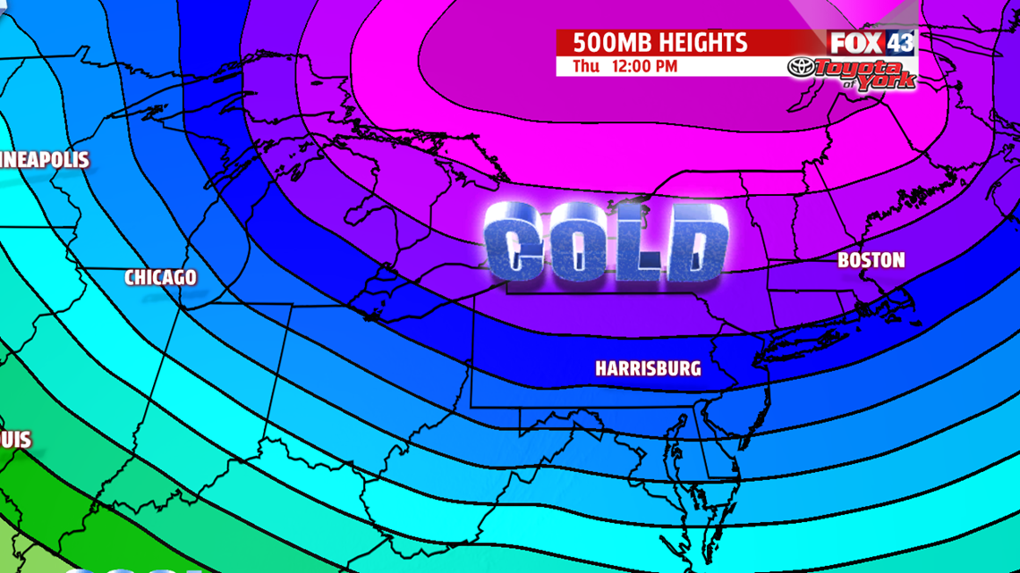
ARCTIC BLAST: The end of the week ends on an extremely cold note. An Arctic blast settles in Thursday. This knocks temperatures into the 20s! Expect plenty of clouds and lake effect snow showers and flurries. It’s blustery as well, knocking wind chills into the teens and single digits. Friday is still bitterly cold for this time of year. Expect readings in the upper teens to lower 20s! This is after morning lows begin in the single digits! Clouds increase Friday ahead of our next system.
WEEKEND SYSTEM: We’ll keep an eye on this next system for another wintry mess. Temperatures slowly rise through the weekend, so as our next system crosses through Friday night into Saturday, the potential is there for another mixed bag of precipitation. With cold air well established, we could see some accumulating snow before the transition to a wintry mix/rain through Saturday morning. It’s way too early to iron out exact details, and much can still change, so check back for updates! A few rain and snow showers are possible Sunday.
Have a great Monday!
