

BRIEF GRIPPING COLD SPELL
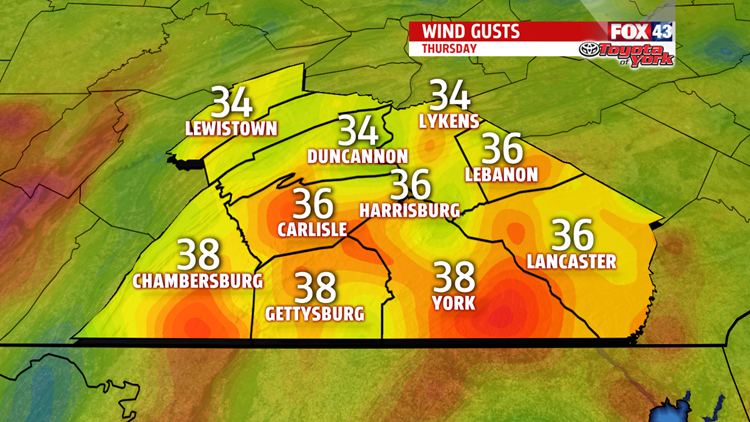
The next more potent system arrives tonight and brings a drastic change to our temperatures for a couple days. Temperatures drop out of the 20s overnight tonight into the teens through the day Thursday. But it’s the strong, gusty winds around 30 to 40 mph dropping wind chills to the single digits, and at times, at or below zero!

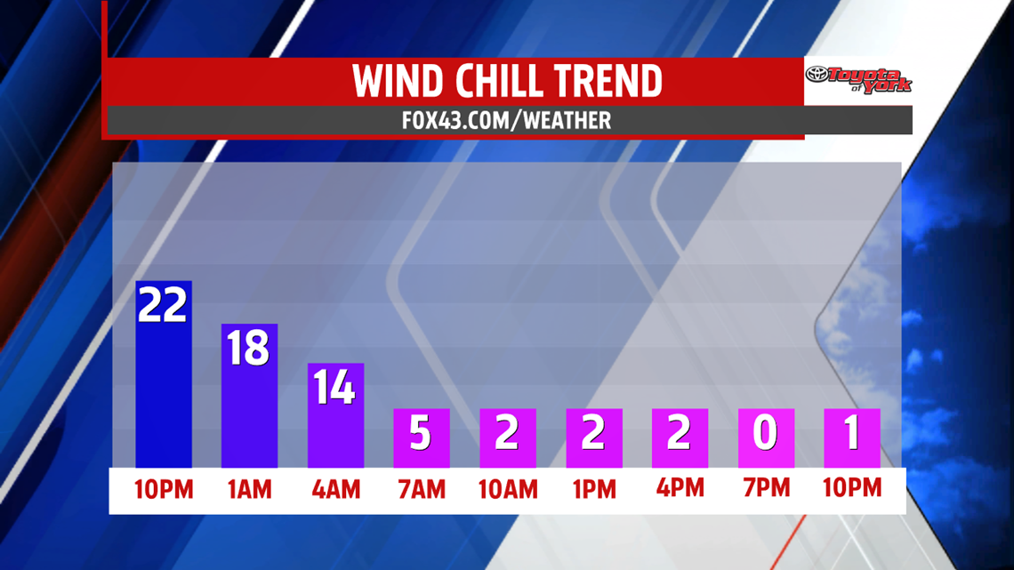
We are also watching for lake effect snow bands to stream over the mountains into the area. Snow squalls present dangerous traveling conditions with sudden loss of visibility and slippery roads. High pressure begins to build in Friday helping to relax the winds. Wind chills are still at or below zero for the morning Friday but recover to the teens during the afternoon. Clouds return late in the day towards evening ahead of our next system which looks to bring our first accumulation of snow. We could also have ice to contend with as well.
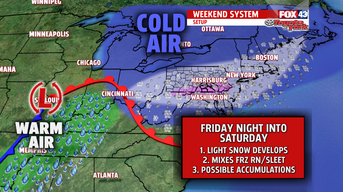
WINTRY MIX FOR WEEKEND
With the frigid air in place overnight into Saturday, the atmosphere is conducive to snow showers initially. Before any transition to a mix, we are likely to see minor accumulations across the area. Warm air looks quick to ride in but in the upper levels of the atmosphere while the surface temperatures remain at or below freezing. This means a period of freezing rain, bringing an accumulation of ice, on top of the snow. The question is how long it takes for surface temperatures to warm. They are expected to but it could take all day. We could see a period of sleet too. Eventually, warmer air is able to scour out the colder air at the surface and change the precipitation to plain rain later Saturday into Sunday. Highs Saturday slowly rise through the 30s while it’s much warmer early Sunday in the middle 40s. Keep in mind it is way too early to pinpoint exact details and totals. Much change change. The FOX43 weather team has you covered and will keep you posted through the web and our social media pages.

NEXT WEEK
Monday looks quiet with high pressure bringing sunshine and drier conditions to begin the week.
Stay with FOX43 Weather for updated changes to the forecast through the rest of the week!
Have a good day!
MaryEllen Pann,
Chief Meteorologist
