

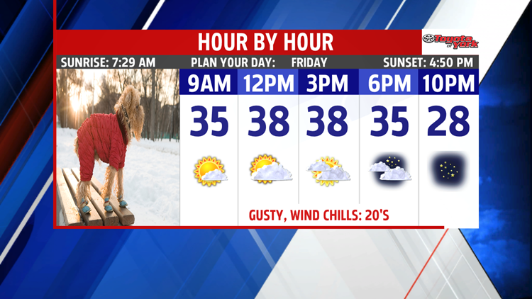
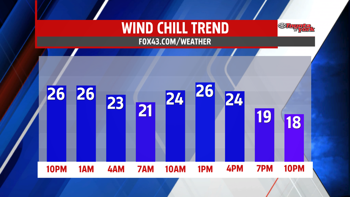
GUSTY AND COLD

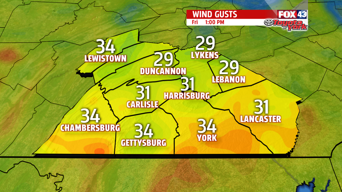
Wind chills stay in the teens and 20s the next 24 hours. You may see a few flurries during the day too.

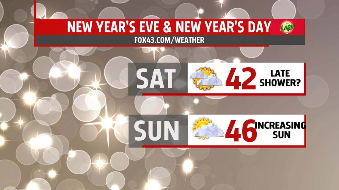
NEW YEAR’S EVE AND NEW YEAR’S DAY
It’s a frigid morning Saturday with lows in the 20s. Despite limited sunshine, temperatures climb back to the 40s. Right now, New Year’s Eve is dry to start but after midnight, a few light snow showers are possible but are gone by early Sunday as system quickly swings through. More sunshine is expected the second half of the weekend and first day of 2017. With the brighter skies, temperatures are milder in the middle and upper 40s.

NEXT WEEK
Our next best threat for wet weather arrives for Monday. Keep the umbrella handy as more widespread showers begin the week. With morning lows near freezing or below in spots, there is a chance for a wintry mix initially before changing over to rain showers the rest of the day. Highs are slow to rise into the lower 40s. Showers may linger early Tuesday then we are drying out the rest of the day. It’s breezy with sunshine increasing through the afternoon. Highs are mild in the upper 40s and lower 50s. A stray shower for Wednesday can’t be ruled out as an Arctic front swings through with limited moisture. Temperatures still remain above average in the 40s to near 50 degrees, however, temperatures turn much colder behind this system for Thursday.


Stay with FOX43 Weather for updated changes to the forecast through the rest of the week!
Have a good day!
MaryEllen Pann,
Chief Meteorologist
