

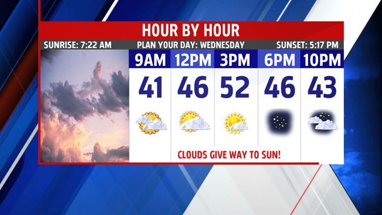
BEST DAY OF THE WEEK

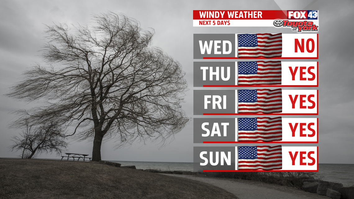

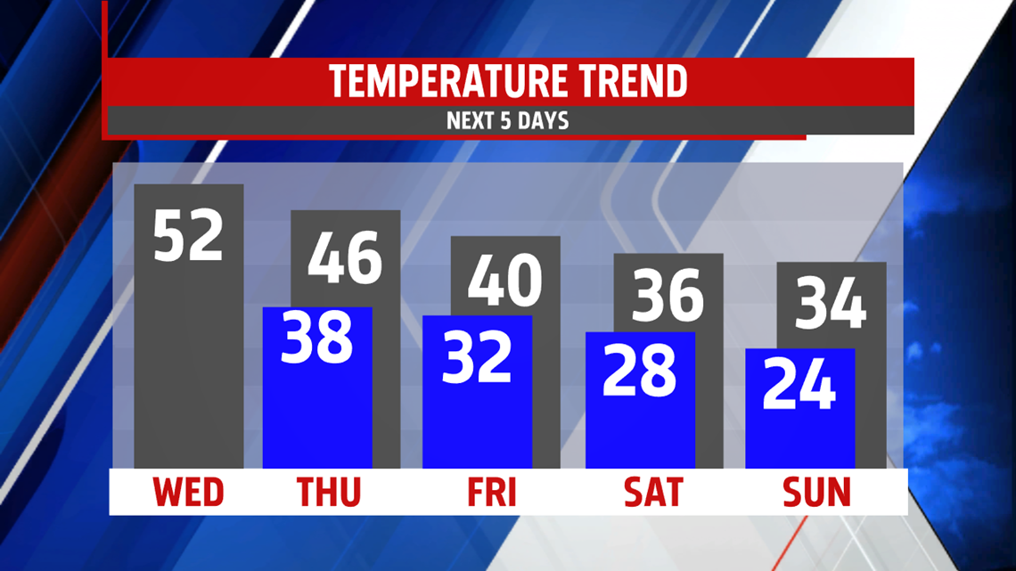
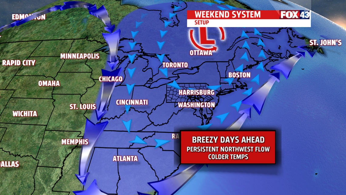
WINTER RETURNS FOR WEEKEND
Plenty of clouds blanket the area for the weekend. Temperatures are much chillier in the lower and middle 30s with mornings lows in the 20s. A northwest breeze keeps the colder air rushing in and may even bring a few snow flurries too. Upper-level trough deepens and strong energy keeps Sunday much of the same with highs in the lower and middle 30s. Breezy under partly to mostly cloudy skies.

SLOW RECOVERY FROM THE COLD
We continue cold but near seasonable averages for Monday. Deep trough finally begins to lose its grip on the area as it lifts out later in the day. Highs are in the middle 30’s. which is typical for this time of the year. Tuesday features more sunshine and milder temperatures back in the lower 40s.
