

A TASTE OF WINTER FOR THE WEEKEND

NEXT WEEK
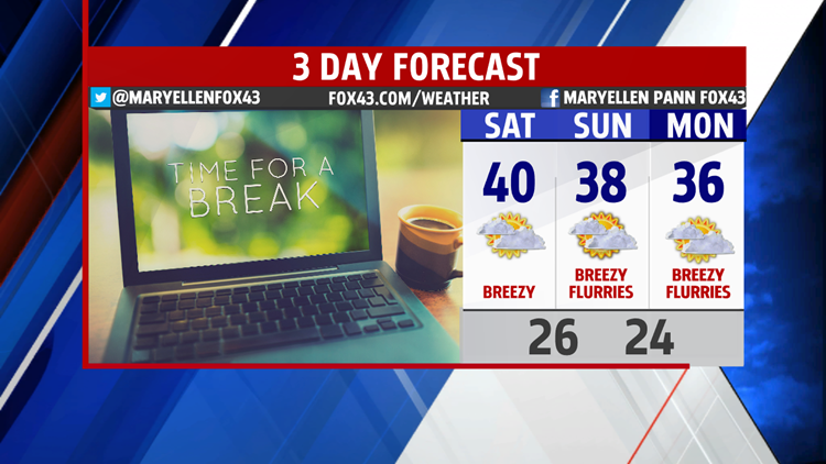
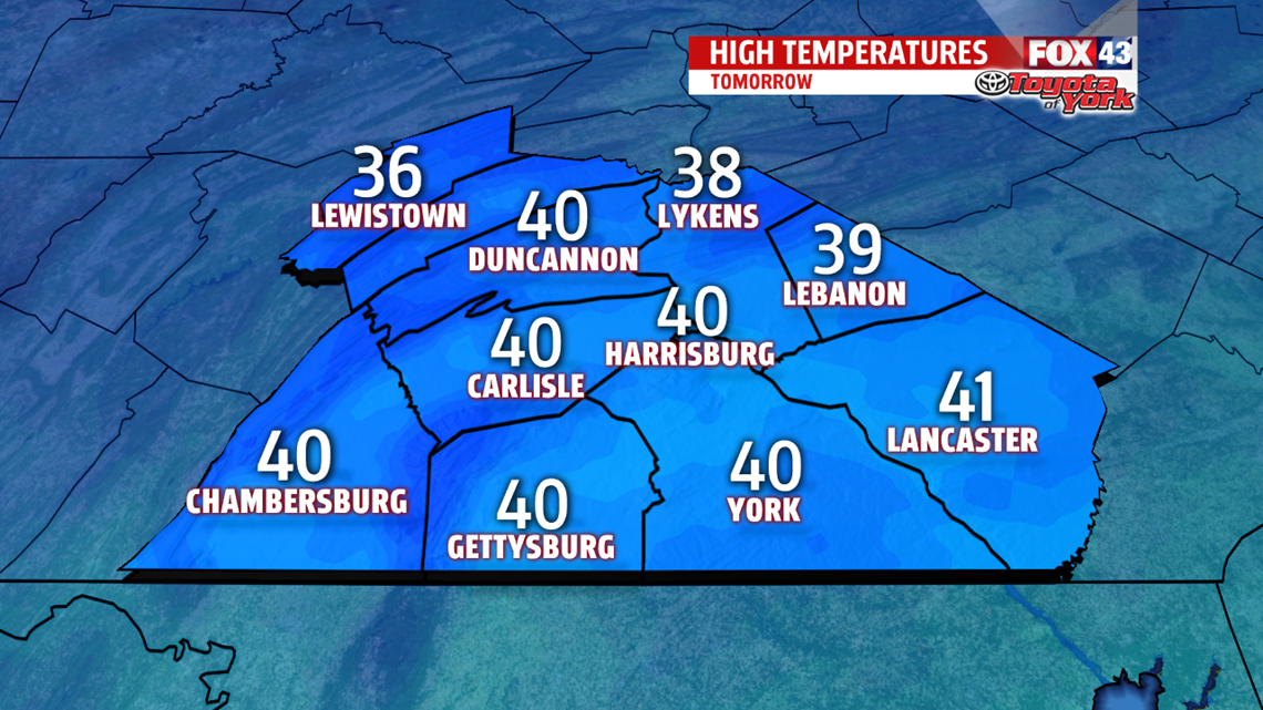
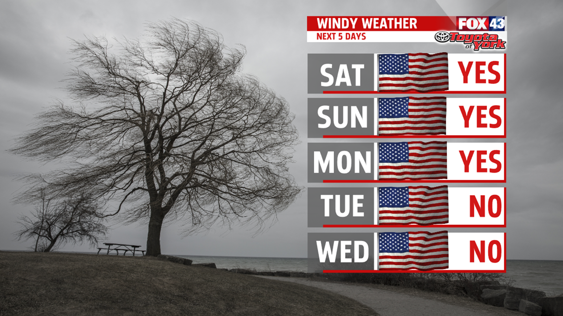
You’ll need extra layers as you head out early Monday. The cold is reinforced by some upper-level energy, and with plenty of clouds still lingering temperatures struggle through the lower and middle 3os. It’s another breezy day with wind chills in the 20s. A fast moving clipper system comes through Tuesday with light snow showers. Highs are able to reach 40 before the clouds thicken. Wednesday, we are dry with more sunshine. Highs are fairly mild in the upper 30s and lower 40s. The front reinforces colder air to end the week. It is dry both Thursday and Friday with plenty of sunshine, but highs are cold in the lower to middle 30s.

Have a great weekend!
MaryEllen Pann,
Chief Meteorologist
