

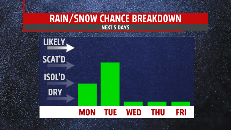

COOLER FOR MONDAY: You may see a few flurries as you head out to start the work week and the chance stays with us into the afternoon. Don’t expect any accumulation as these will be very light and pass pretty quickly. The sun will peak out at times under partly to mostly cloudy skies with highs in the low to mid 30s.


SNOW, RAIN AND WIND: Very light accumulation is possible Tuesday morning before light passing snow transitions to rain by the late morning into the early afternoon, especially in the northern counties. A coating to an inch is possible in some spots. After the transition to rain Tuesday afternoon, the wind picks up overnight into Wednesday. Gusts up to 25-30mph are likely under mostly sunny skies.

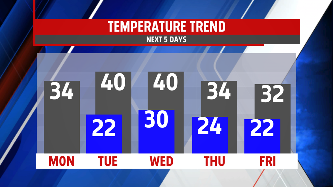
STAYING COLD: Temperatures stay cold heading into next weekend as we get back to where we should be for this time of year. Highs will stay around freezing Thursday and into the weekend.
Have a great start to the week!
-Meteorologist Bradon Long
