

A RETURN TO COLDER TEMPS
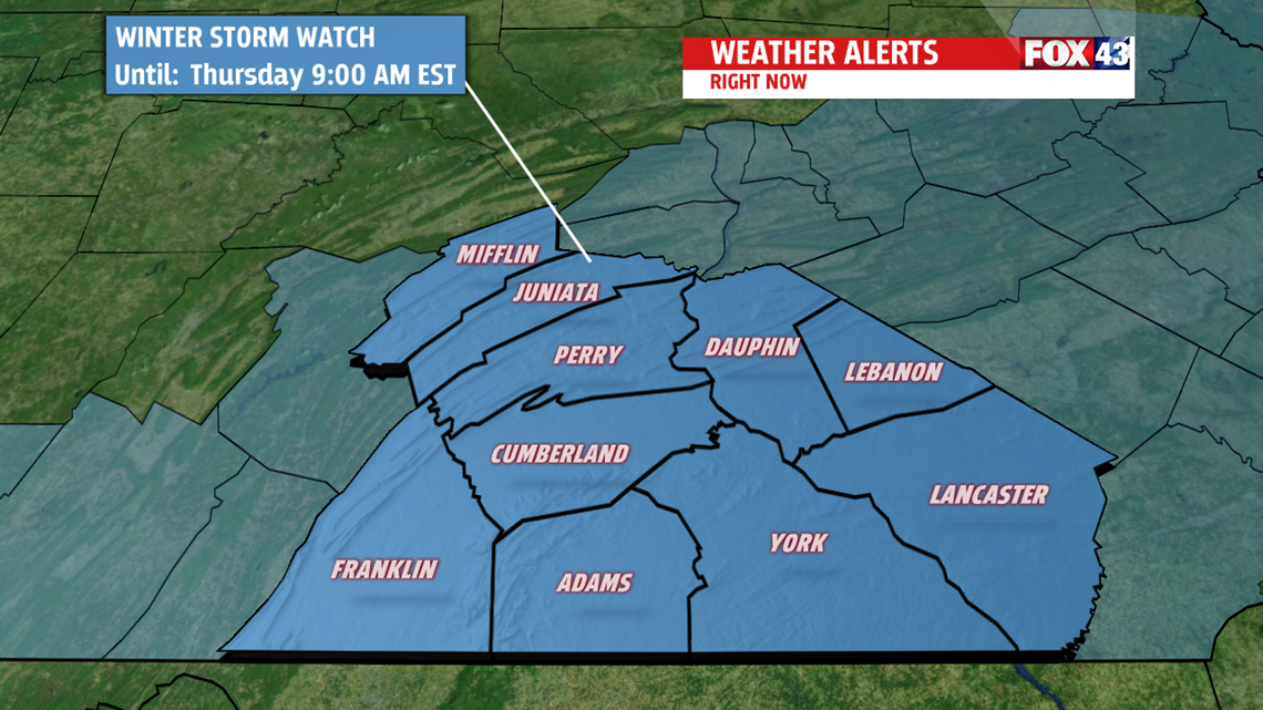
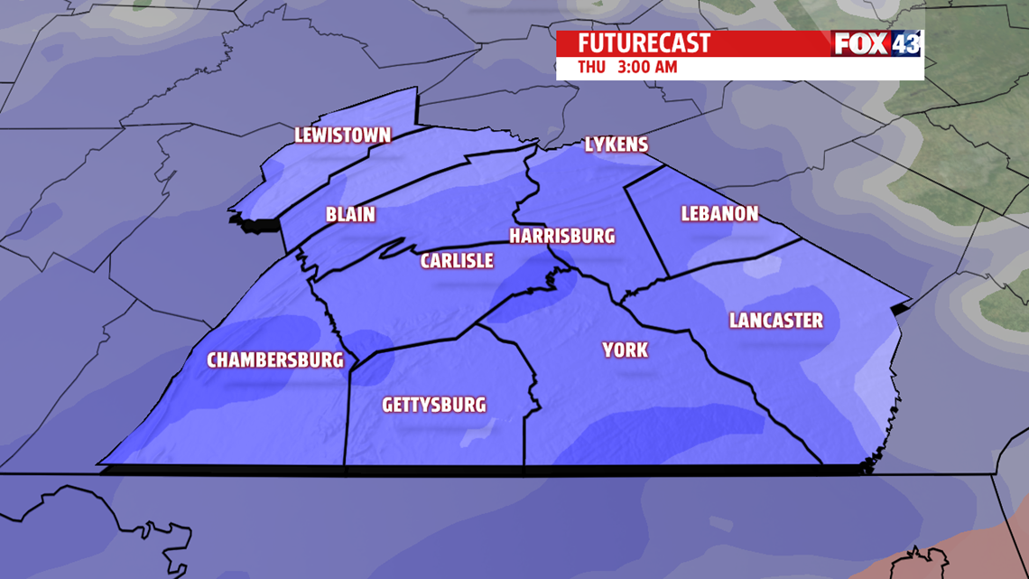
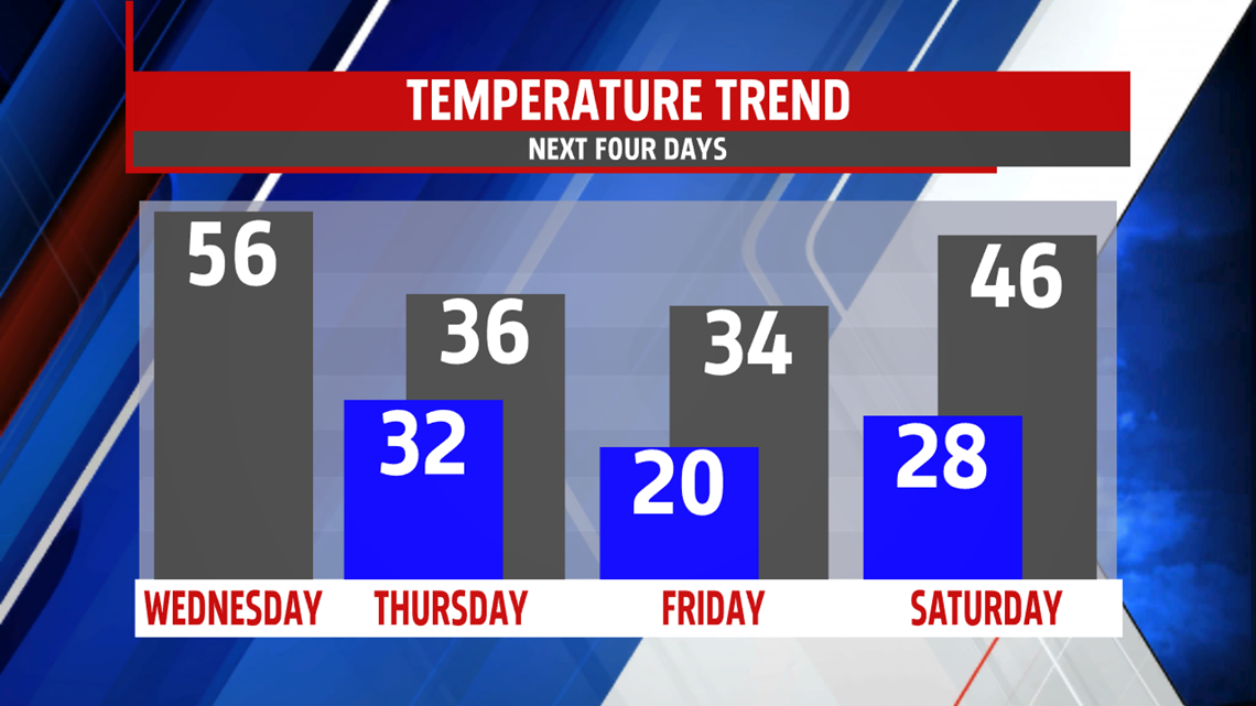
Heading into Wednesday, temperatures remain mild in the 50s. A few lingering showers, into the early morning hours, are possible. High temperatures are obtained late morning then fall during the afternoon into the 40s as colder air slowly returns. Timing of colder air and just how cold it gets plays a critical role in precipitation type with our next system Wednesday night into early Thursday. A wave of low pressure brings moisture in late into the overnight period. Right now, indications are it starts as rain. As colder air spills in, rain changes to a mix which changes to snow. Speed of the system and how quickly the colder air moves in will determine if snow accumulates. Right now it is likely we’ll see several inches of snow accumulate. A WINTER STORM WATCH is in effect Wednesday night until Thursday morning.


MILD WEEKEND
Temperatures swing back above average to the 40s. And, showers return too. Saturday is mostly cloudy with a few light showers later in the day towards evening. Expect plenty of dry hours to begin the weekend but a greater threat for showers returns Sunday. Temperatures stay mild in the middle and upper 40s.

NEXT WEEK
It is mild to start the week with highs in the middle and upper 40s Monday. Winds are breezy too. Tuesday, temperatures fall back a few degrees but readings manage to climb to the lower 40s under mostly sunny skies.
Have a blessed day!
MaryEllen Pann,
Chief Meteorologist
