


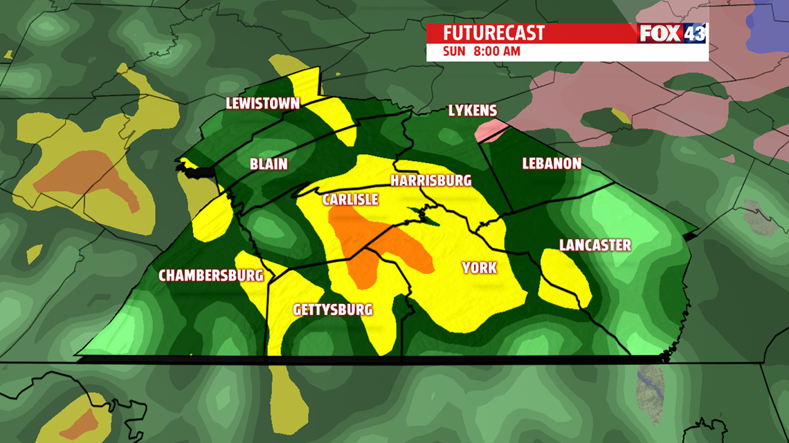
RAIN FOR SUNDAY: Showers begin moving in from west of east in the very early morning hours of Sunday morning, around 2-4AM, and continue throughout most of the morning. The commute to church or any other Sunday morning activities will be a soaker area-wide.

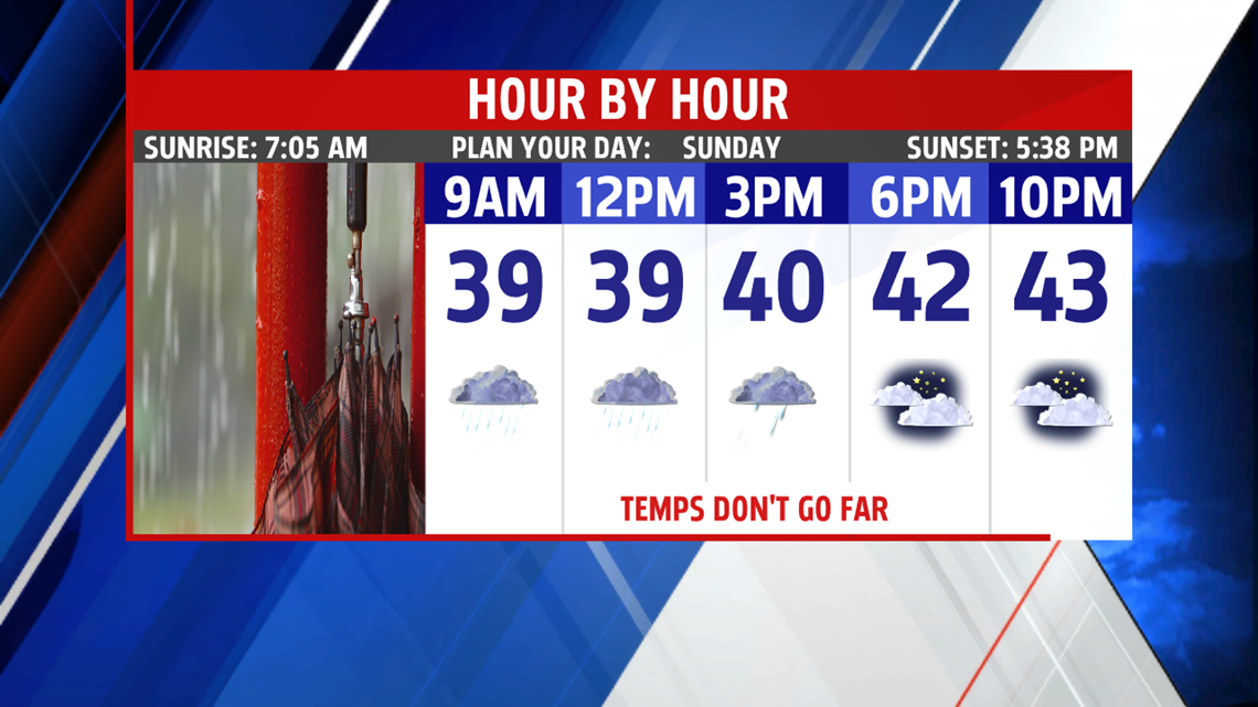
Showers continue off and on throughout the day with hit-or miss showers and even a little bit of mix for our northern counties as well. They taper off as we head towards the evening with the high being close to midnight.
BREEZE KICKS UP: Winds change direction after the showers pass through and welcome a strong WNW breeze for all of Monday. It’ll be your usual “hold onto your hat,” day with sustained winds at 20-30mph and gusts up to 50mph likely.

Our breezes calm or Tuesday before coming back with a vengeance Wednesday and Thursday.

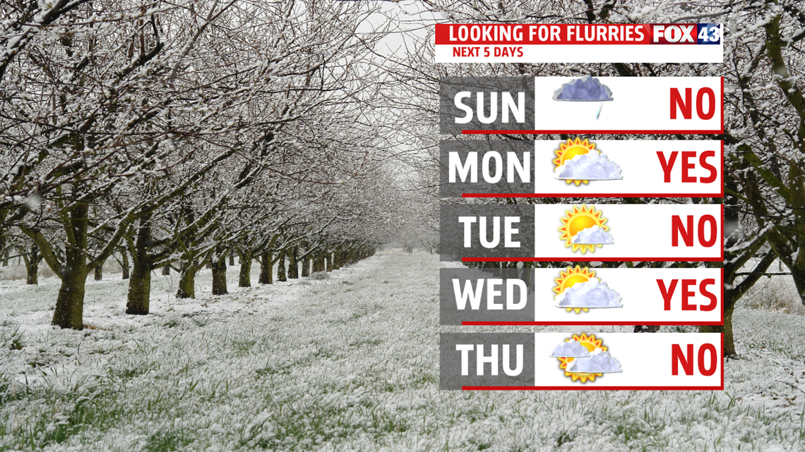
LOTS OF SUNSHINE NEXT WEEK: Other than the chance of a few flurries in the early morning hours next week, we see a lot more sunshine coming our way. Partly to mostly sunny skies dominate the forecast as highs hover around that 40 degree mark.
Have a great day!
-Meteorologist Bradon Long
