

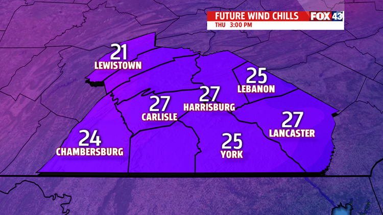
GUSTY, COLD THURSDAY


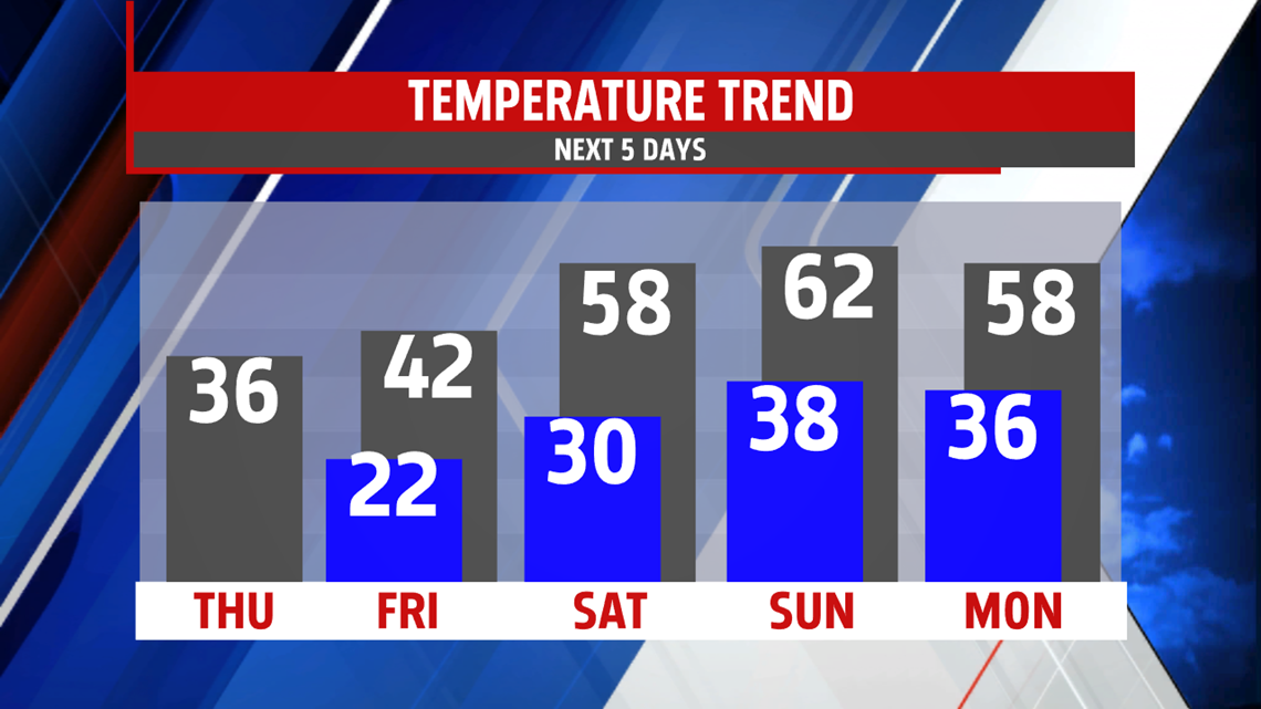
Winds continue overnight into Thursday with gusts near 30mph during the afternoon. A northwest flow and partly to mostly cloudy skies keeps colder air in place, so temperatures remain in

the 30s, with wind chill values in the 20s. High-pressure building in Thursday night relaxes the breeze heading into Friday. The calm conditions and mostly clear skies leads to a cold morning in the lower 20s. Under abundant sunshine, temperatures recover to the lower 40s.
SPRING-LIKE STRETCH
Temperatures begin to surge upward into the weekend. A stretch of unseasonably mild air settles in for several days. Highs Saturday are in the upper 50s under plenty of sunshine. A few passing clouds possible. Sunday is even nicer with highs flirting with 60 degrees! A few more clouds pass through the area.

NEXT WEEK
Temperatures remain well above average in the 50’s to near 60 degrees under sunny skies Monday. A few stray showers are possible Tuesday with just a stray shower Wednesday. Despite clouds, temperatures are mild in the 50s through mid-week.

Have a blessed day!
MaryEllen Pann,
Chief Meteorologist
