

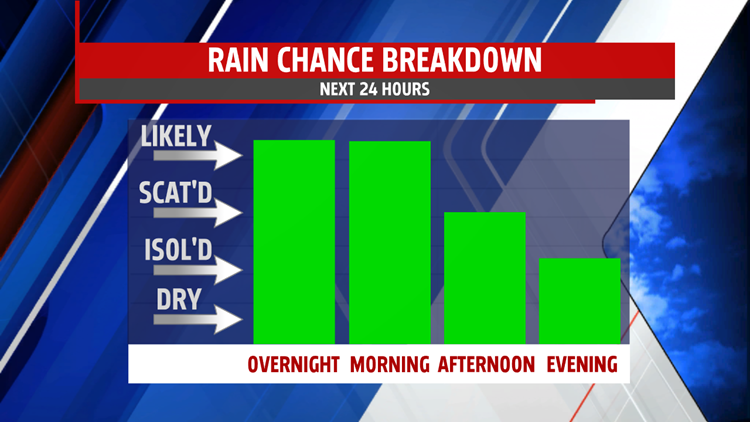

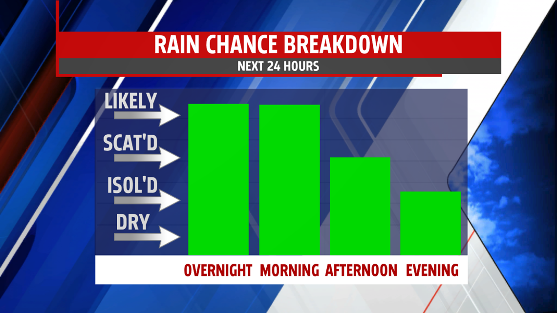
RAINY OVERNIGHT: Showers move in for the northern portions of the area beginning after 9PM tonight and overtake the area after midnight. Scattered showers last throughout the morning into the morning commute. Isolated showers continue all day Tuesday, but not everybody sees them throughout the day. Another wave comes through late Tuesday night with the cool front, clearing out skies and switching winds to out of the west to start a breezy Wednesday.

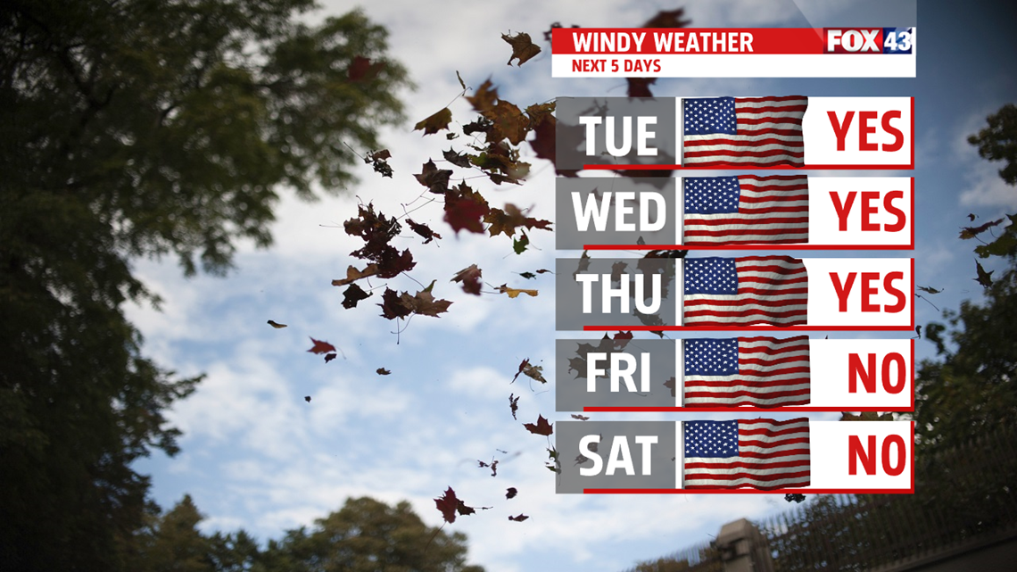
BREEZY BUT DRY WEEK: Winds increase a bit with the rain for Tuesday and really kick up for Wednesday and Thursday. Gusts up to 25mph out of the west, turning northwest, are likely both days under otherwise mostly sunny skies with highs in the mid-to-upper 50s.
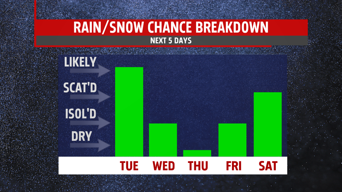
TRICKY WEEKEND FORECAST: Frankly speaking, forecast models starting Friday night throughout the weekend are all over the place. Light snow looks likely late Friday night and lasting until the morning hours of Saturday, with more possible again Sunday morning. A couple of models show several inches of snow falling throughout the weekend, while others show temperatures well above freezing with only AM snow possible. Right now, I’m going with highs in the upper 30s and low 40s with light snow under mostly cloudy skies both days.

This has been changing model run-to-run and will continue to do so over the next several days, so keep up to date with MaryEllen, Andrea and myself over the next several days as we get closer to the weekend. We’ll give you the information you need to be weather smart.
Have a great one!
-Meteorologist Bradon Long
