

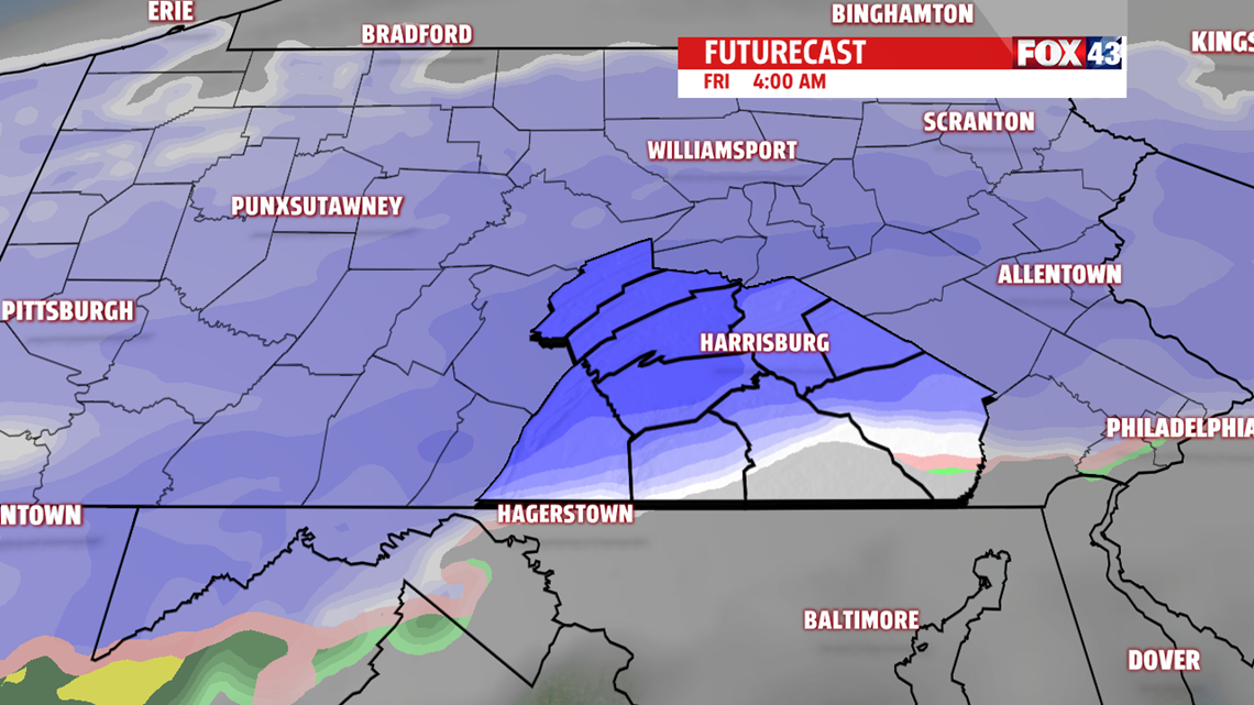
TRACKING OUR NEXT SYSTEM

WEEKEND OUTLOOK
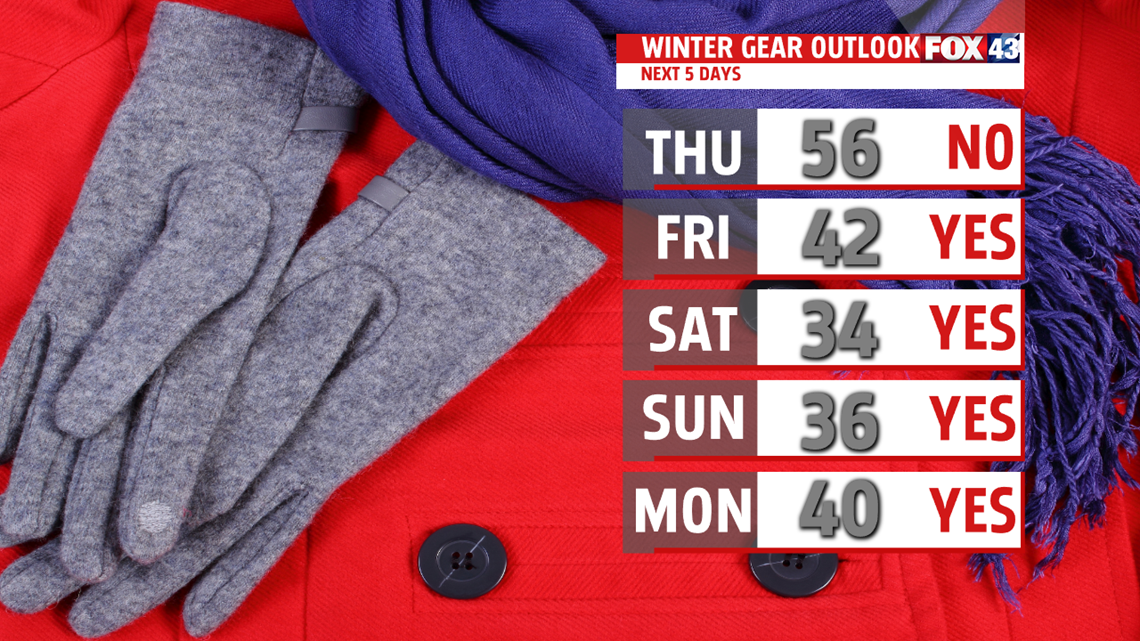
We begin the weekend much colder as a chillier air mass slips into the area. Morning lows are in the teens to near 20 degrees. It looks like we’ll dodge a bullet with a southern system staying far enough away to give us mainly flurries. Clouds increase Saturday and highs are cold in the lower and middle 30s. By Sunday, more sunshine is expected during the afternoon and the breeze returns. Highs in the 30s will feel like the 20s for much of the day.

NEXT WEEK
We begin the week cold and quiet. Clouds increase through the day as a fast clipper slides through overnight. A few light snow showers are possible. Snow showers remain for Tuesday as a secondary wave develops. Light accumulation is possible and we’ll keep you posted in the next several days. Temperatures remain below average, in the upper 30s to near 40 degrees, to begin the week. Sunshine, breezy conditions and moderating temperatures return Wednesday.
Have a blessed day!
MaryEllen Pann,
Chief Meteorologist
