

FRIGID WEEKEND OUTLOOK

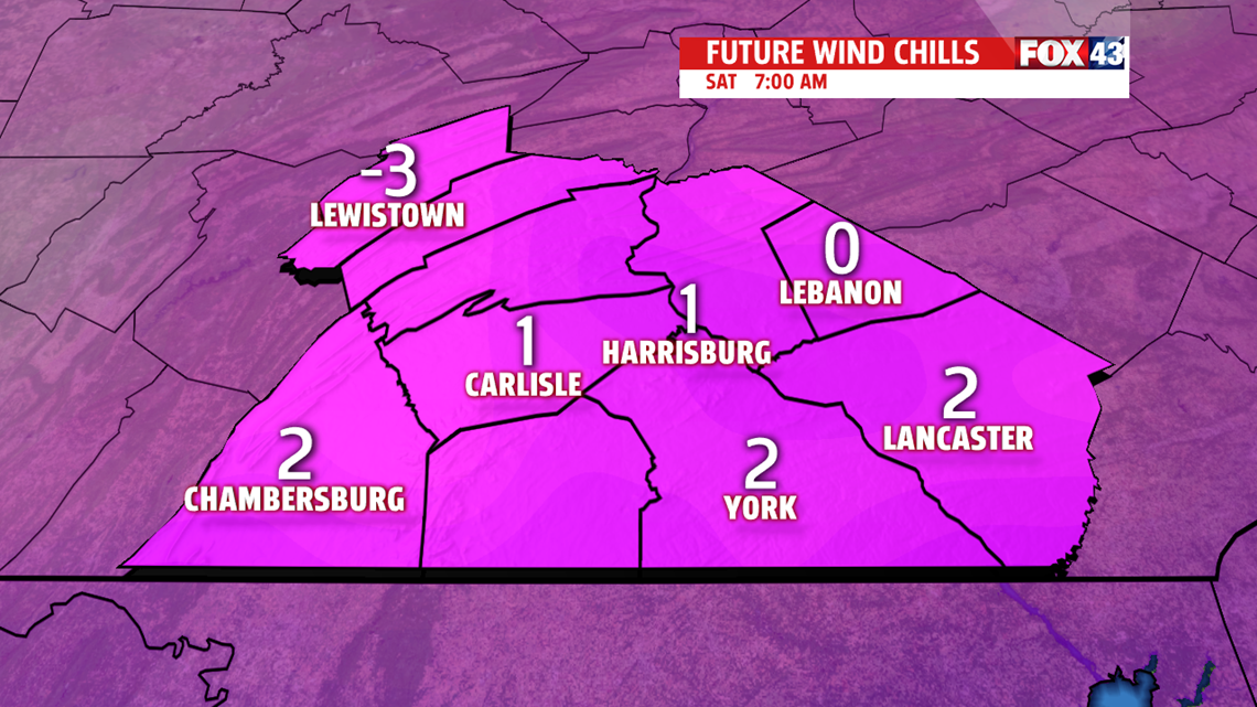
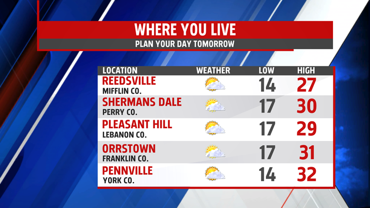
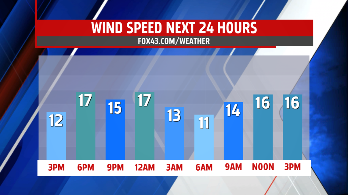
Much colder air settles in across the region for a couple of days. While most of the weekend is dry, a few flurries are likely for Saturday. Winds are still breezy to start the weekend, so be prepared for single digit wind chills early, and only in the teens by

afternoon!!! Afternoon readings climb through the 20’s to barely touch 30 degrees. Many layers are needed to stay warm if you’re heading out. Another frigid morning Sunday with lows in the teens. Winds are calmer but it’s still cold in the lower and middle 30s.

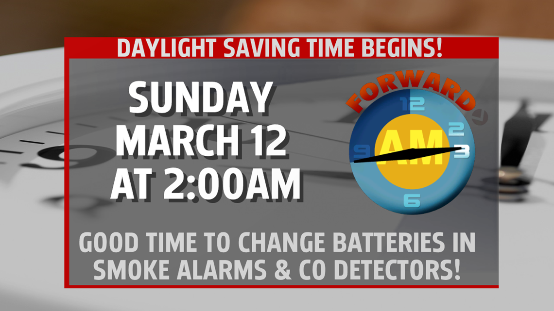
DAYLIGHT SAVING TIME RETURNS
Before heading to bed Saturday, be sure to change clocks ahead one hour, as it is time to return to Daylight Saving Time. It is also a good time to check the batteries in your smoke alarms and CO detectors.
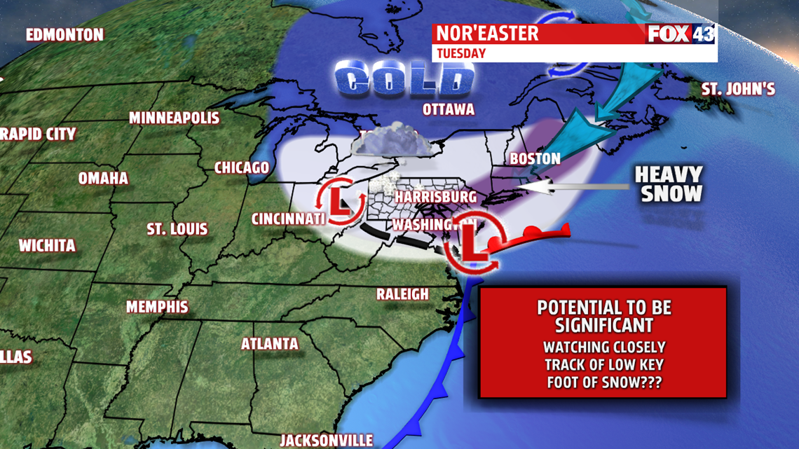
MORE SNOW CHANCES NEXT WEEK
It’s a frigid morning in the teens. We start out the day with sunshine but the clouds make a return through the afternoon as our next system approaches. Readings are still well below March average in the middle 30s. An evening snow shower is possible, however, snow is more likely overnight and through the day Tuesday. We’ll be watching this system very carefully, as a classic nor’easter looks to develop with significant accumulations looking likely for parts of the Mid-Atlantic and the Northeast. The cold spell continues for the rest of the week with highs remaining in the 30s. Wednesday is breezy with leftover snow showers, and highs in the lower 30s. Wind chills will run in the teens and 20s. Thursday and Friday expect more sunshine and calmer conditions. Temperatures go from the 30s Thursday to lower 40s by the end of the week.

Have a blessed day!
MaryEllen Pann,
Chief Meteorologist
