

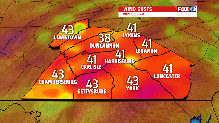
FRIGID, GUSTY WEDNESDAY

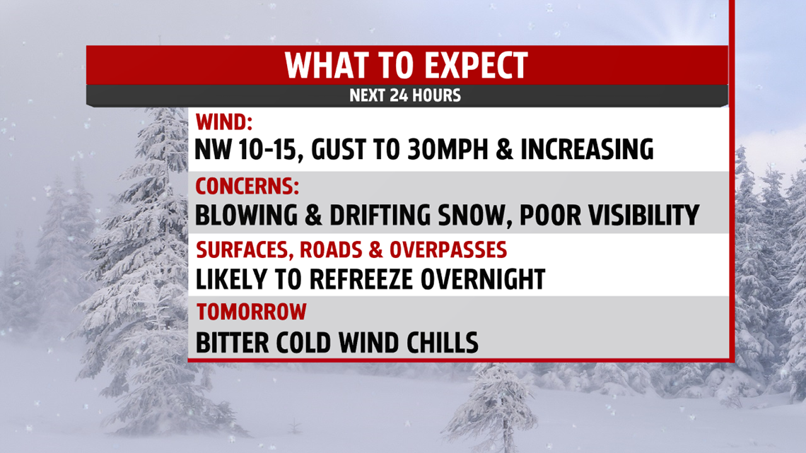
Wednesday is the coldest day of the next several. Icy areas likely tonight with lows in the upper teens. Strengthening winds will ice up overpasses, on and off ramps very quickly. Wind chills drop to single digits by morning. Temperatures stay in the 20s, but with

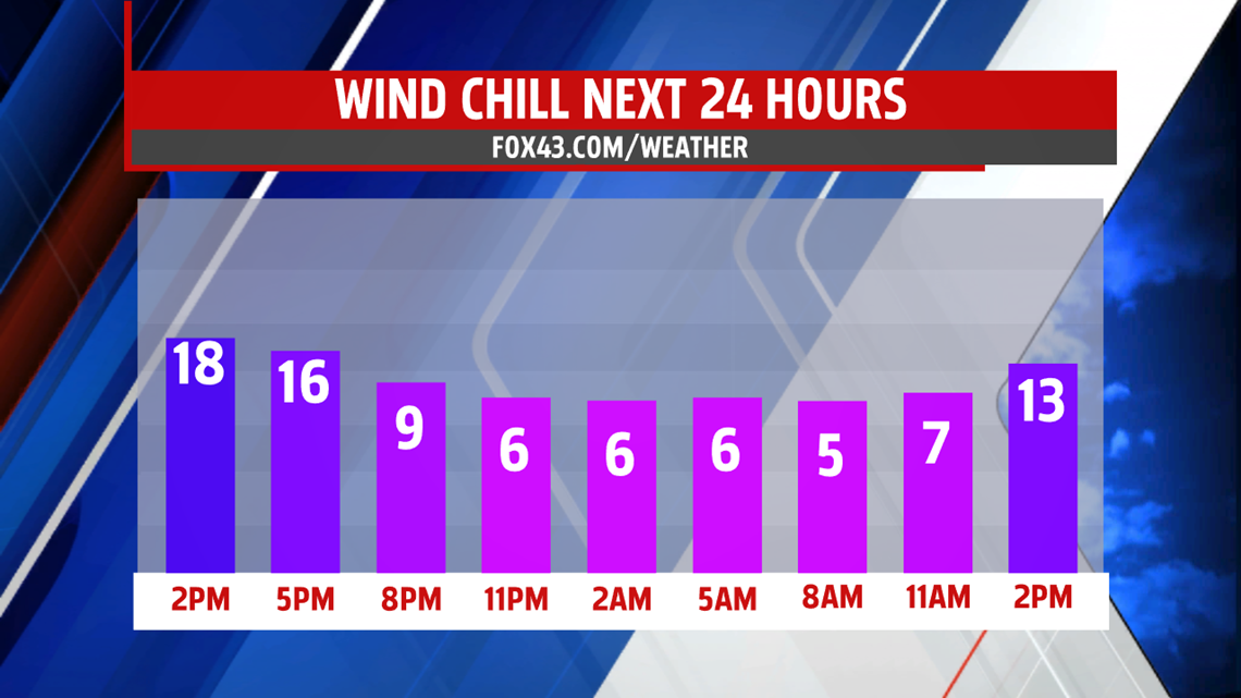
strong gusts over 40mph at times, wind chill readings are in the low teens. More clouds than sunshine and I can’t rule out a few light snow flurries or snow showers. The winds will cause blowing and drifting snow. More sunshine pops out Thursday, but the chill remains. Temperatures are only a few degrees higher in the upper 20s to near 30 degrees. While the breeze is not as strong, it is expected to be 10 to 15 mph. Friday starts out sunnier with clouds returning later in the day. It is milder near 40 too. Keep in mind, however, average high temperature is 49 degrees so temperatures are still falling short of where we should be this time of year. Friday evening rain and or snow showers are possible as our next system arrives.


WEEKEND OUTLOOK
We may begin the day with a rain and or snow showers but the rest of the day is drier and milder. Highs climb to the lower 40s. Skies brighten up as the day wears on. Sunday is partly cloudy with highs near 40 degrees, however, the winds increase producing wind chill values in the 30s. Plenty of sunshine to start the week, and milder temperatures too. Highs are in the lower and middle 40s. Showers do return late Monday night into Tuesday.

Be “Weather Smart”, stay safe and indoors until the storm passes.
MaryEllen Pann,
Chief Meteorologist
