

COLD GRIP SLOWLY WEAKENS

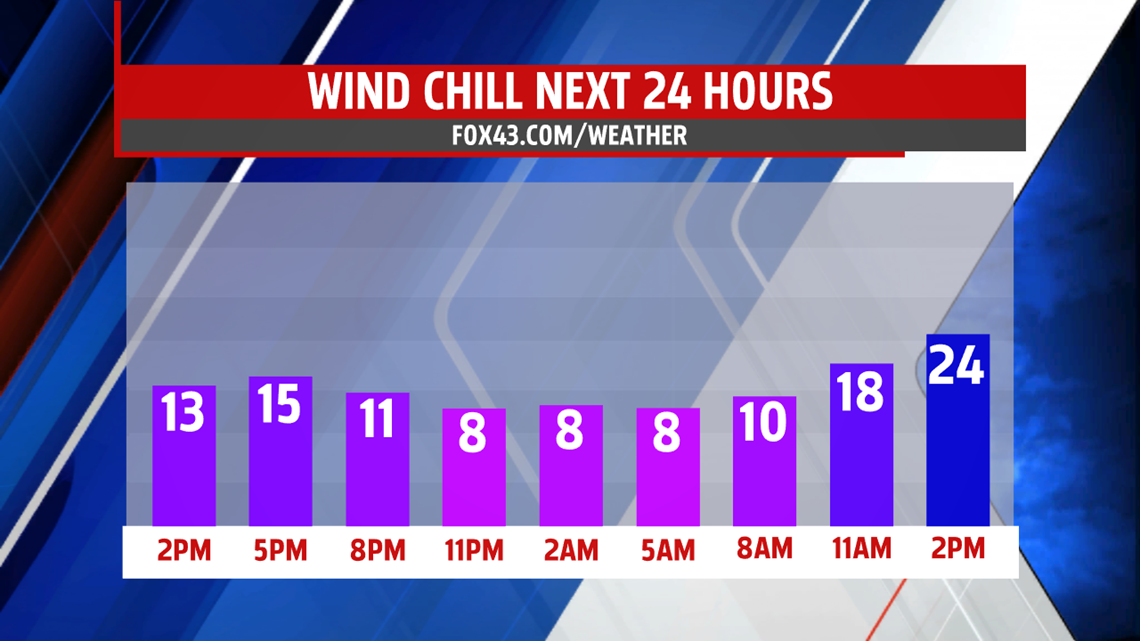
Clouds break up overnight and winds ease allowing for temperatures to plummet to the middle and upper teens. A slight breeze will create wind chill values in the single digits once again. More sunshine pops out Thursday helping temperatures bump up

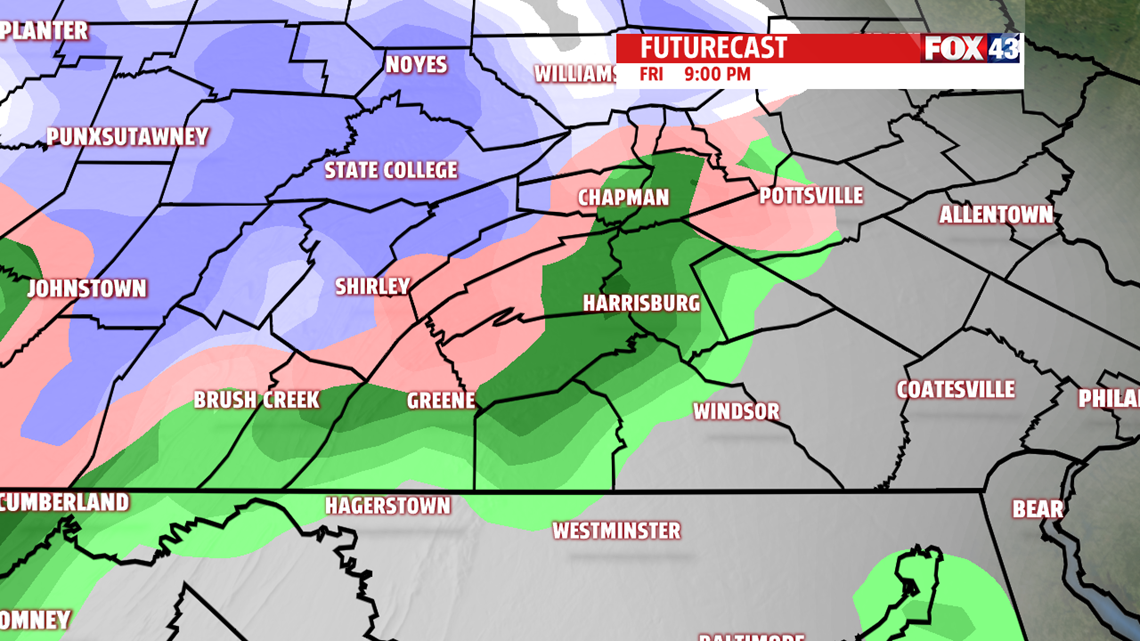
a bit. However, it is still very cold in the lower and middle 30s. While the breeze is not as strong, it is expected to be 10 to 15 mph, thus, wind chill readings remain in the 20s. Friday starts out sunnier but frigid cold. Clouds build later in the day. Temperatures nudge a bit more to near 40 degrees. Keep in mind, however, average high is 50 degrees so temperatures are still falling short of where we should be this time of year. St. Patrick’s Day evening rain and or snow showers are possible as our next system arrives. Some ice may mix in too.

WEEKEND OUTLOOK
We may begin the day with a few rain and or snow showers but the rest of the day is drier. Clouds remain thick limiting sunshine. Highs still manage the lower 40s. Skies are brighter for the second half of the weekend but not by much. Still, plenty of lingering clouds and the breeze picks back up too. Highs hover around 40 degrees.

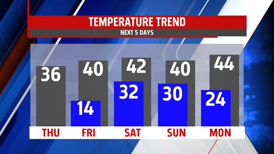
TEMPERATURES CLIMB A BIT MORE
Spring officially arrives Monday, and you can expect sunshine to kick off the week. Temperatures nudge up even more to the middle 40s, and even closer to seasonable averages in the upper 40s by Tuesday. A weak system clips the area with a few showers overnight into the morning but scoots through quickly. Temperatures fall back a bit on Wednesday.
Be “Weather Smart”, and watch FOX43 News and Weather!
MaryEllen Pann,
Chief Meteorologist
