

GOING FROM MILD TO CHILLY

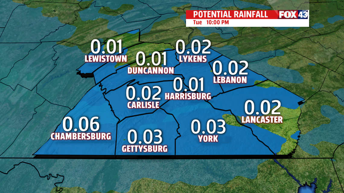
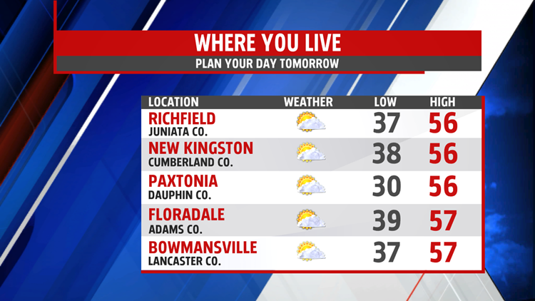
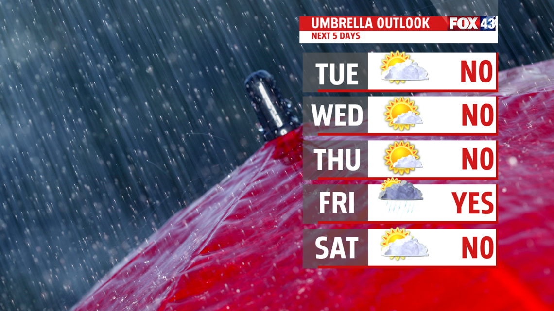
Happy Spring everyone! We dry out from early morning showers leaving a pretty decent day Tuesday. After morning lows in the upper 30s, we should climb to the lower and middle 50s. Chillier air returns for Wednesday knocking temperatures back down. Highs only recover to near 40 after morning lows in the upper 20s. It is dry under partly sunny skies. More sunshine f

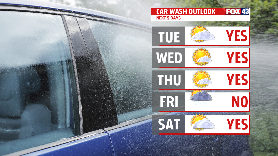
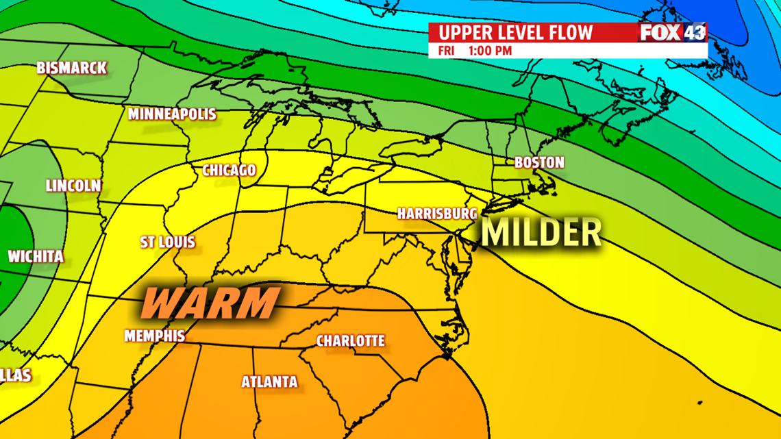
or Thursday, as high pressure builds in overhead. Winds relax but temperatures take a dive to the lower 20s by morning. It’s still colder than average in the upper 30s and lower 40s. Clouds build in as the next frontal system approaches Friday. A few showers are possible too. Temperatures are right at seasonable averages in the lower 50s. With the warm front to the north, temperatures soar Saturday.

WEEKEND OUTLOOK
It’s a very mild start to the weekend, as temperatures rise quickly to the 60s and may touch 70 in spots, thanks to a warm breeze ahead of a cold front. We have a frontal boundary stationary just north of us and a cold front approaching from the west. Still plenty of cloud cover and showers increase late Saturday into the day Sunday as the front to our north is shunted south by strong area of high pressure across Canada. With a persistent easterly flow and front nearby, rainis a good bet for the second half of the weekend. The wet weather holds temperatures near 50 degrees. Still some differences on how Monday looks. A few models bring in some energy keeping shower chances around. Most of the day is cloudy. Temperatures near average in the lower 50s.

Be “Weather Smart” and watch FOX43 for all your weather and news updates
MaryEllen Pann,
Chief Meteorologist
