

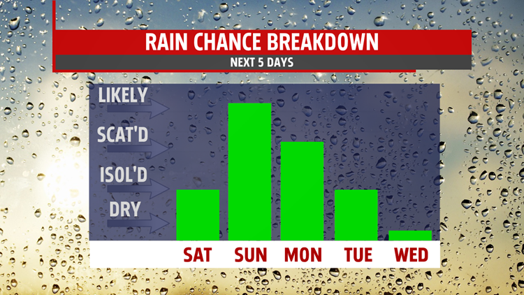

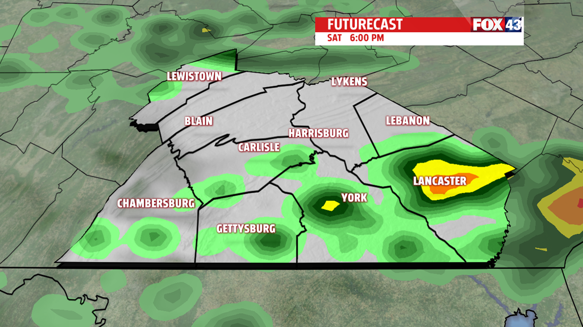
WHERE THE WARM FRONT GOES: Clouds increase throughout the day tomorrow starting in the early afternoon after a start in the mid to upper 40s. A warm front drifts south into Central PA tomorrow afternoon, which limits us from hitting 70 in most spots. If it drifts far enough south, a few showers could start in the early evening for our southeastern counties. Otherwise we see a cloudy evening with light winds throughout the day.


SHOWERS TO START THE WEEK: Sunday looks warmer than most of this week, but dreary and rainy. Scattered showers with light-to-moderate rain is likely for most of the area throughout the day under cloudy skies. Temperatures start in the mid 40s and only make the low-to-mid 50s with otherwise light winds. Showers continue into the Monday morning commute as well, but with breezy southwesterly winds we see the mid 60s. Tuesday looks to be almost a copy of Monday, but with rain chances later in the day.
WARMER NEXT WEEK: We cool off a bit with a wind shift into the upper 50s and low 60s for Wednesday, but see much more sunshine and remain dry.

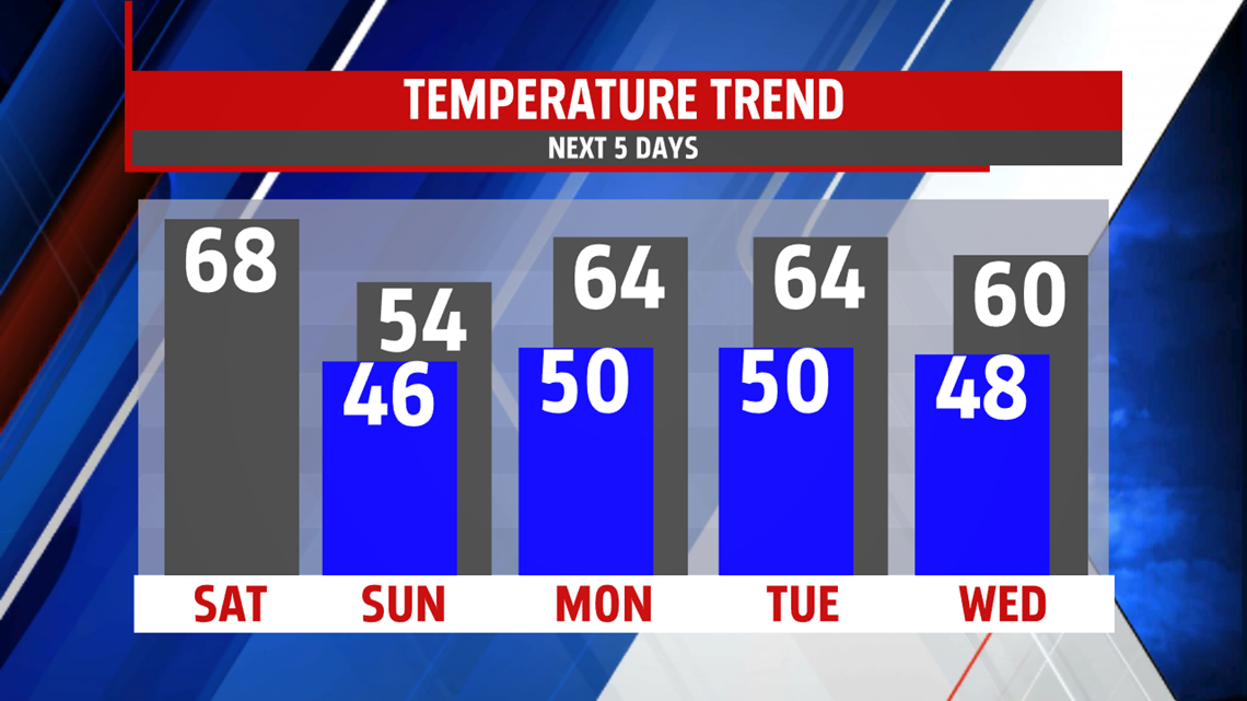
We hover around 60 for the rest of the week under partly cloudy skies.
Have a great weekend!
-Meteorologist Bradon Long
