


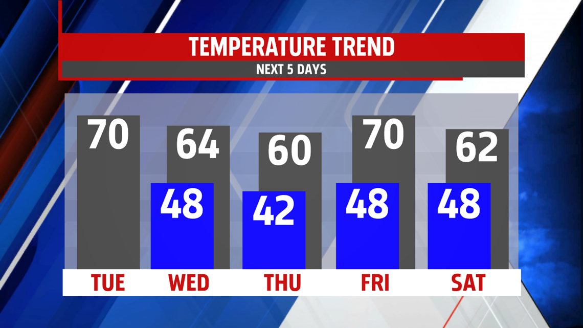
UNSETTLED END TO WEEK: Our next system arrives Thursday, bringing plenty of clouds. It brings the chance for late afternoon showers after a dry start. Afternoon temperatures are in the upper 50s to near 60 degrees. Through the night, and into early Friday, expect periods of heavy rain. There’s some drying, and perhaps some sunshine late morning through the afternoon before skies turn mostly cloudy. There’s still the chance for some afternoon showers. Temperatures temporarily spike into the middle 60s to near 70 degrees, but any 70 degree reading is higher dependent on whether or not this window of sunshine can manage to sneak into the area.
COOL WEEKEND, FEW SHOWERS: Cooler air works back in behind the system as it stalls over the region. This keeps cloudy and cool conditions in place for the weekend. There’s limited sunshine, and the chance for a few showers. Temperatures hover near, if not a bit above, 60 degrees. Breezy conditions are expected as well, adding the extra chill to this cooler than average first weekend on May. Monday is slightly more optimistic. There’s a chance for an isolated shower, with a touch more sun breaking through the clouds. Expect temperatures to remain cool, with readings in the middle to upper 50s.
Have a great Tuesday!
