


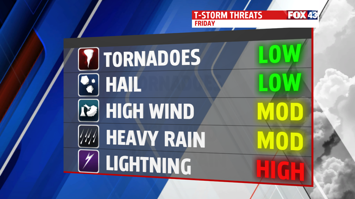
LATE RAIN TONIGHT: Off and on showers are possible the rest of the evening before another wave of showers and a few rumbles of thunder very late Friday night. Areas to the west see the best chances, with very small hail possible until around midnight. Our high tops out near 60 around midnight with dropping temperatures under cloudy skies heading towards morning.

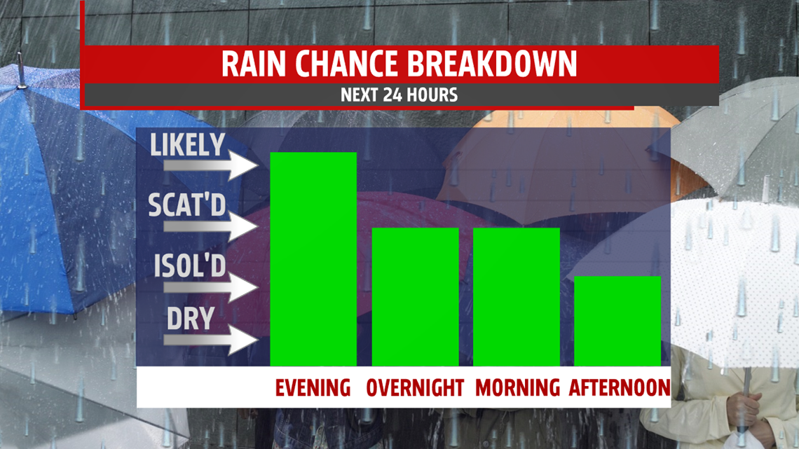
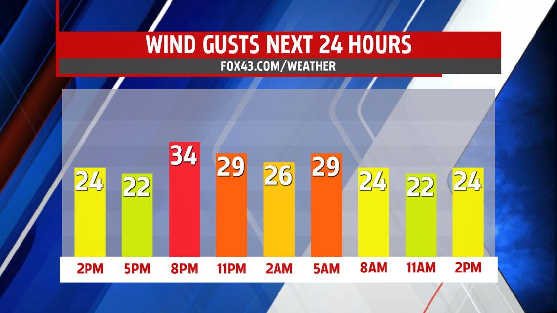
MORE FOR THE MORNING: Another wave of showers moves through in the morning starting around 8AM lasting until just before the noon-time hour. Off and on showers will be possible for the rest of the day under cloudy skies. Winds will be breezy, shifting from out of the southeast to the northwest as the cold front pushes through. Keep the umbrella and the jacket out all day long.

STAYING COOL: We stay in the upper 50s and low 60s with breezy conditions all weekend and into Monday. A few showers are possible for Sunday into Monday morning under mostly cloudy skies. We see more sunshine heading towards Monday and Tuesday with temperatures slow to warm in the mid 60s.
Have a fantastic weekend!
-Meteorologist Bradon Long
