

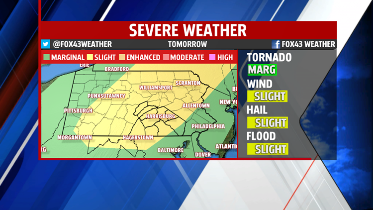


STRONG TO SEVERE STORMS SATURDAY
This evening a few stray storms may develop but diminish once the sun sets. Rest of the night is muggy and sticky with lows quite warm in the 70s early Saturday morning. We heat up quickly and the humidity is quite noticeable. An approaching cold front, combined with the heat and humidity will trigger scattered afternoon and evening showers and thunderstorms. Some of the storms could strengthen reaching severe levels. The Storm Prediction Center has placed the area in a SLIGHT Risk, which is a 2 on a scale of 1 to 5. Our threat focus is for damaging winds, hail and torrential downpours. The tornado threat is very low but not zero. Readings reach 90 in many spots before the storms develop. The front crosses late night leaving the second half of the weekend dry.

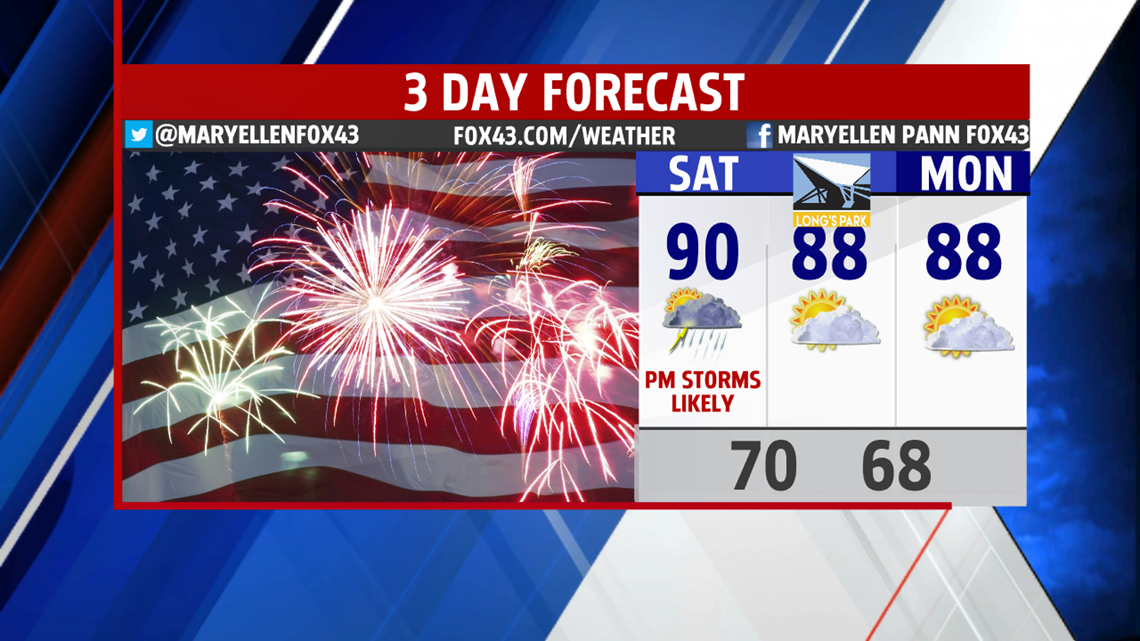
The humidity drops some but it is still muggy. High temperatures are warm in the upper 80s to near 90 degrees. Our Independence Day Celebration at Long’s Park is looking very warm and humid but rain free.
FOURTH OF JULY AND REST OF WEEK
Temperatures remain warm for the week. Humidity drops a tad more Monday. However, typical heat and humidity remains for the first week of July. Readings climb to the upper 80s almost each day. Storms threaten Tuesday and Wednesday but are isolated in nature. Fourth of July fireworks at dusk should go off without a concern for thunderstorms. It is hotter Wednesday near 90 degrees.

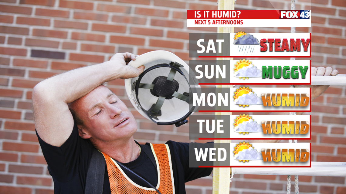
Best threat for scattered showers and thunderstorms is Thursday. Temperatures remain warm in the upper 80s. Another cold front approaches Friday. Ahead of the front, a push of very warm and more humid air slides in. Readings approach 90 degrees. A few afternoon and early evening storms are possible but diminish once the front crosses the area late in the evening.
Stay “Weather Smart” with the FOX43 Weather team!
Have a good day!
MaryEllen Pann,
Chief Meteorologist
