


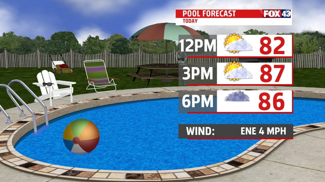

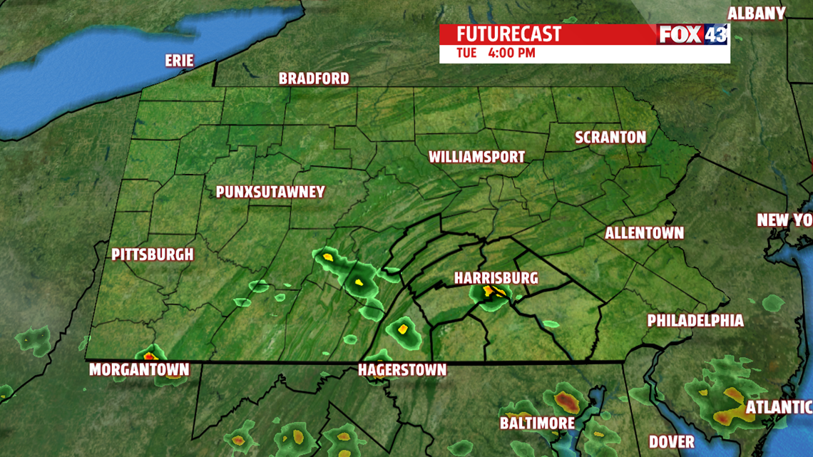


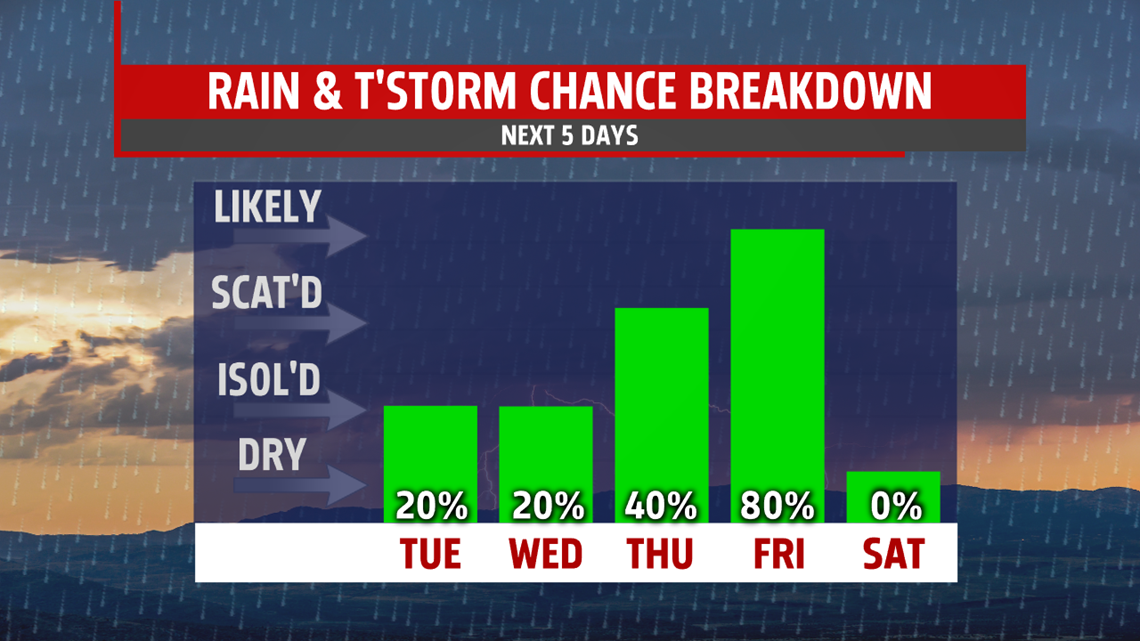
STILL WARM & HUMID, FEW T-STORMS: Wednesday and Thursday bring more of the same. The humidity feels muggier, and there’s the chance for an isolated shower or thunderstorm each day. They are the hit-or-miss type that not every location sees. Thursday brings a slightly better chance than Wednesday. Temperatures are in the lower to middle 80s Wednesday, and then the lower 80s on Thursday. It’s still quite warm and stuffy for Friday ahead of a potent cold front. There’s the chance for afternoon and evening showers and thunderstorms. Temperatures reach the middle to upper 80s.
WEEKEND OUTLOOK: Some cooling takes place into the weekend, and lower humidity levels settle in as well. Saturday brings some clouds to start, but conditions should be dry as sunshine works into the region. Sunday features plenty of sunshine for the area. Temperatures are in the middle 80s Saturday, and then fall into the upper 70s to lower 80s on Sunday. Monday temperatures rebound under plenty of sun. Expect readings in the middle to upper 80s.
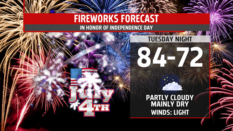
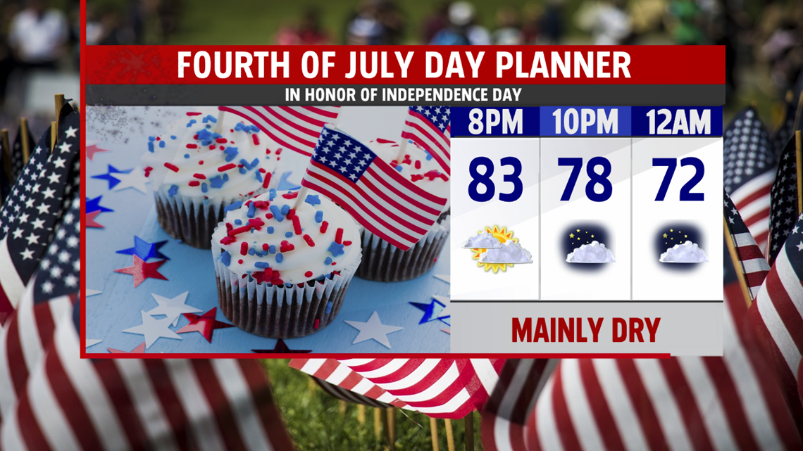
Have a great 4th of July!
