


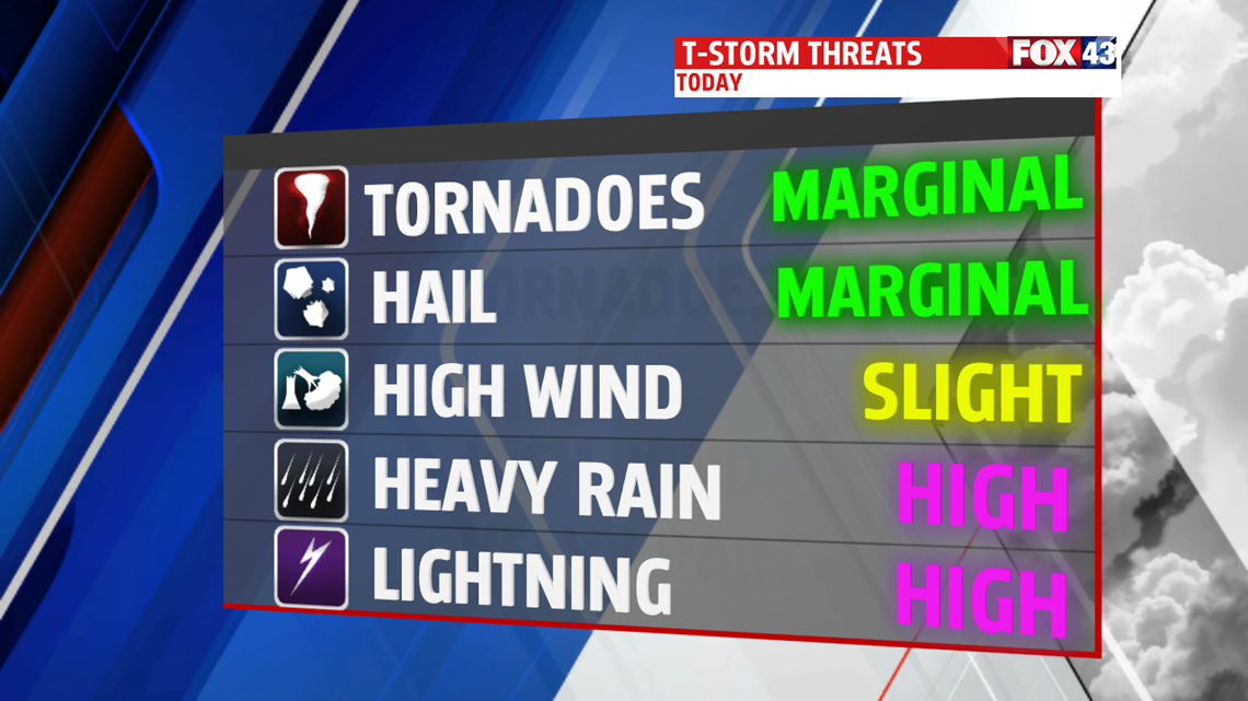
ISOLATED T-STORMS: We continue to see the chance for slow-moving, long lasting isolated thunderstorms for the next couple of days. The chance seeing them out your door is low, but there will be a storm or two with high humidity values and very warm temperatures over the next few days. Everyone has the same low chance of seeing them in the afternoon into the early evening. These storms will have locally heavy downpours and gusty winds associated with them.
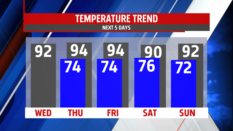
STAYING HOT AND HUMID: Highs over the next several days stay in the low-to-mid 90s with a heat index near or at 100 degrees. Morning lows stay in the low-to-mid 70s with morning fog possible throughout most of the rest of the week. Dew points remain very high as well in the upper 60s and low 70s.

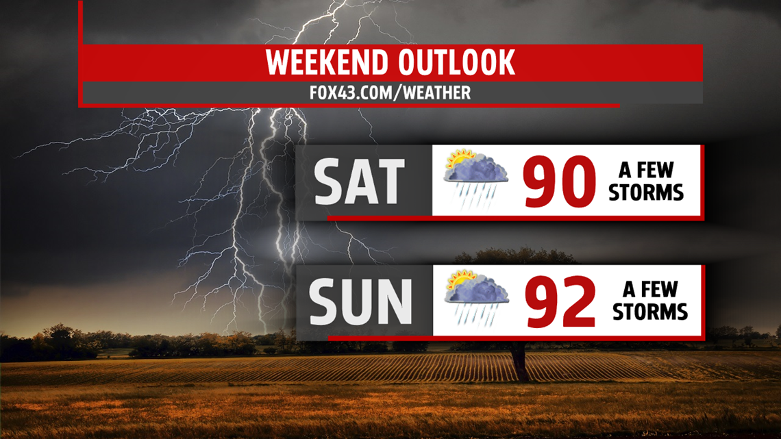
WEEKEND STORM CHANCES: The best chance for widespread showers and thunderstorms comes late in the week and into the weekend. Our higher chances start Friday with highs in the low-to-mid 90s and increase through Sunday. A few thunderstorms may be severe. Keep your FOX43 Weather App handy if you have any plans on another hot and humid weekend.
Have a great day!
-Meteorologist Bradon Long
