


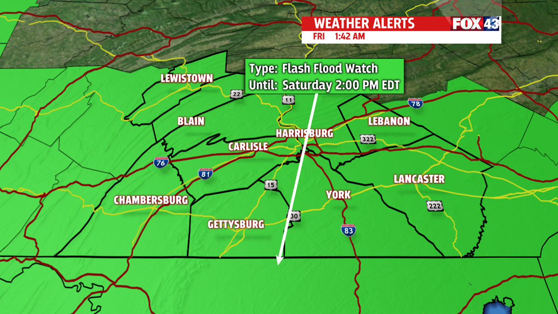


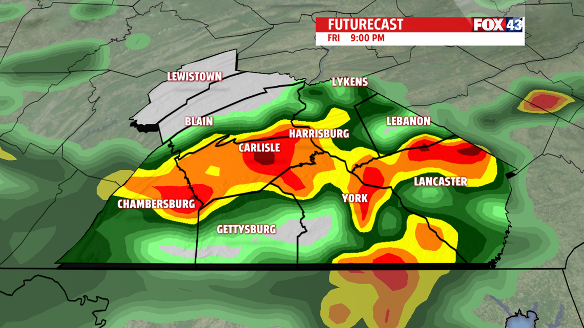

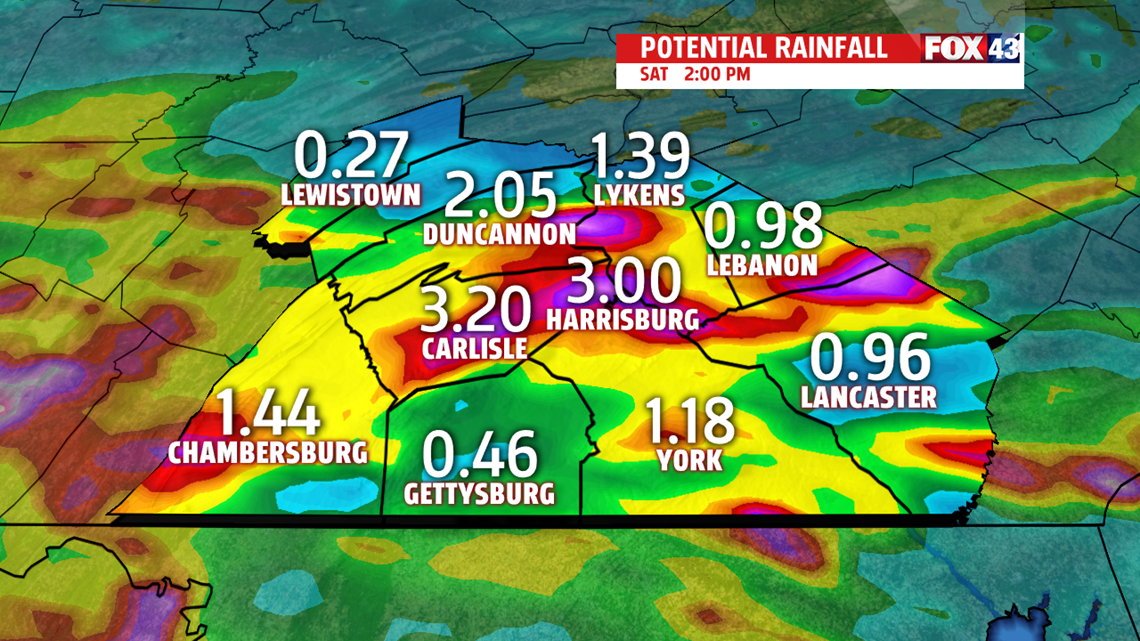
WEEKEND OUTLOOK: Showers last into the first half of the weekend. Heavier downpours are still likely in spots through the morning, and a few areas of flash flooding are still possible before conditions dry out through early afternoon. Temperatures are cool, with readings in the middle 70s. It’s breezy through the morning, with winds slowly fading during the afternoon. Expect partly sunny skies for Sunday. Highs are a touch milder, in the upper 70s to lower 80s, but this is a bit on the cooler side for late July. Humidity levels are come down through Saturday, and are very comfortable for Sunday!
WARMING NEXT WEEK: The pattern slowly warms through the first half of next week. Monday is mostly sunny and quiet. Readings are in the lower 80s. The humidity is bit more noticeable, but isn’t uncomfortable. Tuesday is mostly sunny, more humid, and warmer. Highs are in the middle 80s with muggy conditions. It’s more of the same Wednesday with partly cloudy skies. Readings are in the middle to upper 80s. Thursday brings a return to 90s. Temperatures hover near the 90 degree mark under partly sunny skies. Humidity levels are uncomfortable, and there’s the chance for a couple thunderstorms.
Have a great weekend!
