

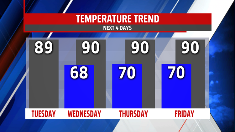


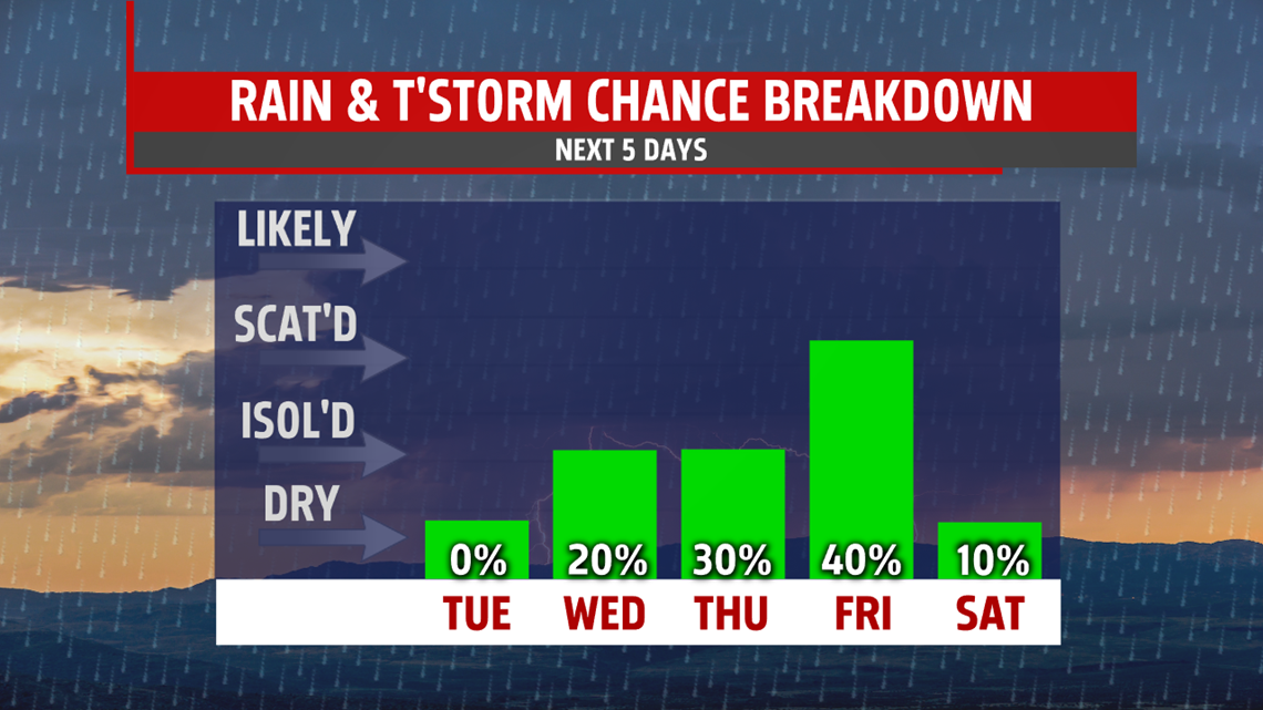
HUMID WITH SMALL T-STORM CHANCES: Our next system approaches through the middle to end of the week, and although it is mainly dry, there are some small shower and thunderstorm chances. Wednesday is hot and humid, with afternoon temperatures pushing the 90 degree mark. There’s a small chance for a couple thunderstorms, but most should remain dry. There’s a better chance for a few thunderstorms Thursday. It’s still muggy and very warm, with temperatures in the middle 80s to near 90 degrees. Friday still brings the chance for a few showers or thunderstorms as the next cold front finally crosses. Readings are in the middle 80s to near 90 degrees.
WEEKEND OUTLOOK: An isolated shower could linger into Saturday depending on how quickly the next system exits the region. Otherwise, Saturday is fairly quiet with lowering humidity levels. Temperatures are in the middle 80s with plenty of afternoon sunshine and breezy winds. Sunday brings plenty of sunshine, low humidity levels, and cooler temperatures. Expect afternoon high temperatures in the lower to middle 80s. Monday is partly sunny, and the next system could bring the chance for a few thunderstorms. Readings are in the lower to middle 80s. The humidity is back too.
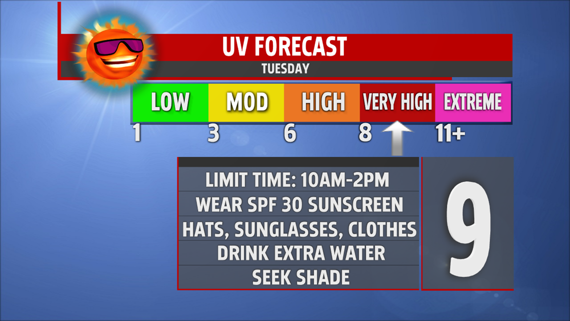
Have a great Tuesday!
