


SEVERE WEATHER TUESDAY: A SLIGHT risk of severe weather has been issued for the far northeastern portions of Central PA Tuesday. On a scale of 1-to-5, we’re at a 2. Everyone else is in a MARGINAL risk.

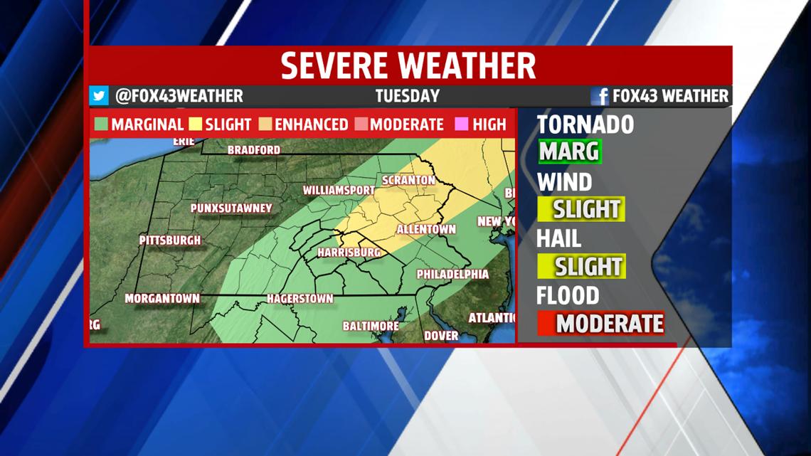
Showers and thunderstorms will develop by the mid-afternoon in the northwestern counties and move eastward throughout the early evening. A few of these storms could be severe. The main threats will be heavy rain that could lead to flash flooding and 60+MPH winds. Small hail up to the size of quarters is not out of the question. The tornado threat is very low.


RAIN WEDNESDAY: Our rainmaker for Tuesday hangs with us heading into Wednesday, but brings us a lot of cloud cover and off-and-on rain throughout the day. Highs don’t leave the 60s for the most part with a few local low-70s. We may see a little clearing by the early evening under otherwise cloudy skies. Rain totals could near the 1″ mark for some areas when all is said and done Wednesday.

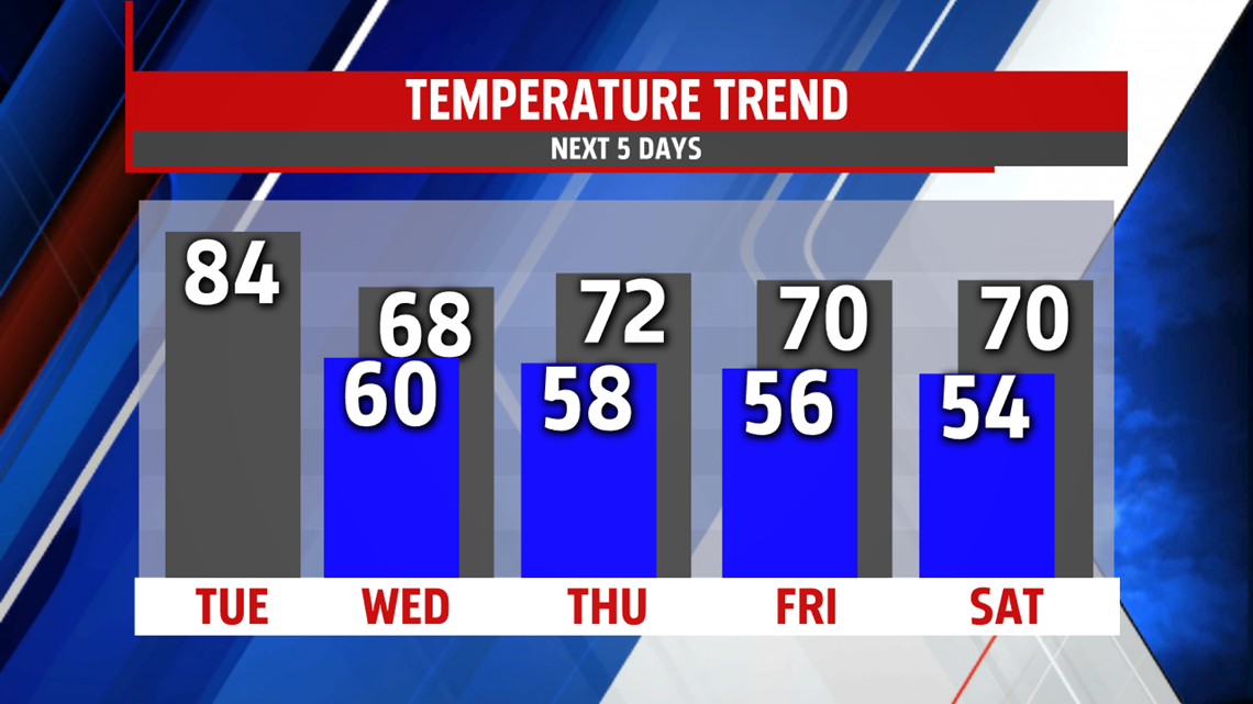
CLEARING OUT THE REST OF THE WEEK: Sunshine returns, but temperatures stay cooler heading into the weekend thanks to northerly winds. Highs stsay in the low 70s with a lot of sunshine heading into another nice start of the weekend.
Have a great rest of your Labor Day!
-Meteorologist Bradon Long
