

SAYING GOODBYE TO THE HEAT & HUMIDITY

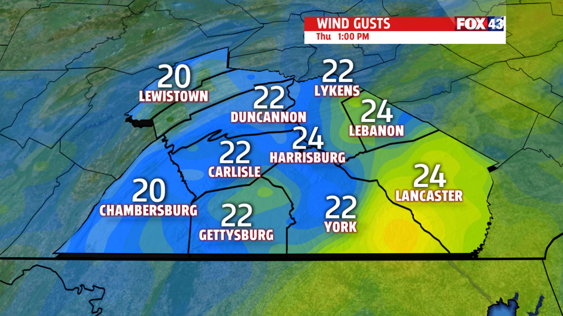
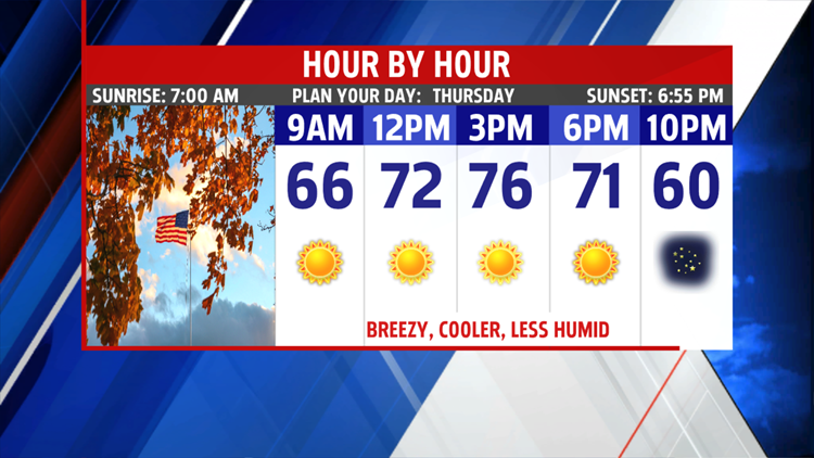
It’s the last summer like evening for awhile. Temperatures are warm in the 80s, which fall to the 70s later tonight. A strong cold front pushes through the area, followed by much cooler, more comfortable air. Finally, it will feel more like fall. Morning lows in the 60s warm to the middle 70s by afternoon. Winds pick up out of the northwest 10 to 15 mph, with gusts around 25 mph. Skies

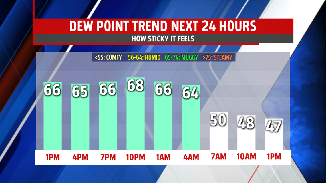
continue bright with abundant sunshine and few clouds. Turn off the A/C! Morning lows are back into the 50s by Friday morning. Highs struggle to reach the upper 60s and lower 70s. Clouds do increase as a piece of upper level energy pivots through the area late in the day and overnight. This feature just brings added clouds. Rain threat remains very low. We need the rain but the dry stretch continues through early next week.
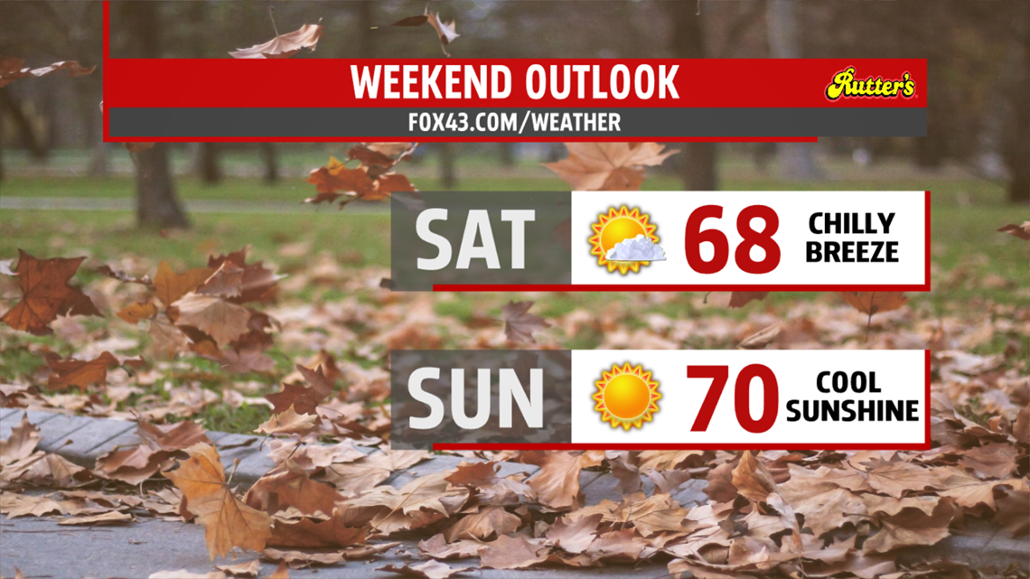
WEEKEND OUTLOOK
For those of you who love the fall weather, you’ll enjoy the weekend! Morning lows in the 40s, provide a crisp start to the day. Afternoon highs expected in the 60s both days. Some spots could touch 70 on Sunday. Clouds are around early Saturday but clear out as high pressure dominates the region. The winds are breezy to begin the weekend, but settle as the high moves overhead by Sunday. Temperatures begin to warm back into the lower and middle 70s for Monday and Tuesday with mostly sunny skies.

Stay “Weather Smart” all week long with the FOX43 Weather team!
Have a good day!
MaryEllen Pann,
Chief Meteorologist
