


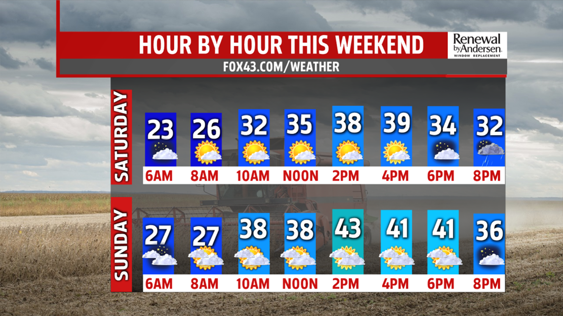
CHILLY WEEKEND OUTLOOK: Even colder air settles into the region overnight on Friday, and widespread 20s are likely Saturday morning! There could be record cold morning lows. It remains very chilly with plenty of sun for Saturday. The sun doesn’t boost temperatures too much compared to Friday’s high temperatures. Readings are in the upper 30s to lower 40s. Sunday brings increasing clouds as the next system approaches. A few showers hold off until the overnight period, perhaps mixing at times with some flakes. Accumulations are not likely.
NEXT WEEK: Monday is partly sunny, after a lingering shower or two early. Temperatures are in the middle to upper 40s during the afternoon. Tuesday is drier with plenty of sunshine. Temperatures are a bit milder. Readings are in the upper 40s to lower 50s. Wednesday temperatures increase a touch more, and it’s a bit cloudier. This is because the next system approaches. It could bring a late day or evening shower, but for now most, if not all, of the day should be dry. Sunny skies are back for Thursday. Temperatures are a bit higher in the 50s.
Have a great weekend!
