


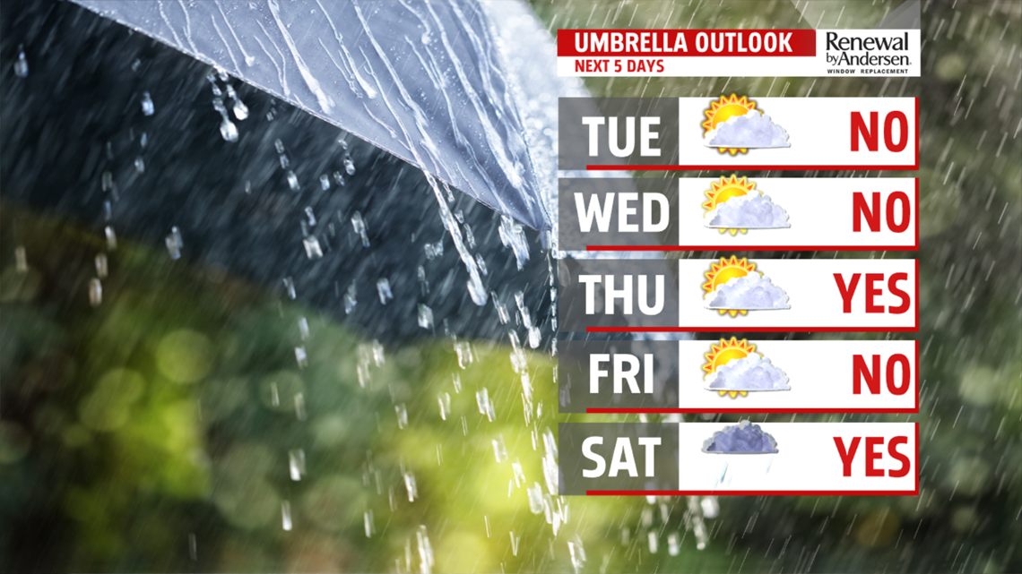
QUIET & COOL STRETCH: The middle to the end of the week is mainly dry and still a bit on the cool side. Wednesday starts fairly sunny, but clouds are expected to increase ahead of the next system later during the afternoon. Expect temperatures in the upper 40s to lower 50s. The system crosses through overnight, and it’s out of here by Thursday. There will be some passing overnight showers, with perhaps a shower lingering near daybreak. There are some clouds early Thursday morning before the system clears Central PA. The rest of the day is partly sunny. Highs are near 50 degrees. It's a bit breezy. Friday starts with sun, and there’s a good amount of sun for the first half of the afternoon. The next system approaches, and it builds clouds late. The day is dry, with temperatures in the middle 40s to near 50 degrees.
WEEKEND OUTLOOK: Saturday brings the chance for rain showers as the next system scoots through Central PA. A good portion of the day looks rainy. Expect temperatures in the middle 40s to lower 50s. Cooler air quickly moves in behind it in time for Sunday. It’s breezy, with another shot of chilly air. Readings only reach the middle 30s to near 40 degrees. The cold air touches off some lake effect flurries. There’s still a breeze for Monday, and it’s still quite chilly for this time of year. Expect readings in the upper 30s to lower 40s under partly cloudy skies.
Have a great Tuesday!
