

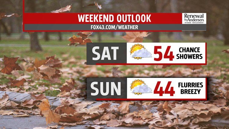


COLD FRONT APPROACHES: Saturday morning starts around the freezing mark under clear conditions. Winds are light out of the southwest. A few clouds start developing around noon, with a cold front approaching by mid-afternoon. A few spotty showers will be light, but possible. Winds shift out of the northwest as temperatures under cloudy conditions for the evening.
COOLER AND DRY: Sunday morning starts around freezing again, with a few flurries possible in our northwestern counties. Highs don’t leave the low-to-mid 40s. Northwesterly winds keep us cool and could gust to 20MPH under otherwise mostly sunny skies. Similar story for Monday, but highs inch closer to the 50-degree mark.

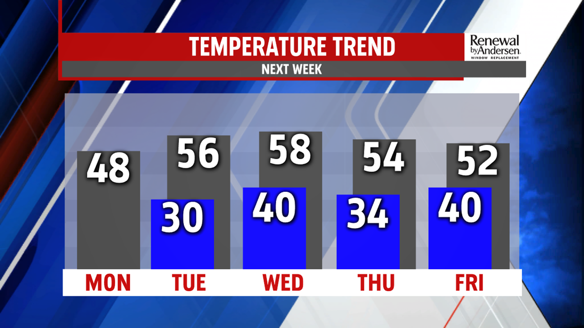
WARM UP NEXT WEEK: Tuesday is warmer, into the low-and-mid 50s under mostly sunny conditions thanks to a warm southwest wind. Wednesday is just a touch warmer before our next cold front sweeps through right before sunset. A few showers will be possible as temperatures drop just a bit finishing out the month of November.
Have a great weekend!
-Meteorologist Bradon Long
