


STARTING THE WEEK: We have a repeat of Sunday to start the work week. Highs start near freezing with highs in the low-50s. Skies are mostly sunny for a good part of the day, but we'll see a few more clouds later in the afternoon. Winds remain light, but moisture will begin to move into the area with southeast winds. We remain dry.

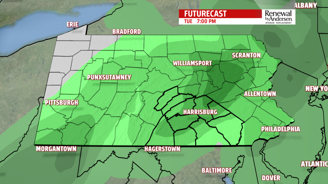
NEXT RAIN CHANCE: A few sprinkles are possible Tuesday morning with lows in the upper-30s. Then, the bulk of the rain starts around noon and lasts throughout the day. This rain will be light overall, so totals won't be drastically high. Highs stay in the mid-50s for Tuesday as you keep the umbrella handy all day long.

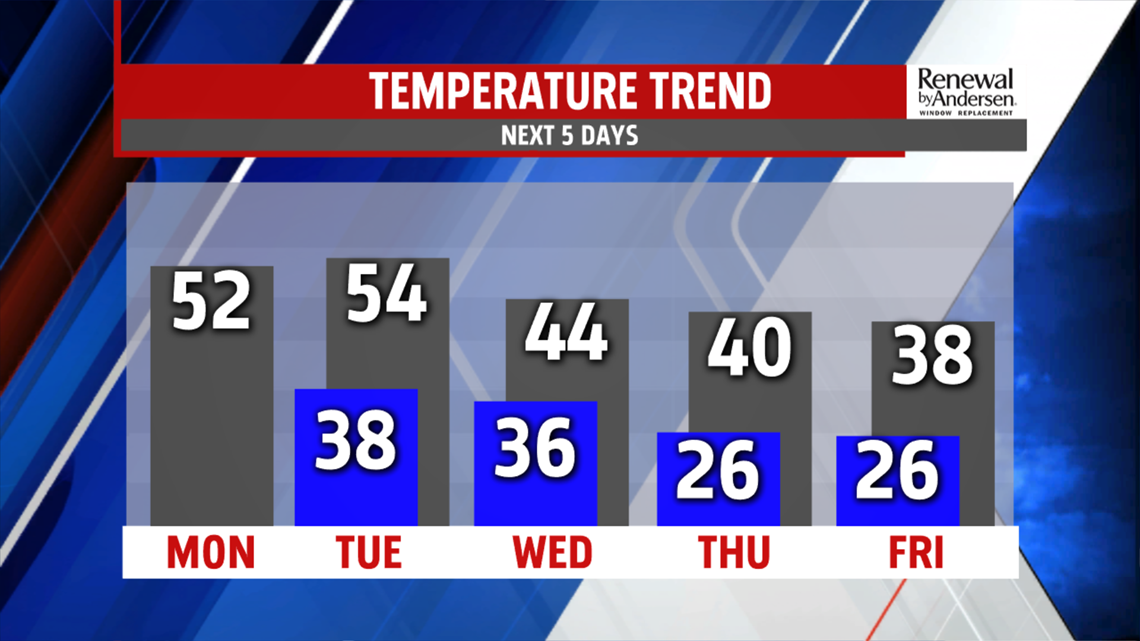
COLDER AIR, SNOW?: We're colder for Wednesday with highs in the mid-40s early in teh day. Skies remain mostly cloudy. A sprinkle can't be ruled out in the very early morning in the eastern counties. Our temperatures slowly drop into the upper-30s by the end of the week and stay there for highs during the rest of the Weather Smart Forecast. Light snow (yes, snow) is also possible Saturday morning, with a trace possible.
Have a good rest of your weekend!
-Meteorologist Bradon Long
