

WEEKEND FLURRIES AND LIGHT SNOW
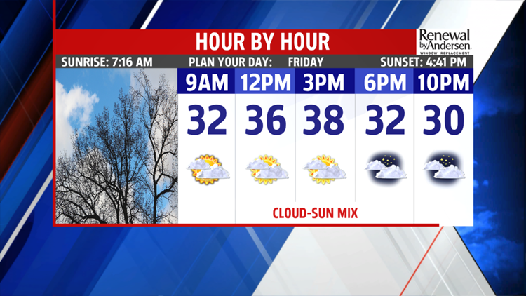
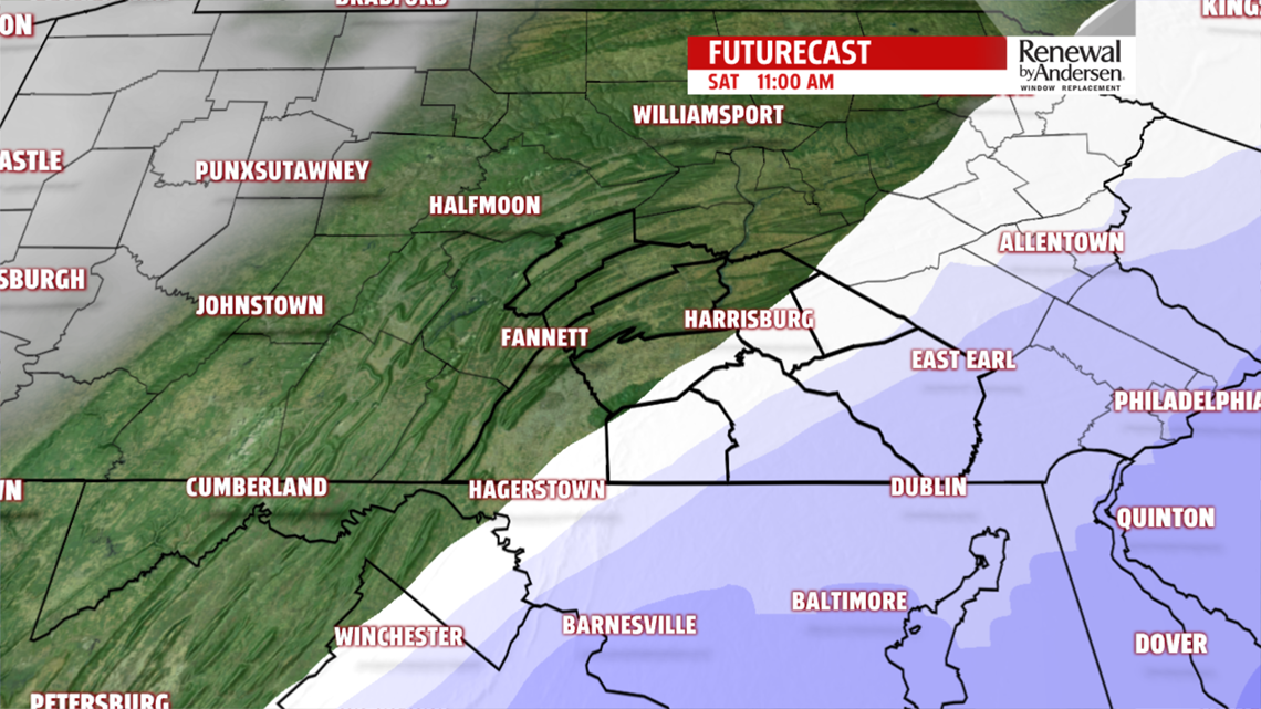
A few flurries or sprinkles are possible this evening, otherwise, skies are mostly cloudy. Bundle up it’s cold in the 30s. Morning lows are in the 20s, and with more clouds than sunshine, temperatures hold in the middle and upper 30s for the afternoon. We are still watching a coastal storm for Friday night into Saturday. Some models have shifted the moisture west, which

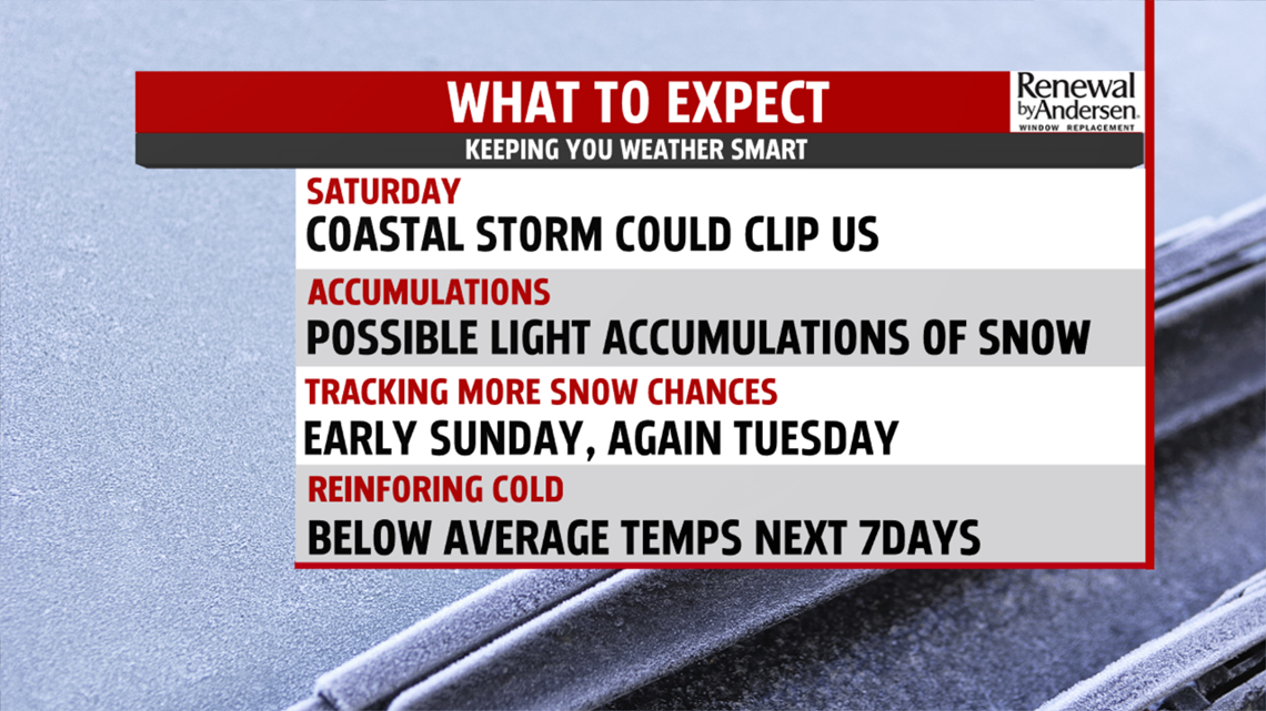
means areas like, Lancaster and York counties, could get clipped with light snow. We continue to monitor the trend and will bring you the latest as it becomes available. Readings are looking chillier Saturday in the middle and upper 30s. Then we are tracking strong upper level energy, and low pressure at the surface for Saturday night into early Sunday. A few

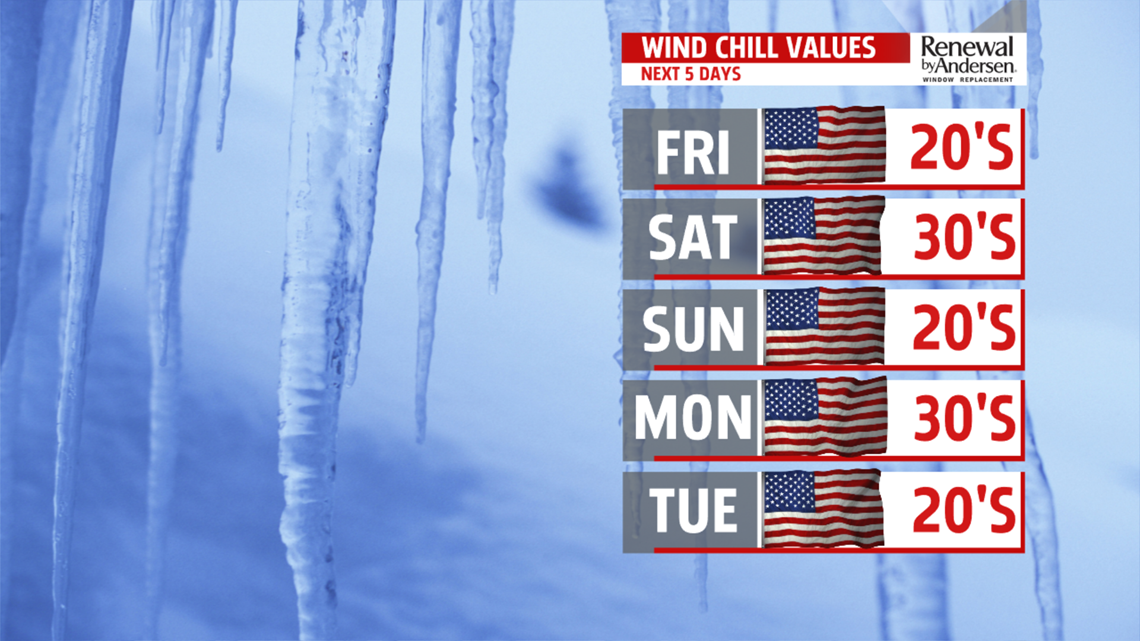
snow flurries, and spotty light snow showers are possible. The only accumulations expected are in the higher elevations and no more than dusting. Gusty winds will produce wind chills in the teens and 20s, so you’ll need plenty of extra layers heading outdoors. Readings only top out in the lower and middle 30s. A calmer, sunnier day expected to begin the week.
WINTER ARRIVES EARLY

We get a brief break in the clouds Monday, allowing more sunshine to bump temperatures back to the upper 30s and lower 40s. Winds are calmer too. Our next potent system is quickly moving in overnight into Tuesday. Clouds thicken and light snow showers begin before the morning drive time. You’ll need to allow extra time for the commute. Right now, most areas look to pick up an inch of snow. Areas north and northwest may see an additional inch. A punch of Arctic air hits the area, with highs in the 30s Tuesday, plummeting to the 20s by Wednesday. Morning lows in the teens. Prepare for much colder wind chill readings with gusty winds expected both days. Chilly sunshine expected for Thursday, along with a few flurries. Highs are in the lower 30s.
The FOX43 Weather Team is keeping you “Weather Smart” all week long!
Have a good day!
MaryEllen Pann,
